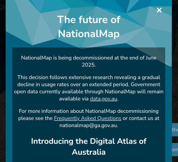
TIL... 🙄. nationalmap.gov.au is/was an open source TerriaJS instance delivering all kinds of data via open standards in a single space.
The digital atlas of Australia is based on proprietary ESRI services. Colour me disappointed, not surprised
The strategic question being: why develop a new digital atlas if the old one was not used? 🤔
Personally I would have chosen to keep developing an open platform, especially in current geopolitical light.
#geostrategy #openplatforms #foss4g #australia


Andrew •
Dr Adam Steer •
something about if you are not resisting you are collaborating springs to mind.
I mean sure these decisions were made a while ago but who could have forecast such a risk??
I know a bloke, but he's permanently ejected from geospatial things in Australia for speaking about such risks...
Dr Adam Steer •
"but we have a contract"
Cool cool are you able to change business decisions within the contracted party? Probably no. You have a risk you simply cannot control or mitigate.
This is why #FOSS should be at the heart of all national digital infrastructures.
#FOSS4G #infrastructure #risk #auspol
Hugs4friends ♾🇺🇦 🇵🇸😷 hat dies geteilt