Zum Inhalt der Seite gehen


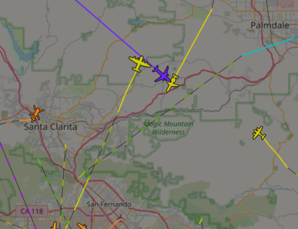
Image from ADSBExchange showing a C130 and Mad Dog passing each other going between Fox Field in Palmdale and the CA fires to load up and drop Phos-chek. It is interesting to watch all the helicopters clear when an MD-80 comes in.
#CaliforniaFires #Firefighters #Aircraft #California #PalisadesFire
Map of area between San Fernando and Palmdale with planes and helicopter icons superimposed over it. The aircraft have lines representing their flight tracks behind them. Each track is colored to indicate the altitude of the aircraft. Of note are two tracks just above the center in yellow that are for the MD-80 and C-130 flying in opposite directions at a similar altitude of around 6000 feet. There is a purple aircraft and track flying towards the bottom right at a much higher altitude of 30000 feet, probably going to one of the other commercial airports.
Dieser Beitrag wurde bearbeitet. (1 Tag her)