Satellite images show Israeli forces intensifying demolitions in south Gaza
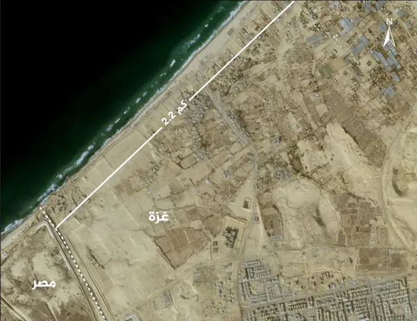
Satellite images show that the Israeli military has stepped up the destruction of homes and agricultural lands in the al-Mawasi area in southern Gaza.
The images, taken between December 9 and January 1, show widespread demolition of buildings and structures and bulldozing of land and greenhouses in the area, which is located the Tal as-Sultan neighborhood, west of the city of Rafah.
@palestine
#Gaza
#AlMawasi

