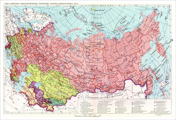
My latest "conspiracy theory": the standard map projection used by the Soviet Union really makes sense only if Scandinavia was part of it. Otherwise you would move slightly the centre, rather than have dangling Chukotka in the top-right corner.
See more maps of the USSR: https://istorik.net/502-karty-sssr.html #maps #mapstodon
See more maps of the USSR: https://istorik.net/502-karty-sssr.html #maps #mapstodon
Карты СССР - 1922, 1929, 1937, 1941, 1946, 1976, 1990
Старые карты СССР с подробными границами всех 15 республик СССР от 1922-го по 1990-й показывают, как образовался и выглядел Советский Союз, занимавший 1/7 часть суши Земли.Карта СССР 1922 г.Карта СССР на момент образования, 30 декабря 1922 г.Исторические события мира XIX, XX, XXI века | Историк (istorik.net)

