#PalisadesFire
Latest perimeter shows 21,596 acres
Never ignore an order to evacuate. The fire officials have information that you do not.
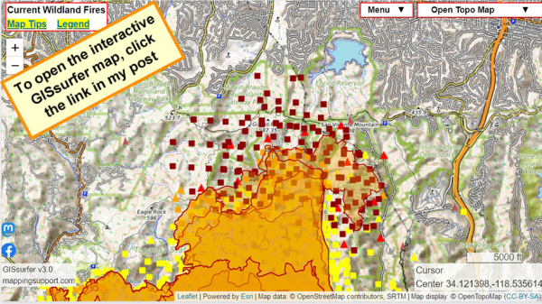
Dark symbols on the map are MODIS and VIIRS satellite heat detections. This data is not real time and location are only approximate. Sometimes this data is ‘false positive’. For more information open the map and click “Map tips” upper left corner.
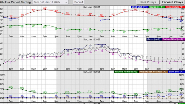
NOAA is forecasting wind gusts close to 40mph very early Sunday.
Open GISsurfer map:
https://mappingsupport.com/p2/gissurfer.php?center=34.121397,-118.535614&zoom=13&basemap=Open_Topo_Map&overlay=MODIS_7_day,VIIRS_7_day,Perimeter_FIRIS_intel,Fire_camera_location&data=https://mappingsupport.com/p2/special_maps/disaster/USA_wildland_fire.txt
GISsurfer General Purpose Web Map and GIS Viewer | Surf GIS DATA
GISsurfer lets you surf a nearly endless amount of GIS data. Click a layer in the GIS server's table of contents and that data appears on the map.mappingsupport.com


