#PalisadesFire
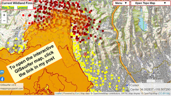
When the map opens there is a red marker (just below map center) at Cordelia Rd.
Fire is approaching this area. Helicopters dropping water are working. Structure defense teams are present. H/T @ai6yr for radio monitoring.
Open GISsurfer map:
https://mappingsupport.com/p2/gissurfer.php?center=34.092837,-118.507290&zoom=13&basemap=Open_Topo_Map&overlay=MODIS_7_day,VIIRS_7_day,Perimeter_FIRIS_intel,Fire_camera_location&data=https://mappingsupport.com/p2/special_maps/disaster/USA_wildland_fire.txt||34.084767,-118.507161
GISsurfer General Purpose Web Map and GIS Viewer | Surf GIS DATA
GISsurfer lets you surf a nearly endless amount of GIS data. Click a layer in the GIS server's table of contents and that data appears on the map.mappingsupport.com

