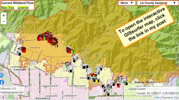
#EatonFire damage assessment. This work is ongoing. Each time you open the map you will see the most recent information.
To search on an address click Menu > Search.
The damage layer is 'on top' and clickable.
The parcel layer (at end of overlay list) includes address and owner's name. To learn how to make that the 'top' layer and clickable, please read the "Map tips" link in upper left corner.
Red - Destroyed > 50%
Orange - Major 26-50%
Yellow - Minor 10-25%
Green - Affected 1-9%
Black - No damage
White - Inaccessible
Open GISsurfer map:
https://mappingsupport.com/p2/gissurfer.php?center=34.195817,-118.098213&zoom=13&basemap=LA_County_basemap&overlay=Perimeter_FIRIS_intel,LA_County_map,LA_County_parcels,Eaton_damage_assessment&data=https://mappingsupport.com/p2/special_maps/disaster/USA_wildland_fire.txt
GISsurfer General Purpose Web Map and GIS Viewer | Surf GIS DATA
GISsurfer lets you surf a nearly endless amount of GIS data. Click a layer in the GIS server's table of contents and that data appears on the map.mappingsupport.com
Dieser Beitrag wurde bearbeitet. (15 Stunden her)

