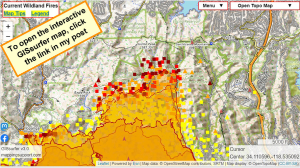
#PalisadesFire
The NE part of the fire is expanding and more evacuations have been ordered.
Check this same link in the morning and you will see newer data.
The fire camera layer (brown arrowheads) is ‘on top’ and clickable.
Open GISsurfer map:
https://mappingsupport.com/p2/gissurfer.php?center=34.110596,-118.535092&zoom=13&basemap=Open_Topo_Map&overlay=MODIS_7_day,VIIRS_7_day,Perimeter_FIRIS_intel,Fire_camera_location&data=https://mappingsupport.com/p2/special_maps/disaster/USA_wildland_fire.txt
GISsurfer General Purpose Web Map and GIS Viewer | Surf GIS DATA
GISsurfer lets you surf a nearly endless amount of GIS data. Click a layer in the GIS server's table of contents and that data appears on the map.mappingsupport.com

