Suche
Beiträge, die mit karte getaggt sind
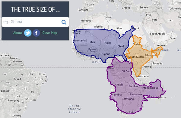
... Hier der Link zur Webseite mit der entsprechenden Kartendarstellung, auf der man sich selbst ein Bild machen, wie die Größe bzw. die Verzerrungen eines Landes mit dem Abstand vom Äquator in Richtung der Pole zunehmen: http://thetruesize.com/
#thetruesize #map #country #size #projektion #karte #welt #world
#thetruesize #map #country #size #projektion #karte #welt #world

Compare Countries With This Simple Tool
Drag and drop countries around the map to compare their relative size. Is Greenland really as big as all of Africa? You may be surprised at what you find! A great tool for educators.The True Size
Ahoi liebe Gemeinde, kann man via Browser in Open Street Map (wie bei Google Map) eigene "Punkte" auf der Karte platzieren und mit Kurztext versehen zwecks Beschreibung?
#map #oepnstreet #openstreetmap #karte #gpogle #googlemaps
#map #oepnstreet #openstreetmap #karte #gpogle #googlemaps
