Zum Inhalt der Seite gehen

Suche

Beiträge, die mit remoteimaging getaggt sind


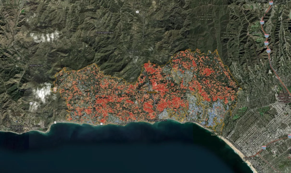
Use of Sentinel-1 satellite to assess landscape changes due to the Palisades Fire (via NASA). #PalisadesFire #RemoteImaging #Wildfires #Sentinel1
This map displays change detection imagery from areas impacted by wildfires in Southern California. Change is detected using a logarithmic difference calculation to highlight where change has occurred in Sentinel-1 Synthetic Aperture Radar (SAR) imagery between Dec. 28, 2024, and Jan. 9, 2025. In general, the forested areas impacted by fire appear red, as the structural complexity of the canopy is decreased when vegetation is burned. Urban areas appear blue, as burned buildings are more irregular in structure than rooftops. Credits: Log Difference layer generated by Alaska Satellite Facility (ASF). Source 10-m Sentinel-1 RTC products in power scale were processed by ASF DAAC HyP3 2025 using GAMMA software. Contains modified Copernicus Sentinel data 2025, processed by ESA. Wildfire perimeters courtesy of CAL FIRE


Wind driven embers laugh at your defensible space.

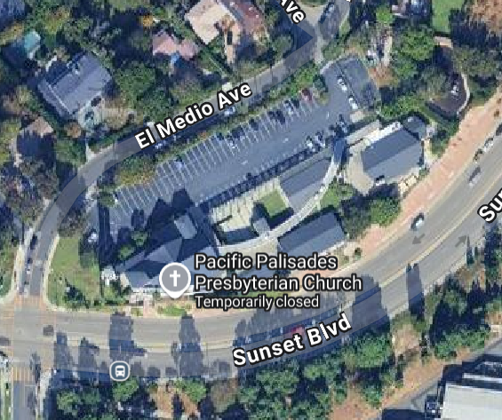
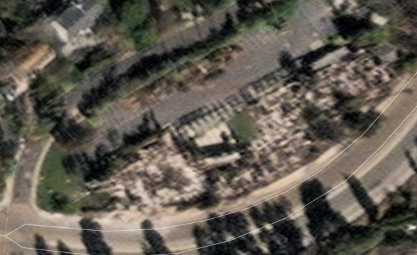
Pacific Palisades Prebysterian Church (Before/After) on Sunset Blvd. (After: MAXAR remote imaging).

#PalisadesFire #RemoteImaging #MAXAR
Large church with a huge parking lot and grass and roads around it, ideal defensible space
Rubble of entire church burnt to the ground