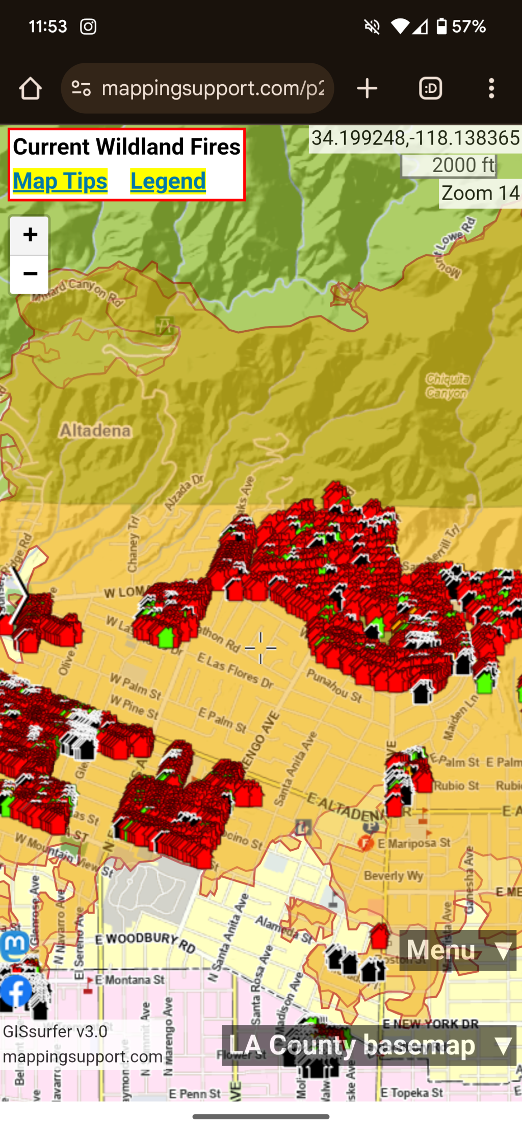
It's grim watching the damage assessment map slowly fill in with red from the #EatonFire in #Altadena.
Thanks to @mappingsupport for including the data layer: https://mappingsupport.com/p2/gissurfer.php?center=34.195817,-118.098213&zoom=13&basemap=LA_County_basemap&overlay=Perimeter_FIRIS_intel,LA_County_map,LA_County_parcels,Eaton_damage_assessment&data=https://mappingsupport.com/p2/special_maps/disaster/USA_wildland_fire.txt
Thanks to @mappingsupport for including the data layer: https://mappingsupport.com/p2/gissurfer.php?center=34.195817,-118.098213&zoom=13&basemap=LA_County_basemap&overlay=Perimeter_FIRIS_intel,LA_County_map,LA_County_parcels,Eaton_damage_assessment&data=https://mappingsupport.com/p2/special_maps/disaster/USA_wildland_fire.txt
GISsurfer General Purpose Web Map and GIS Viewer | Surf GIS DATA
GISsurfer lets you surf a nearly endless amount of GIS data. Click a layer in the GIS server's table of contents and that data appears on the map.mappingsupport.com

