Not what we wanted to see. 😟
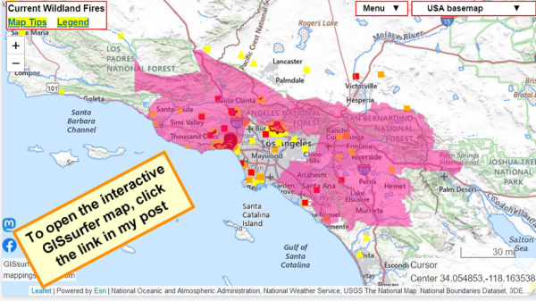
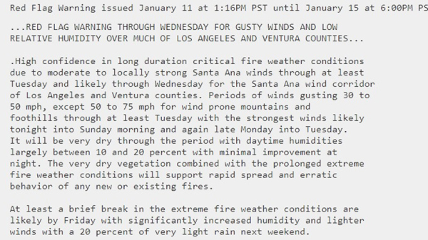
#RedFlagWarning now includes #PalisadesFire.
For details from NOAA - including timing - open the map, click a spot in the red area. Scroll down in the popup that appears since there might be more than one watch/warning and each one has its own link for the details.
Open GISsurfer map:
https://mappingsupport.com/p2/gissurfer.php?center=34.054853,-118.163538&zoom=8&basemap=USA_basemap&overlay=MODIS_7_day,VIIRS_7_day,Perimeter_FIRIS_intel,Lake_river_stream,Red_flag_warning&data=https://mappingsupport.com/p2/special_maps/disaster/USA_wildland_fire.txt
GISsurfer General Purpose Web Map and GIS Viewer | Surf GIS DATA
GISsurfer lets you surf a nearly endless amount of GIS data. Click a layer in the GIS server's table of contents and that data appears on the map.mappingsupport.com


