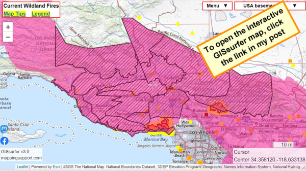
If you have not seen it yet, this map shows the areas that are subject to both a #RedFlagWarning (red) and a #HighWindWarning (diagonals) beginning at 4am Tuesday.
To search on an address click Menu > Search.
For official details from NOAA including timing, open the map, zoom in, click in red area. Scroll down in the popup that appears since there might be multiple weather watches/warnings for the spot you clicked and each one has its own link to the details.
#PalisadesFire #EatonFire #LAfires #SantaAnna
Open GISsurfer map:
https://mappingsupport.com/p2/gissurfer.php?center=34.358120,-118.633138&zoom=9&basemap=USA_basemap&overlay=MODIS_7_day,VIIRS_7_day,Perimeter_FIRIS_intel,High_wind_warning,Red_flag_warning&data=https://mappingsupport.com/p2/special_maps/disaster/USA_wildland_fire.txt
GISsurfer General Purpose Web Map and GIS Viewer | Surf GIS DATA
GISsurfer lets you surf a nearly endless amount of GIS data. Click a layer in the GIS server's table of contents and that data appears on the map.mappingsupport.com

