Zum Inhalt der Seite gehen

Suche

Beiträge, die mit firewx getaggt sind


#NIFC #wildfires #firewx
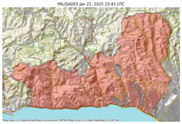
NIFC New Or Updated Wildfire Perimeter
Incident Name: PALISADES
Acres: 23448.0 acres
Updated: Jan 21, 2025 23:43 UTC
Source: IRWIN
#PALISADESFire #CAwx
Visual map representation of the PALISADES wildfire, showing the perimeters of the 23448.0 acre fire on a map.


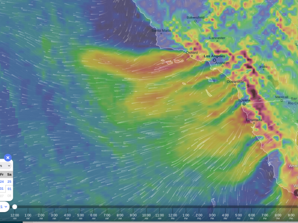
This wind pattern is pretty striking... This kind of very long distance pattern isn't something I have seen normally (usually the Santa Ana's don't get as far out to sea... ps. don't go sailing, unless you like to end up in deep open ocean 👀

Curious if this is a new extreme WX pattern due to all the CO2 we're throwing into the atmosphere... i.e. completely novel wind pattern, extreme Santa Ana?

#wind #firewx #SantaAna
Red streams of very high winds going out across from land all the way out to sea


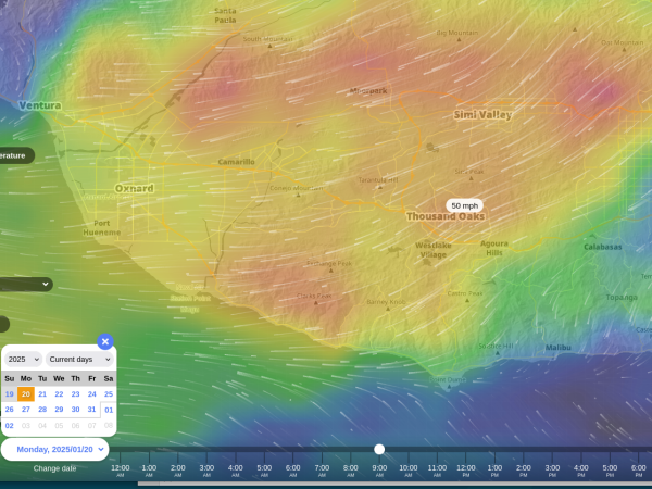
I guess I'm brewing extra coffee for tomorrow morning, assuming SCE gets happy with the power shutoffs early. (yes, better they shut off power than light off a fire that turns this county into smoking ruins, yes.) #PSPS #FireWx #wildfires #CAwx #SCE #VenturaCounty
Extremely high wind gust from Ventura to Santa Clarita expected tomorrow starting around 8am


#NIFC #wildfires #firewx
NIFC New Or Updated Wildfire Perimeter
Incident Name: Eaton
Acres: 14012.0 acres
Updated: Jan 17, 2025 21:16 UTC
Source: IRWIN
#EatonFire #CAwx
Visual map representation of the Eaton wildfire, showing the perimeters of the 14011.95097293921 acre fire on a map.


#NIFC #wildfires #firewx
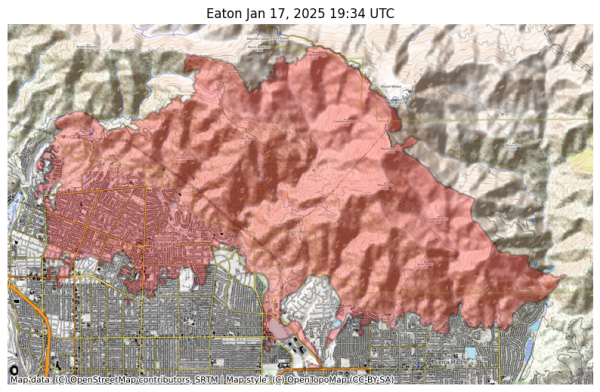
NIFC New Or Updated Wildfire Perimeter
Incident Name: Eaton
Acres: 13952.2 acres
Updated: Jan 17, 2025 19:34 UTC
Source: IRWIN
#EatonFire #CAwx
Visual map representation of the Eaton wildfire, showing the perimeters of the 13952.196833317988 acre fire on a map.


#NIFC #wildfires #firewx
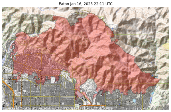
NIFC New Or Updated Wildfire Perimeter
Incident Name: Eaton
Acres: 13936.0 acres
Updated: Jan 16, 2025 22:11 UTC
Source: IRWIN
#EatonFire #CAwx
Visual map representation of the Eaton wildfire, showing the perimeters of the 13936.005096737503 acre fire on a map.


#NIFC #wildfires #firewx
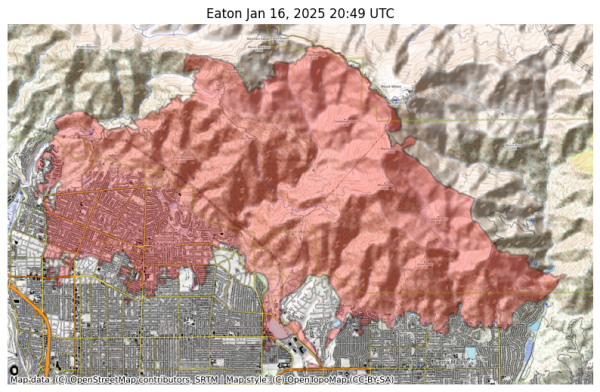
NIFC New Or Updated Wildfire Perimeter
Incident Name: Eaton
Acres: 13938.0 acres
Updated: Jan 16, 2025 20:49 UTC
Source: IRWIN
#EatonFire #CAwx
Visual map representation of the Eaton wildfire, showing the perimeters of the 13937.992630597404 acre fire on a map.


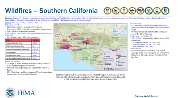
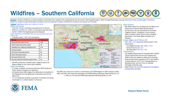
FEMA Update on Los Angeles Area wildfires. (Note: FEMA will be slightly later and out of sync with local sources, CALFIRE / County of Los Angeles)

1/16/25 0713

#EatonFire #PalisadesFire #FireWx #LosAngeles #disaster #LAFires2025
Wildfires – Southern California
Situation: Elevated Fire Weather is expected to persist through today and Red Flag Warnings remain in effect through this afternoon for the mountainous areas of Los Angeles and Ventura counties. Southern California
Edison (SCE) continues de-energization with the potential to impact 291k (+23k) customers due to the fire weather.
National Watch Center
Lifelines: (FEMA Region IX SLB , as of 11:40 p.m. ET, Jan 15)
Safety and Security:
▪ 82k (-1k) mandatory evacuations for LA County
▪ 6:00 p.m. to 6:00 a.m. curfew in evacuation/warning zones
▪ 8,802 firefighting personnel deployed
Food, Hydration, and Shelter: (ARC S


#NIFC #wildfires #firewx
NIFC New Or Updated Wildfire Perimeter
Incident Name: Eaton
Acres: 13925.1 acres
Updated: Jan 16, 2025 05:16 UTC
Source: IRWIN
#EatonFire #CAwx
Visual map representation of the Eaton wildfire, showing the perimeters of the 13925.10811681974 acre fire on a map.


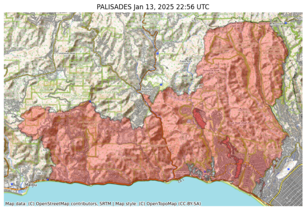
#NIFC #wildfires #firewx
NIFC New Or Updated Wildfire Perimeter
Incident Name: PALISADES
Acres: 23461.4 acres
Updated: Jan 13, 2025 22:56 UTC
Source: IRWIN
#PALISADESFire #CAwx
Visual map representation of the PALISADES wildfire, showing the perimeters of the 23461.372682408288 acre fire on a map.


The Hollywood Reporter

A Lahaina Fire Survivor’s Step-by-Step Guide to Recovering From Tragedy and What to Do First

A former Billboard editor-in-chief (and THR music editor) and her family escaped the inferno that reduced her beloved Maui town to ashes. She offers actionable steps for those in the same position following the blazes raging across Los Angeles.

https://www.hollywoodreporter.com/news/local-news/lahaina-fire-survivor-guide-recovering-tragedy-what-to-do-1236107722/

#wildfires #EatonFire #PalisadesFire #LahainaFire #firewx #disasters


CalOES Shelters 11/13/25 1155

Shelters Available for Communities Impacted by Wildfires in Southern California

Published: Jan 13, 2025

As California endures wildfires fueled by high winds, the California Governor’s Office of Emergency Services (Cal OES) is coordinating with the California Department of Social Services and local governments to ensure impacted communities have access to shelters and vital services.

For specific shelter operation details, please contact your local authorities.

(see list below)
https://news.caloes.ca.gov/shelters-available-for-communities-impacted-by-wildfires-in-southern-california-5/

#wildfires #firewx #EatonFire #PalisadesFire


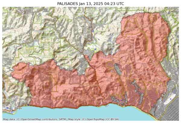
#NIFC #wildfires #firewx
NIFC New Or Updated Wildfire Perimeter
Incident Name: PALISADES
Acres: 23465.4 acres
Updated: Jan 13, 2025 04:23 UTC
Source: IRWIN
#PALISADESFire #CAwx
Visual map representation of the PALISADES wildfire, showing the perimeters of the 23465.390643641626 acre fire on a map.


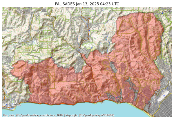
#NIFC #wildfires #firewx
NIFC New Or Updated Wildfire Perimeter
Incident Name: PALISADES
Acres: 23465.4 acres
Updated: Jan 13, 2025 04:23 UTC
Source: IRWIN
#PALISADESFire #CAwx
Visual map representation of the PALISADES wildfire, showing the perimeters of the 23465.390643641626 acre fire on a map.


#NIFC #wildfires #firewx
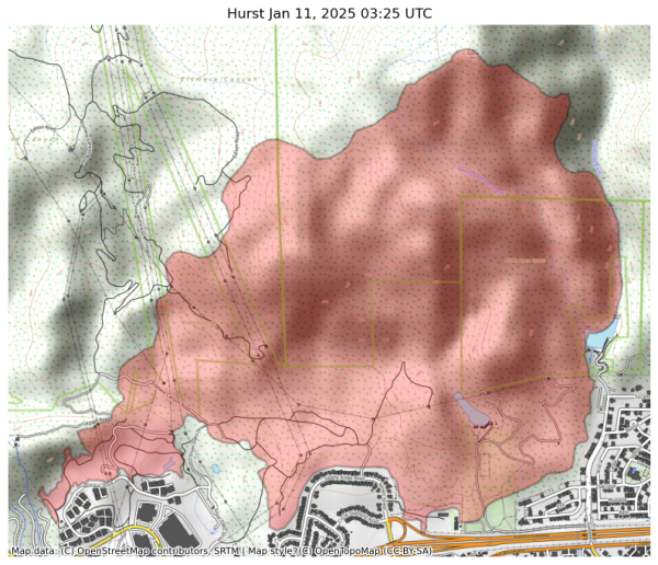
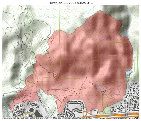
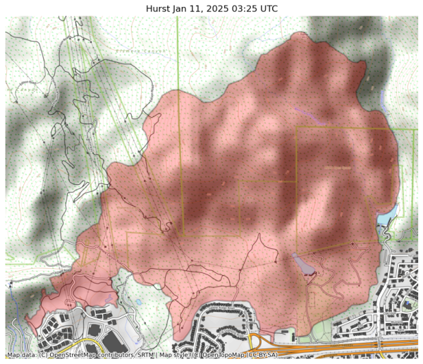
NIFC New Or Updated Wildfire Perimeter
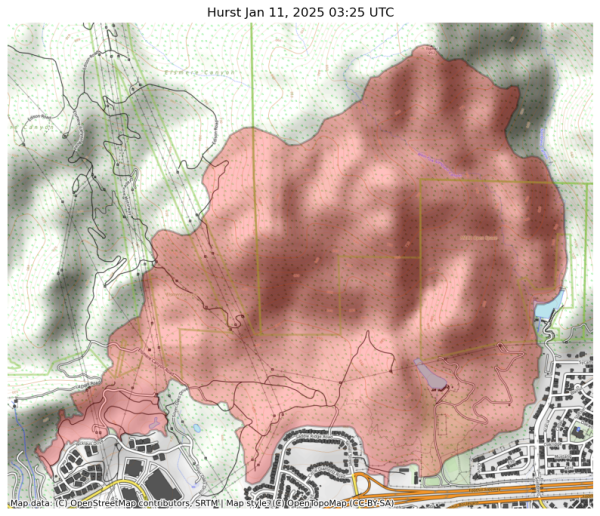
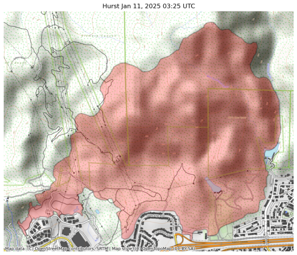
Incident Name: Hurst
Acres: 799.8 acres
Updated: Jan 11, 2025 03:25 UTC
Source: IRWIN
#HurstFire #CAwx
Visual map representation of the Hurst wildfire, showing the perimeters of the 799.8176376199292 acre fire on a map.


#NIFC #wildfires #firewx
NIFC New Or Updated Wildfire Perimeter
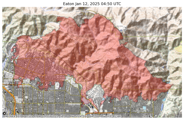
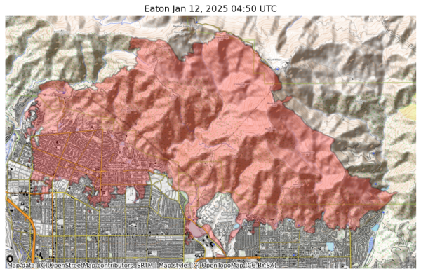
Incident Name: Eaton
Acres: 13955.9 acres
Updated: Jan 12, 2025 04:50 UTC
Source: IRWIN
#EatonFire #CAwx
Visual map representation of the Eaton wildfire, showing the perimeters of the 13955.878955014614 acre fire on a map.


#NIFC #wildfires #firewx
NIFC New Or Updated Wildfire Perimeter
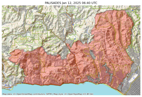
Incident Name: PALISADES
Acres: 23508.0 acres
Updated: Jan 12, 2025 06:40 UTC
Source: IRWIN
#PALISADESFire #CAwx
Visual map representation of the PALISADES wildfire, showing the perimeters of the 23507.982324286368 acre fire on a map.


#NIFC #wildfires #firewx
NIFC New Or Updated Wildfire Perimeter
Incident Name: Hurst
Acres: 799.8 acres
Updated: Jan 11, 2025 03:25 UTC
Source: IRWIN
#HurstFire #CAwx
Visual map representation of the Hurst wildfire, showing the perimeters of the 799.8176376199292 acre fire on a map.


#NIFC #wildfires #firewx
NIFC New Or Updated Wildfire Perimeter
Incident Name: Eaton
Acres: 13955.9 acres
Updated: Jan 12, 2025 04:50 UTC
Source: IRWIN
#EatonFire #CAwx
Visual map representation of the Eaton wildfire, showing the perimeters of the 13955.878955014614 acre fire on a map.


#NIFC #wildfires #firewx
NIFC New Or Updated Wildfire Perimeter
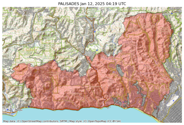
Incident Name: PALISADES
Acres: 23440.4 acres
Updated: Jan 12, 2025 04:19 UTC
Source: IRWIN
#PALISADESFire #CAwx
Visual map representation of the PALISADES wildfire, showing the perimeters of the 23440.350923679274 acre fire on a map.


#NIFC #wildfires #firewx
NIFC New Or Updated Wildfire Perimeter
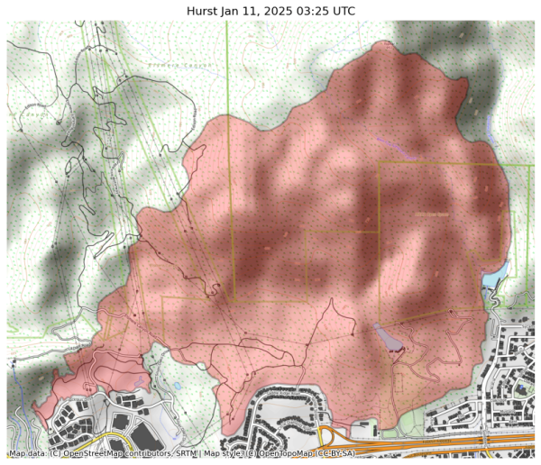
Incident Name: Hurst
Acres: 799.8 acres
Updated: Jan 11, 2025 03:25 UTC
Source: IRWIN
#HurstFire #CAwx
Visual map representation of the Hurst wildfire, showing the perimeters of the 799.8176376199292 acre fire on a map.


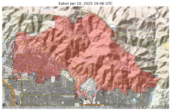
#NIFC #wildfires #firewx
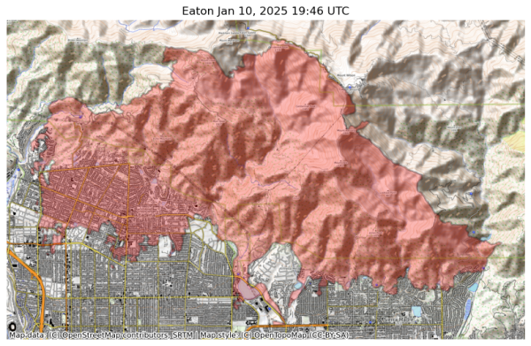
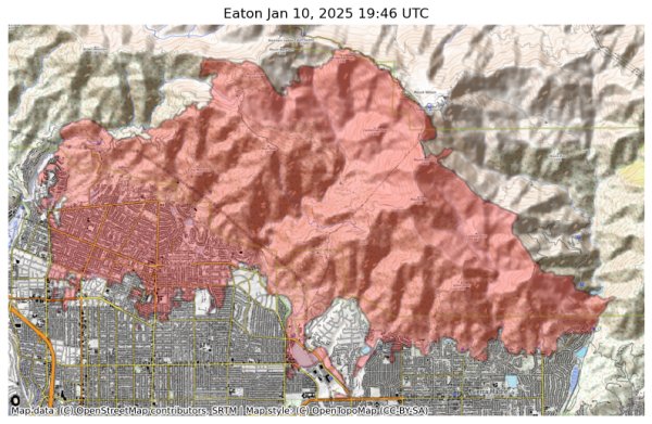
NIFC New Or Updated Wildfire Perimeter
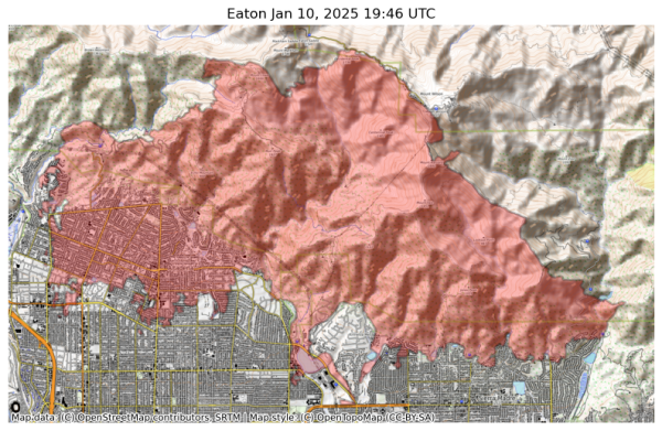
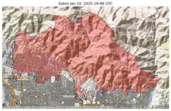
Incident Name: Eaton
Acres: 14017.1 acres
Updated: Jan 10, 2025 19:46 UTC
Source: IRWIN
#EatonFire #CAwx
Visual map representation of the Eaton wildfire, showing the perimeters of the 14017.12678455924 acre fire on a map.


#NIFC #wildfires #firewx
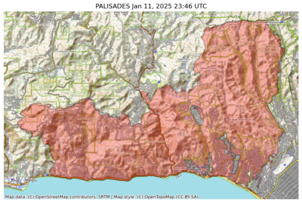
NIFC New Or Updated Wildfire Perimeter
Incident Name: PALISADES
Acres: 23342.9 acres
Updated: Jan 11, 2025 23:46 UTC
Source: IRWIN
#PALISADESFire #CAwx
Visual map representation of the PALISADES wildfire, showing the perimeters of the 23342.901882481692 acre fire on a map.


#NIFC #wildfires #firewx
NIFC New Or Updated Wildfire Perimeter
Incident Name: Hurst
Acres: 799.8 acres
Updated: Jan 11, 2025 03:25 UTC
Source: IRWIN
#HurstFire #CAwx
Visual map representation of the Hurst wildfire, showing the perimeters of the 799.8176376199292 acre fire on a map.


#NIFC #wildfires #firewx
NIFC New Or Updated Wildfire Perimeter
Incident Name: Eaton
Acres: 14017.1 acres
Updated: Jan 10, 2025 19:46 UTC
Source: IRWIN
#EatonFire #CAwx
Visual map representation of the Eaton wildfire, showing the perimeters of the 14017.12678455924 acre fire on a map.


#NIFC #wildfires #firewx
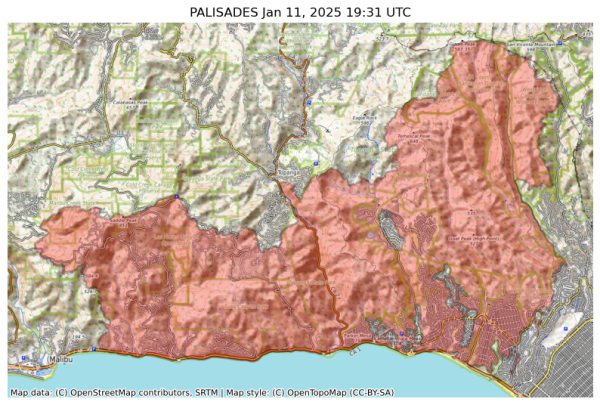
NIFC New Or Updated Wildfire Perimeter
Incident Name: PALISADES
Acres: 22346.7 acres
Updated: Jan 11, 2025 19:31 UTC
Source: IRWIN
#PALISADESFire #CAwx
Visual map representation of the PALISADES wildfire, showing the perimeters of the 22346.652937034385 acre fire on a map.


#NIFC #wildfires #firewx
NIFC New Or Updated Wildfire Perimeter
Incident Name: Hurst
Acres: 799.8 acres
Updated: Jan 11, 2025 03:25 UTC
Source: IRWIN
#HurstFire #CAwx
Visual map representation of the Hurst wildfire, showing the perimeters of the 799.8176376199292 acre fire on a map.


#NIFC #wildfires #firewx
NIFC New Or Updated Wildfire Perimeter
Incident Name: Eaton
Acres: 14017.1 acres
Updated: Jan 10, 2025 19:46 UTC
Source: IRWIN
#EatonFire #CAwx
Visual map representation of the Eaton wildfire, showing the perimeters of the 14017.12678455924 acre fire on a map.


#NIFC #wildfires #firewx
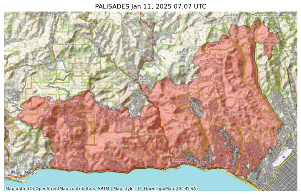
NIFC New Or Updated Wildfire Perimeter
Incident Name: PALISADES
Acres: 21317.0 acres
Updated: Jan 11, 2025 07:07 UTC
Source: IRWIN
#PALISADESFire #CAwx
Visual map representation of the PALISADES wildfire, showing the perimeters of the 21317.0 acre fire on a map.


#NIFC #wildfires #firewx
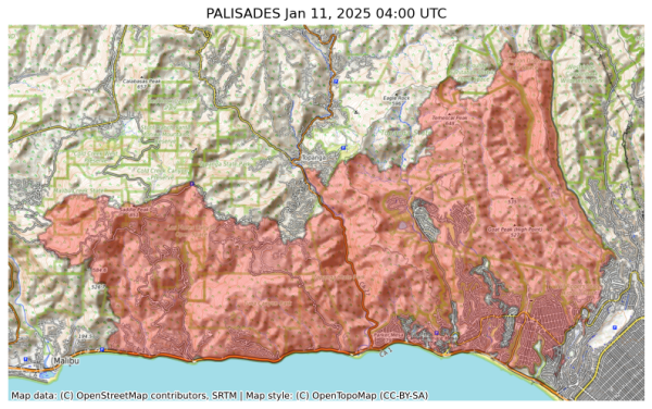
NIFC New Or Updated Wildfire Perimeter
Incident Name: PALISADES
Acres: 21317.0 acres
Updated: Jan 11, 2025 04:00 UTC
Source: IRWIN
#PALISADESFire #CAwx
Visual map representation of the PALISADES wildfire, showing the perimeters of the 21317.0 acre fire on a map.


#NIFC #wildfires #firewx
NIFC New Or Updated Wildfire Perimeter
Incident Name: Hurst
Acres: 799.8 acres
Updated: Jan 11, 2025 03:25 UTC
Source: IRWIN
#HurstFire #CAwx
Visual map representation of the Hurst wildfire, showing the perimeters of the 799.8176376199292 acre fire on a map.


#NIFC #wildfires #firewx
NIFC New Or Updated Wildfire Perimeter
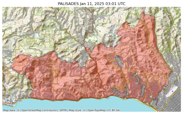
Incident Name: PALISADES
Acres: 20459.7 acres
Updated: Jan 11, 2025 03:01 UTC
Source: IRWIN
#PALISADESFire #CAwx
Visual map representation of the PALISADES wildfire, showing the perimeters of the 20459.68301284337 acre fire on a map.


#NIFC #wildfires #firewx
NIFC New Or Updated Wildfire Perimeter
Incident Name: Eaton
Acres: 14017.1 acres
Updated: Jan 10, 2025 19:46 UTC
Source: IRWIN
#EatonFire #CAwx
Visual map representation of the Eaton wildfire, showing the perimeters of the 14017.12678455924 acre fire on a map.


#NIFC #wildfires #firewx
NIFC New Or Updated Wildfire Perimeter
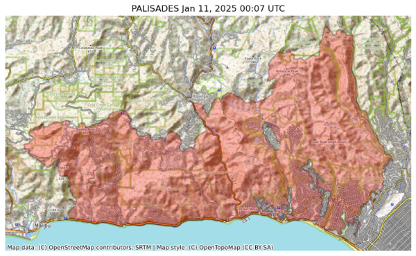
Incident Name: PALISADES
Acres: 20455.9 acres
Updated: Jan 11, 2025 00:07 UTC
Source: IRWIN
#PALISADESFire #CAwx
Visual map representation of the PALISADES wildfire, showing the perimeters of the 20455.88850296879 acre fire on a map.


#NIFC #wildfires #firewx
NIFC New Or Updated Wildfire Perimeter
Incident Name: Eaton
Acres: 14017.1 acres
Updated: Jan 10, 2025 19:46 UTC
Source: IRWIN
#EatonFire #CAwx
Visual map representation of the Eaton wildfire, showing the perimeters of the 14017.12678455924 acre fire on a map.


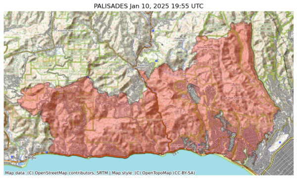
#NIFC #wildfires #firewx
NIFC New Or Updated Wildfire Perimeter
Incident Name: PALISADES
Acres: 20036.7 acres
Updated: Jan 10, 2025 19:55 UTC
Source: IRWIN
#PALISADESFire #CAwx
Visual map representation of the PALISADES wildfire, showing the perimeters of the 20036.658297752892 acre fire on a map.


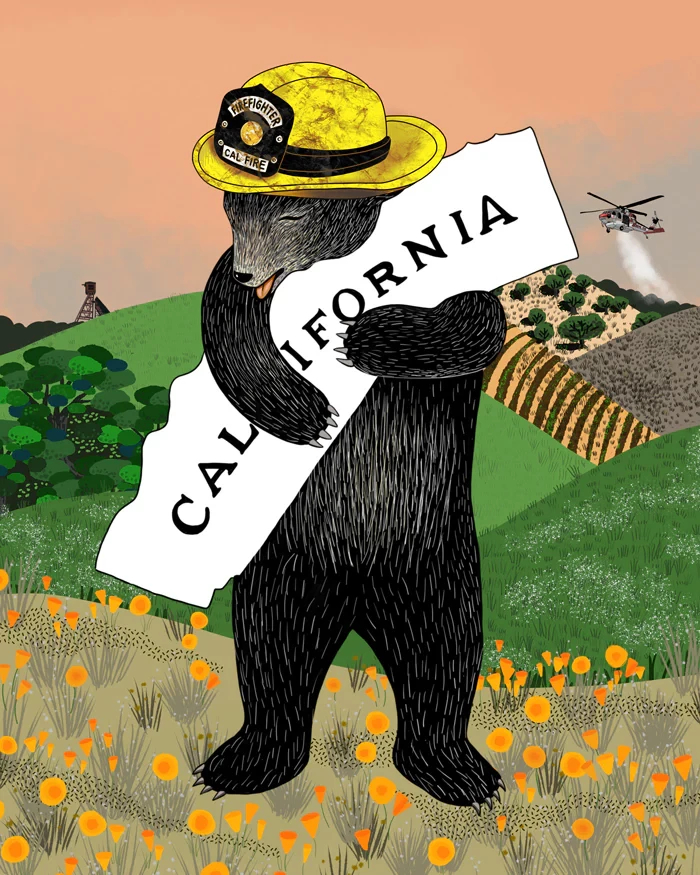
A fantastic poster, and all proceeds go to fire relief efforts. Not all of the LA fires are under the jurisdiction of Cal Fire, but the Palisades fire is.

https://www.3fishstudios.com/products/calfire-bear?utm_campaign=LA%20Fundraiser%20-%20Jan%2010%2C%202025%2C%209%3A17%20AM%20%2801JH8KGPPK7ZPR4KZC7A6N6NN6%29&utm_medium=email&utm_source=3%20Fish%20Studios%20Email%20Subscribers&_kx=pwmK4boK8RSM0bPXxMCUehb_4QeFfx4Fk1Oand8OZuM.Yhxtsb

#FireWX #PalisadesFire #CalFire
Poster with a drawing of a bear, standing up, hugging an item shaped like the state of California; it says California on it. The bear is wearing a firefighter's yellow hat. The bear is standing in a landscape with California poppies at its feet and hills behind it.


City of Malibu

UPDATE 1/10, 9:30 AM. The Palisades Fire has now burned 20,438 acres with 8% containment. New shelter locations. Night time Curfew in effect

UPDATE 1/10, 9:30 AM. The Palisades Fire has now burned 20,438 acres with 8% containment. Winds have improved, but situation remains dangerous. Even if your area is not under evacuation orders, be prepared. New shelters. Night time Curfew in effect.

UPDATE 1/10, 9:30 AM. The Palisades Fire has now burned 20,438 acres with 8% containment. Over 5,000 damaged or destroyed (Malibu and Pacific Palisades). Malibu Building inspectors are conducting rapid visual assessments;

1/x

#PalisadesFire #FireWx #CAwx

https://www.malibucity.org/AlertCenter.aspx?AID=3384