Zum Inhalt der Seite gehen

Suche

Beiträge, die mit FireWx getaggt sind


#NIFC #wildfires #firewx
NIFC New Or Updated Wildfire Perimeter
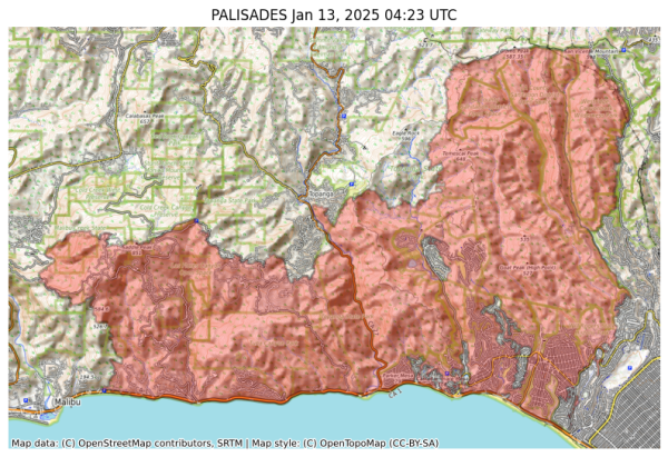
Incident Name: PALISADES
Acres: 23465.4 acres
Updated: Jan 13, 2025 04:23 UTC
Source: IRWIN
#PALISADESFire #CAwx
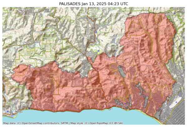
Visual map representation of the PALISADES wildfire, showing the perimeters of the 23465.390643641626 acre fire on a map.


#NIFC #wildfires #firewx
NIFC New Or Updated Wildfire Perimeter
Incident Name: PALISADES
Acres: 23465.4 acres
Updated: Jan 13, 2025 04:23 UTC
Source: IRWIN
#PALISADESFire #CAwx
Visual map representation of the PALISADES wildfire, showing the perimeters of the 23465.390643641626 acre fire on a map.


#NIFC #wildfires #firewx
NIFC New Or Updated Wildfire Perimeter
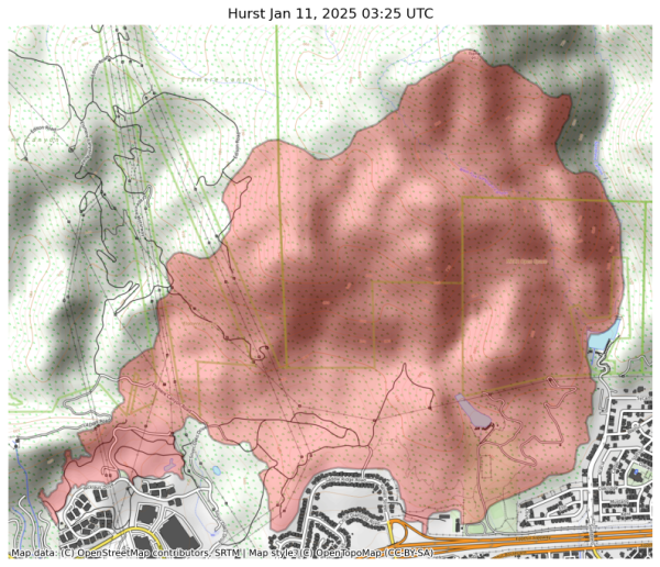
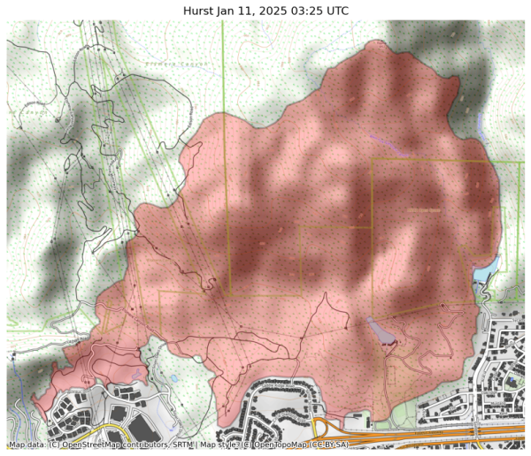
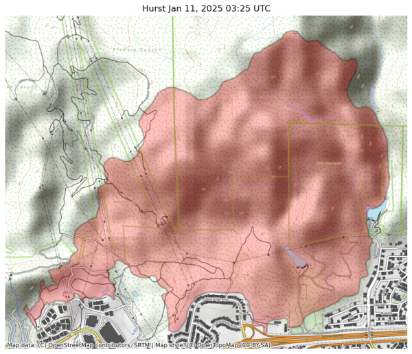
Incident Name: Hurst
Acres: 799.8 acres
Updated: Jan 11, 2025 03:25 UTC
Source: IRWIN
#HurstFire #CAwx
Visual map representation of the Hurst wildfire, showing the perimeters of the 799.8176376199292 acre fire on a map.


#NIFC #wildfires #firewx
NIFC New Or Updated Wildfire Perimeter
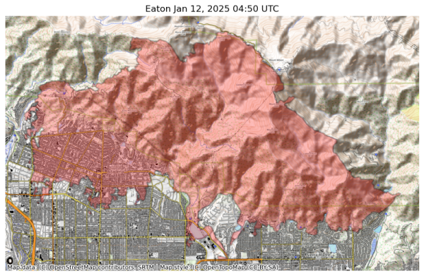
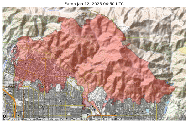
Incident Name: Eaton
Acres: 13955.9 acres
Updated: Jan 12, 2025 04:50 UTC
Source: IRWIN
#EatonFire #CAwx
Visual map representation of the Eaton wildfire, showing the perimeters of the 13955.878955014614 acre fire on a map.


#NIFC #wildfires #firewx
NIFC New Or Updated Wildfire Perimeter
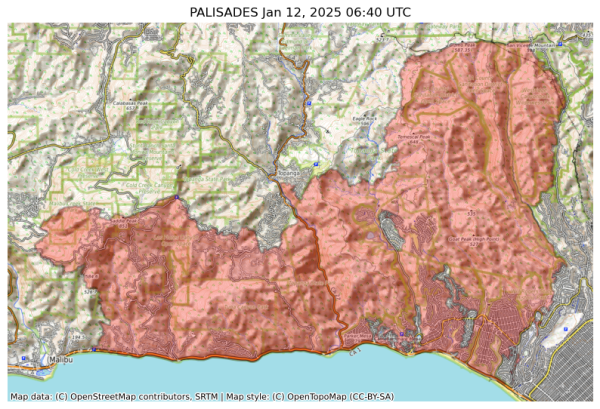
Incident Name: PALISADES
Acres: 23508.0 acres
Updated: Jan 12, 2025 06:40 UTC
Source: IRWIN
#PALISADESFire #CAwx
Visual map representation of the PALISADES wildfire, showing the perimeters of the 23507.982324286368 acre fire on a map.


#NIFC #wildfires #firewx
NIFC New Or Updated Wildfire Perimeter
Incident Name: Hurst
Acres: 799.8 acres
Updated: Jan 11, 2025 03:25 UTC
Source: IRWIN
#HurstFire #CAwx
Visual map representation of the Hurst wildfire, showing the perimeters of the 799.8176376199292 acre fire on a map.


#NIFC #wildfires #firewx
NIFC New Or Updated Wildfire Perimeter
Incident Name: Eaton
Acres: 13955.9 acres
Updated: Jan 12, 2025 04:50 UTC
Source: IRWIN
#EatonFire #CAwx
Visual map representation of the Eaton wildfire, showing the perimeters of the 13955.878955014614 acre fire on a map.


#NIFC #wildfires #firewx
NIFC New Or Updated Wildfire Perimeter
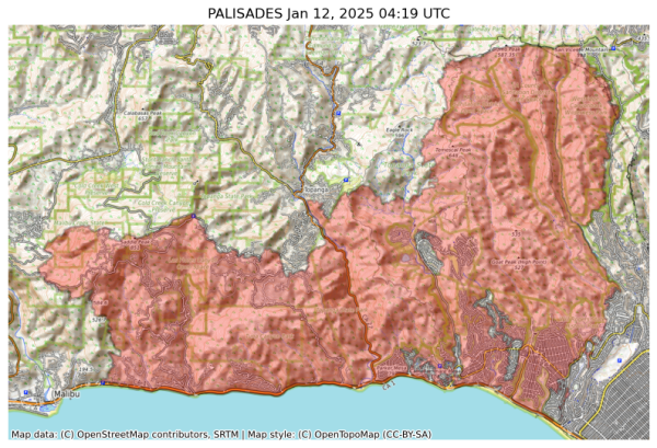
Incident Name: PALISADES
Acres: 23440.4 acres
Updated: Jan 12, 2025 04:19 UTC
Source: IRWIN
#PALISADESFire #CAwx
Visual map representation of the PALISADES wildfire, showing the perimeters of the 23440.350923679274 acre fire on a map.


#NIFC #wildfires #firewx
NIFC New Or Updated Wildfire Perimeter
Incident Name: Hurst
Acres: 799.8 acres
Updated: Jan 11, 2025 03:25 UTC
Source: IRWIN
#HurstFire #CAwx
Visual map representation of the Hurst wildfire, showing the perimeters of the 799.8176376199292 acre fire on a map.


#NIFC #wildfires #firewx
NIFC New Or Updated Wildfire Perimeter
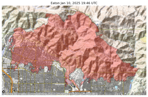
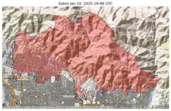
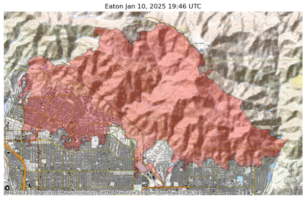
Incident Name: Eaton
Acres: 14017.1 acres
Updated: Jan 10, 2025 19:46 UTC
Source: IRWIN
#EatonFire #CAwx
Visual map representation of the Eaton wildfire, showing the perimeters of the 14017.12678455924 acre fire on a map.


#NIFC #wildfires #firewx
NIFC New Or Updated Wildfire Perimeter
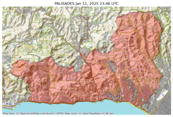
Incident Name: PALISADES
Acres: 23342.9 acres
Updated: Jan 11, 2025 23:46 UTC
Source: IRWIN
#PALISADESFire #CAwx
Visual map representation of the PALISADES wildfire, showing the perimeters of the 23342.901882481692 acre fire on a map.


#NIFC #wildfires #firewx
NIFC New Or Updated Wildfire Perimeter
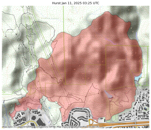
Incident Name: Hurst
Acres: 799.8 acres
Updated: Jan 11, 2025 03:25 UTC
Source: IRWIN
#HurstFire #CAwx
Visual map representation of the Hurst wildfire, showing the perimeters of the 799.8176376199292 acre fire on a map.


#NIFC #wildfires #firewx
NIFC New Or Updated Wildfire Perimeter
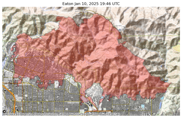
Incident Name: Eaton
Acres: 14017.1 acres
Updated: Jan 10, 2025 19:46 UTC
Source: IRWIN
#EatonFire #CAwx
Visual map representation of the Eaton wildfire, showing the perimeters of the 14017.12678455924 acre fire on a map.


#NIFC #wildfires #firewx
NIFC New Or Updated Wildfire Perimeter
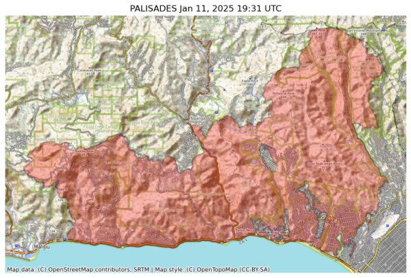
Incident Name: PALISADES
Acres: 22346.7 acres
Updated: Jan 11, 2025 19:31 UTC
Source: IRWIN
#PALISADESFire #CAwx
Visual map representation of the PALISADES wildfire, showing the perimeters of the 22346.652937034385 acre fire on a map.


#NIFC #wildfires #firewx
NIFC New Or Updated Wildfire Perimeter
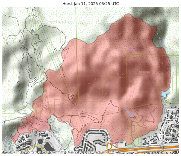
Incident Name: Hurst
Acres: 799.8 acres
Updated: Jan 11, 2025 03:25 UTC
Source: IRWIN
#HurstFire #CAwx
Visual map representation of the Hurst wildfire, showing the perimeters of the 799.8176376199292 acre fire on a map.


#NIFC #wildfires #firewx
NIFC New Or Updated Wildfire Perimeter
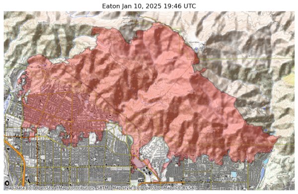
Incident Name: Eaton
Acres: 14017.1 acres
Updated: Jan 10, 2025 19:46 UTC
Source: IRWIN
#EatonFire #CAwx
Visual map representation of the Eaton wildfire, showing the perimeters of the 14017.12678455924 acre fire on a map.


#NIFC #wildfires #firewx
NIFC New Or Updated Wildfire Perimeter
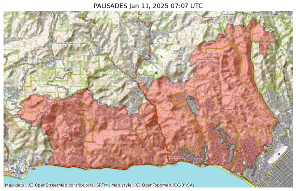
Incident Name: PALISADES
Acres: 21317.0 acres
Updated: Jan 11, 2025 07:07 UTC
Source: IRWIN
#PALISADESFire #CAwx
Visual map representation of the PALISADES wildfire, showing the perimeters of the 21317.0 acre fire on a map.


#NIFC #wildfires #firewx
NIFC New Or Updated Wildfire Perimeter
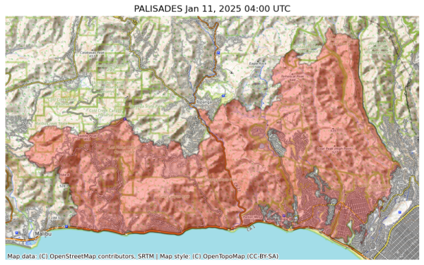
Incident Name: PALISADES
Acres: 21317.0 acres
Updated: Jan 11, 2025 04:00 UTC
Source: IRWIN
#PALISADESFire #CAwx
Visual map representation of the PALISADES wildfire, showing the perimeters of the 21317.0 acre fire on a map.


#NIFC #wildfires #firewx
NIFC New Or Updated Wildfire Perimeter
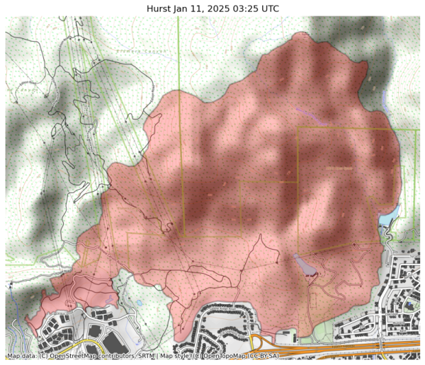
Incident Name: Hurst
Acres: 799.8 acres
Updated: Jan 11, 2025 03:25 UTC
Source: IRWIN
#HurstFire #CAwx
Visual map representation of the Hurst wildfire, showing the perimeters of the 799.8176376199292 acre fire on a map.


#NIFC #wildfires #firewx
NIFC New Or Updated Wildfire Perimeter
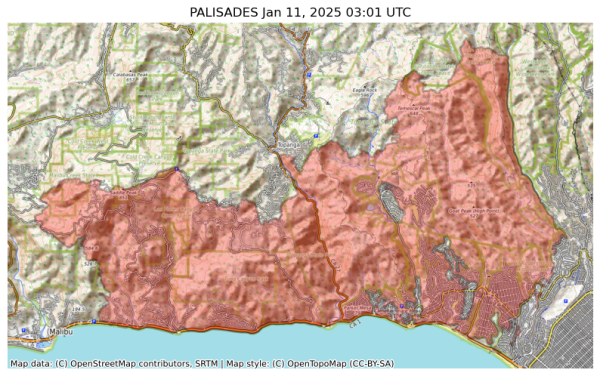
Incident Name: PALISADES
Acres: 20459.7 acres
Updated: Jan 11, 2025 03:01 UTC
Source: IRWIN
#PALISADESFire #CAwx
Visual map representation of the PALISADES wildfire, showing the perimeters of the 20459.68301284337 acre fire on a map.


#NIFC #wildfires #firewx
NIFC New Or Updated Wildfire Perimeter
Incident Name: Eaton
Acres: 14017.1 acres
Updated: Jan 10, 2025 19:46 UTC
Source: IRWIN
#EatonFire #CAwx
Visual map representation of the Eaton wildfire, showing the perimeters of the 14017.12678455924 acre fire on a map.


#NIFC #wildfires #firewx
NIFC New Or Updated Wildfire Perimeter
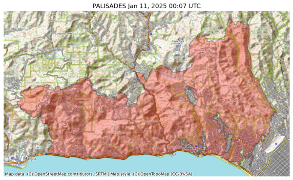
Incident Name: PALISADES
Acres: 20455.9 acres
Updated: Jan 11, 2025 00:07 UTC
Source: IRWIN
#PALISADESFire #CAwx
Visual map representation of the PALISADES wildfire, showing the perimeters of the 20455.88850296879 acre fire on a map.


#NIFC #wildfires #firewx
NIFC New Or Updated Wildfire Perimeter
Incident Name: Eaton
Acres: 14017.1 acres
Updated: Jan 10, 2025 19:46 UTC
Source: IRWIN
#EatonFire #CAwx
Visual map representation of the Eaton wildfire, showing the perimeters of the 14017.12678455924 acre fire on a map.


#NIFC #wildfires #firewx
NIFC New Or Updated Wildfire Perimeter
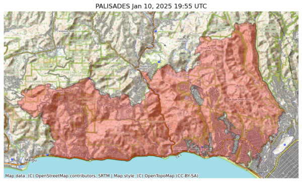
Incident Name: PALISADES
Acres: 20036.7 acres
Updated: Jan 10, 2025 19:55 UTC
Source: IRWIN
#PALISADESFire #CAwx
Visual map representation of the PALISADES wildfire, showing the perimeters of the 20036.658297752892 acre fire on a map.


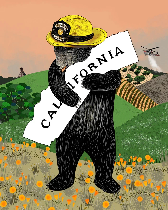
A fantastic poster, and all proceeds go to fire relief efforts. Not all of the LA fires are under the jurisdiction of Cal Fire, but the Palisades fire is.

https://www.3fishstudios.com/products/calfire-bear?utm_campaign=LA%20Fundraiser%20-%20Jan%2010%2C%202025%2C%209%3A17%20AM%20%2801JH8KGPPK7ZPR4KZC7A6N6NN6%29&utm_medium=email&utm_source=3%20Fish%20Studios%20Email%20Subscribers&_kx=pwmK4boK8RSM0bPXxMCUehb_4QeFfx4Fk1Oand8OZuM.Yhxtsb

#FireWX #PalisadesFire #CalFire
Poster with a drawing of a bear, standing up, hugging an item shaped like the state of California; it says California on it. The bear is wearing a firefighter's yellow hat. The bear is standing in a landscape with California poppies at its feet and hills behind it.


City of Malibu

UPDATE 1/10, 9:30 AM. The Palisades Fire has now burned 20,438 acres with 8% containment. New shelter locations. Night time Curfew in effect

UPDATE 1/10, 9:30 AM. The Palisades Fire has now burned 20,438 acres with 8% containment. Winds have improved, but situation remains dangerous. Even if your area is not under evacuation orders, be prepared. New shelters. Night time Curfew in effect.

UPDATE 1/10, 9:30 AM. The Palisades Fire has now burned 20,438 acres with 8% containment. Over 5,000 damaged or destroyed (Malibu and Pacific Palisades). Malibu Building inspectors are conducting rapid visual assessments;

1/x

#PalisadesFire #FireWx #CAwx

https://www.malibucity.org/AlertCenter.aspx?AID=3384


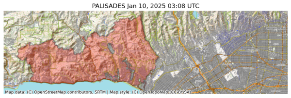
#NIFC #wildfires #firewx
NIFC New Or Updated Wildfire Perimeter
Incident Name: PALISADES
Acres: 19058.7 acres
Updated: Jan 10, 2025 03:08 UTC
Source: IRWIN
#PALISADESFire #CAwx
Visual map representation of the PALISADES wildfire, showing the perimeters of the 19058.65960158052 acre fire on a map.


What you can do

o NOW is the time to act

- Secure any loose objects

- Adjust travel plans in the Tue through Wed timeframe

- Charge necessary electronic and light devices

- Fill up generators

- Park cars away from trees

- When winds start: stay away from trees and windows & use extreme caution with anything that can spark a fire.

#CAwx #FireWx #WindStorm


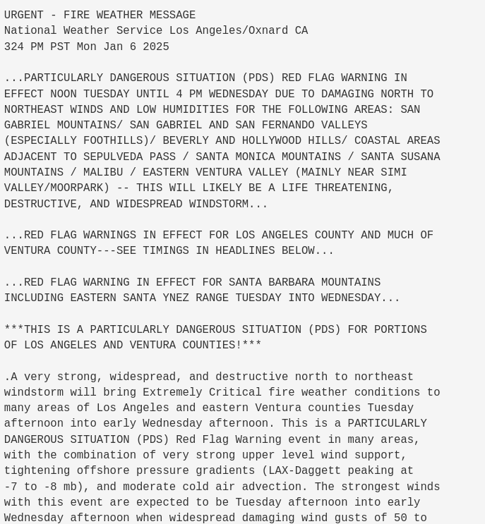
Red Flag Warning was upgraded to PDS Red Flag for Ventura/LA County at 3:24pm #RedFlagWarning #CAwx #FireWx
URGENT - FIRE WEATHER MESSAGE
National Weather Service Los Angeles/Oxnard CA
324 PM PST Mon Jan 6 2025

...PARTICULARLY DANGEROUS SITUATION (PDS) RED FLAG WARNING IN
EFFECT NOON TUESDAY UNTIL 4 PM WEDNESDAY DUE TO DAMAGING NORTH TO
NORTHEAST WINDS AND LOW HUMIDITIES FOR THE FOLLOWING AREAS: SAN
GABRIEL MOUNTAINS/ SAN GABRIEL AND SAN FERNANDO VALLEYS
(ESPECIALLY FOOTHILLS)/ BEVERLY AND HOLLYWOOD HILLS/ COASTAL AREAS
ADJACENT TO SEPULVEDA PASS / SANTA MONICA MOUNTAINS / SANTA SUSANA
MOUNTAINS / MALIBU / EASTERN VENTURA VALLEY (MAINLY NEAR SIMI
VALLEY/MOORPARK) -- THIS WILL LIKELY BE A LIFE THREATENING,
DESTRUCTIVE, AND WIDESPREAD WINDSTORM...

...RED FLAG WARNINGS IN EFFECT FOR LOS ANGELES COUNTY AND MUCH OF
VENTURA COUNTY---SEE TIMINGS IN HEADLINES BELOW...

...RED FLAG WARNING IN EFFECT FOR SANTA BARBARA MOUNTAINS
INCLUDING EASTERN SANTA YNEZ RANGE TUESDAY INTO WEDNESDAY...

***THIS IS A PARTICULARLY DANGEROUS SITUATION (PDS) FOR PORTIONS
OF LOS ANGELES AND VENTURA COUNTIES!***

.A very strong, widespread, and destructive north to northeast
windstorm will bring Extremely Critical fire weather conditions to
many areas of Los Angeles and eastern Ventura counties Tuesday
afternoon into early Wednesday afternoon. This is a PARTICULARLY
DANGEROUS SITUATION (PDS) Red Flag Warning event in many areas,
with the combination of very strong upper level wind support,
tightening offshore pressure gradients


Multiple SCE circuits reported out by local ham radio amateurs in Thousand Oaks/Newbury Park. (I still have power, knock on wood). #PSPS #FireWx #CAwx #ConejoValley #ThousandOaks


[Watch live[ Flames ignite homes and cars as 30,000 people ordered to evacuate from #LosAngeles #wildfire

The fire exploded from 20 acres to 1,200 acres in mere hours and wind speeds could soon reach 100mph (160km/h).

https://www.bbc.com/news/live/c5y81zyp1ext
#FireWx #PalisadesFire #LA #LAFire
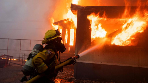

Head's up in Altadena, Close Fire is moving fast, they are trying to push evacuations. #Altadena #FireWx #CAwx


Close Fire in Altadena moving fast, threatening structures... Head's up all. #FireWx #CloseFire #Pasadena https://share.watchduty.org/i/40388?ts=1736303808000


The wind is throwing fire 1/2 to 3/4 miles away

Holy fucking shit that’s so bad

Flashbacks of Oakland Hills in 1991

If you’re in SoCal you can’t underestimate how fire flies….

Be safe. Get out now before you’re trapped.

No joke.

#CAwx #FireWx #PalisadesFire

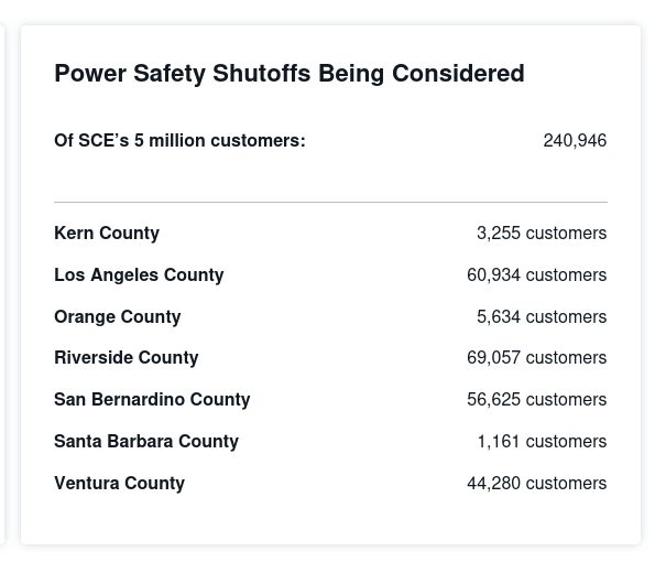
Well, SCE is on notice for this wind event. Charge up your spare batteries, folks. #FireWx #CAwx #wildfires
SCE saying 240,946 customers may see power outages...