Zum Inhalt der Seite gehen

Suche

Beiträge, die mit hughesfire getaggt sind


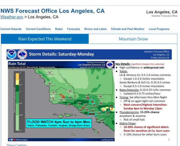
NWS Los Angeles/Oxnard Forecast for Sat-Mon (Jan 25-27)

FLOOD WATCH 4pm Sun to 4pm Mon Eaton, Palisades, Franklin, Hughes, Bridge Burn Scars

https://www.weather.gov/lox/

#CAwx #EatonFire #PalisadesFire #FranklinFire #HughesFire #BridgeFire
NWS LosAngeles/Oxnard infographic showing map of Southern California. Time stamped 24 Jan 2025; 12:36 pm PST 

Includes Key Details: (significant changes from yesterday)
• High confidence in widespread rain
• Totals:
LA & Ventura Co: 0.5-1.0 inches common
• Except 1.0-2.0 inches mountains
Santa Barbara & SLO Co: 0.25-0.5 inches
• Except 0.5-1.0 inches mountains
• Rates/Intensity: 0.10-0.25 in/hr common
• Isolated 0.5-0.75 inches/hour
• Timing: Sat afternoon thru Mon Night
• Off & on again light rain common
• Most concern/Highest intensities:
Sunday 4pm to Monday 12pm
• Thunderstorms: 15-25% chance anywhere & anytime.
• Risk of small hail.
• Debris Flows:
• 10-20% chance of significant debris flows for sensitive LA Co. burn scars
• 5-10% chance for other burn scars


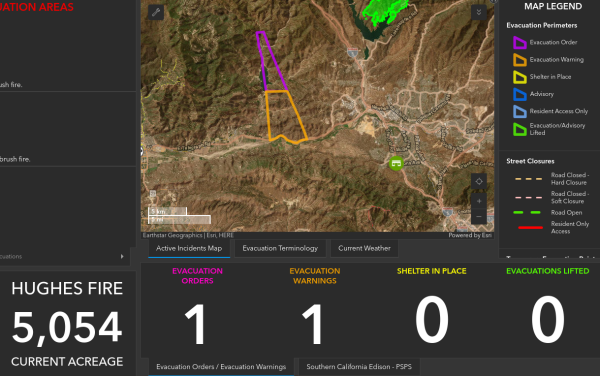
New evacuations in Ventura County for Hughes Fire east side of Piru/Lake Piru.. https://vcemergency.com #HughesFire 1/22/25 1422 #VenturaCounty
Evac warning/orders near Lake Piru


Northbound and Southbound I-5 have been closed. 1/22/25 1419 #HughesFire


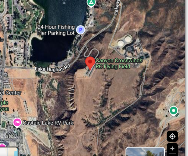
RC flying field referenced by units on radio. 1/22/25 1401 #HughesFire
RC Flying Field on a map near Lake Hughes Rd


*San Francisquito Canyon for those not familiar with the area 1/22/25 1400 #HughesFire


Fire about to impact remote control airport north of Lake Hughes. Wants to ensure evacuations include San Fran Canyon to Copper Hill all the way west to county line. 1/22/25 1359 #HughesFire


[VC Situation Update] Hughes Fire - LA County 1.22.25 (1333)

The United States Forest Service and the Los Angeles County Fire Department are working to control a well-established brush fire near Lake Hughes in Castaic. The fire is currently East of the 5 freeway however heavy smoke is visible from many parts of Ventura County.

The fire is estimated to be in excess of 5000 acres at this time however does not currently pose a threat to Ventura County. No evacuation orders or warnings have been issued for Ventura County residents.

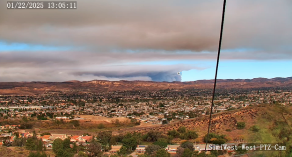
(image via ham radio mesh and @orv ) #HughesFire
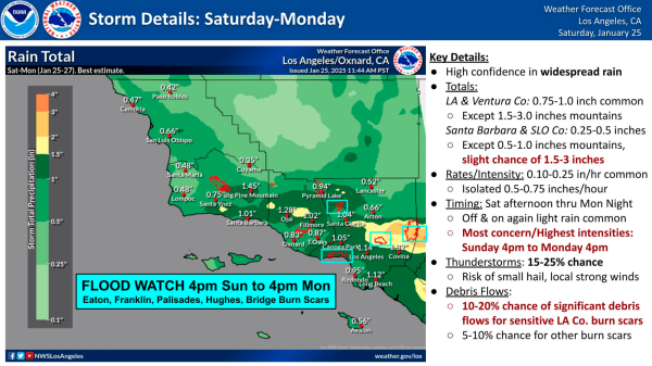
Image of a fire in the distance from ham radio camera


More questions about if the fire is impacting the I-5 North. They are still determining if/when shutdown might be needed. #HughesFire 1/22/25 1352


Request from law enforcement to shut down I-5 north. Fire resources want to avoid shutdown. Will hold off for now. #HughesFire 1/22/25 1347


Fire spotted to below main dam. Fire is outflanking them at toe of the slope #HughesFire 1/22/25 1346


Fire impacting filtration plant just south of Lake Hughes #HughesFire 1/22/25 1343


Heavy impacts on Lake Hughes Road (Castaic) #HughesFire 1/22/25 1333


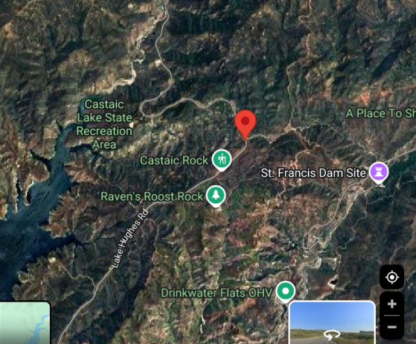
Location of spot there is East side of Lake Castaic near the ruins of one of the biggest disasters in Ventura County/LA history, the ruins of the St. Francis dam. #HughesFire 1/22/25 1315
Dot on map


Spot across Lake Hughes, near Dry Gulch - 50-70 acres #HughesFire 1/22/25 1313


Command post moved to College of the Canyons #HughesFire 1/22/25 1307


Restarting the thread... Ventura County Copter 4 was up checking out the fire and risks to Ventura County a second ago. There is no fire in Ventura County, and the fire remains at Castaic Lake #HughesFire 1/22/25 1304
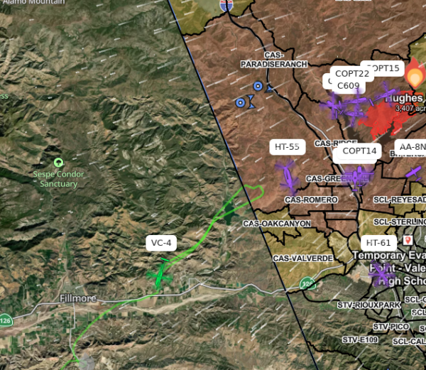
CPT 4 path in Ventura checking out things  in case VCFD neesd to get involved