Suche
Beiträge, die mit mapstodon getaggt sind
Wie könnten absurd kleine Flurstücke der Stadt Braunschweig klingen und ästhetisch dargestellt werden?
Mit einem befreundeten Künstler habe ich eine experimentelle #Soundinstallation gemacht. Falls es euch interessiert, wie aus #Geodaten #Musik bzw #Sound generiert wird, sagt gern bescheid oder schaut euch die Ausstellung an. Einladungstext in den Kommentaren
#gis #gischat #midi #synthesizer #ableton #karten #weirdmaps #Kunst #art #Spatial #geography #geospatial #mapping #mapstodon
Can anyone recommend any good (preferably open source) journey tracking software/apps? I’m working with a researcher undertaking a canoe expedition and he would like to map his journey in real time, using a phone or smart watch, and embed the map in a web page so others can follow the journey.
#mapstodon #mapping #openstreetmap
#mapstodon #mapping #openstreetmap
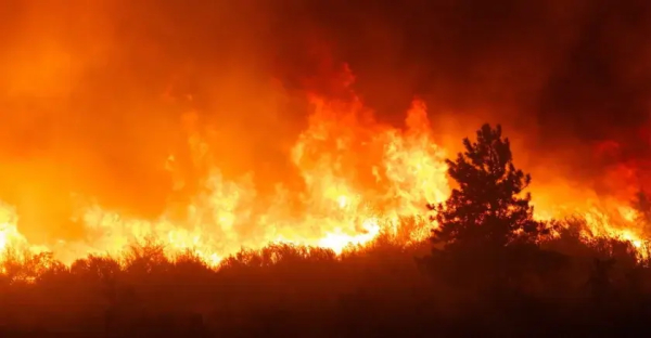
#GIS Is the #Data Backbone for Agencies Battling #LA #Fires https://tinyurl.com/49fanev2 via GovTechNews
#wildfires #EmergencyResponse #CAFires #LAFires #publicsafety #govtech #esri #arcgis #mapping #GISchat #geospatial #mapstodon @esri @gispublicsafety @esrislgov @urisa
#wildfires #EmergencyResponse #CAFires #LAFires #publicsafety #govtech #esri #arcgis #mapping #GISchat #geospatial #mapstodon @esri @gispublicsafety @esrislgov @urisa
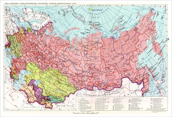
My latest "conspiracy theory": the standard map projection used by the Soviet Union really makes sense only if Scandinavia was part of it. Otherwise you would move slightly the centre, rather than have dangling Chukotka in the top-right corner.
See more maps of the USSR: https://istorik.net/502-karty-sssr.html #maps #mapstodon
See more maps of the USSR: https://istorik.net/502-karty-sssr.html #maps #mapstodon
Карты СССР - 1922, 1929, 1937, 1941, 1946, 1976, 1990
Старые карты СССР с подробными границами всех 15 республик СССР от 1922-го по 1990-й показывают, как образовался и выглядел Советский Союз, занимавший 1/7 часть суши Земли.Карта СССР 1922 г.Карта СССР на момент образования, 30 декабря 1922 г.Исторические события мира XIX, XX, XXI века | Историк (istorik.net)


