Suche
Beiträge, die mit gischat getaggt sind
The Call for Participation is now open! Submit your talk today!
https://2025.stateofthemap.org/calls/general/
#OpenStreetMap #OSM #gischat #sotm #sptm2025 @sotm
State of the Map 2025 – Manila
The global OpenStreetMap conference. 2025 in Manila & online.2025.stateofthemap.org

Mit einem befreundeten Künstler habe ich eine experimentelle #Soundinstallation gemacht. Falls es euch interessiert, wie aus #Geodaten #Musik bzw #Sound generiert wird, sagt gern bescheid oder schaut euch die Ausstellung an. Einladungstext in den Kommentaren
#gis #gischat #midi #synthesizer #ableton #karten #weirdmaps #Kunst #art #Spatial #geography #geospatial #mapping #mapstodon


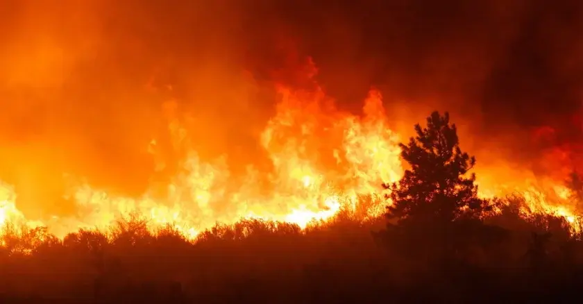
#wildfires #EmergencyResponse #CAFires #LAFires #publicsafety #govtech #esri #arcgis #mapping #GISchat #geospatial #mapstodon @esri @gispublicsafety @esrislgov @urisa
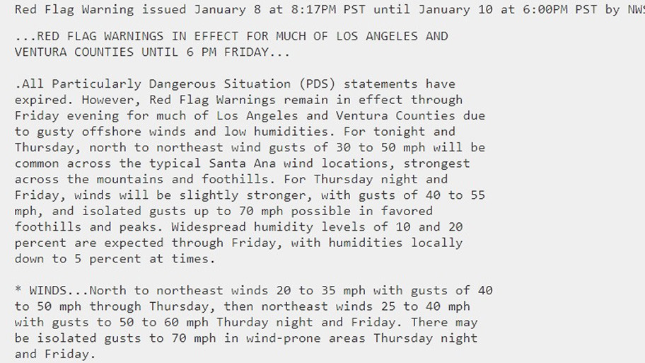
#WindAdvisory
#HighWindWatch
To read details from NOAA, open the map, click colored area, follow the link. Scroll down in the popup since each type of watch or warning has its own link for the details.
Latest perimeter for the #PalisadesFire shows 17,234 acres burned. Zoom in for details.
The maps has lots of #GIS layers that you can turn on/off/restack.
You can make your own custom map links that show the data you want to see.
You can change the ‘top’ layer that is clickable to see attribute data.
Need help? Open the map and see 2 links upper left corner.
#EatonFire #SunsetFire #Geospatial #GISchat
Open GISsurfer map:
https://mappingsupport.com/p2/gissurfer.php?center=34.114612,-118.428497&zoom=10&basemap=USA_basemap&overlay=MODIS_7_day,VIIRS_7_day,Lake_river_stream,Perimeter_FIRIS_intel,Red_flag_warning&data=https://mappingsupport.com/p2/special_maps/disaster/USA_wildland_fire.txt
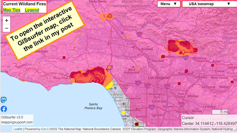

GISsurfer General Purpose Web Map and GIS Viewer | Surf GIS DATA
GISsurfer lets you surf a nearly endless amount of GIS data. Click a layer in the GIS server's table of contents and that data appears on the map.mappingsupport.com