Zum Inhalt der Seite gehen

Suche

Beiträge, die mit QGIS getaggt sind


Die Frage ist: Braucht es zukünftig eine ähnliche „Wollmilchsau“? Vielleicht nicht. Vielleicht reicht eine Kombi aus spezialisierten Tools: #OSMAnd für Offline-Karten, #Bikerouter für Routing, #QGIS für Tourenverwaltung.

Auch wenn #Komoot jetzt neue Wege geht, die nicht allen gefallen: Es gibt Alternativen, die für einzelne Anwendungsfälle oft besser sind – und viele davon sind #OpenSource. Vielleicht ist das die Zukunft: Freiheit, Flexibilität und freies Wissen.

Danke fürs Mitdenken! 😊


Flyover of Broughty Ferry.

First time I've tried starting from a LAZ point cloud rather than a pre-processed raster.

Great to see how much point cloud functionality is provided out-of-the-box in :qgis:

Used python script to get OBJ file into Blender - not strictly needed

The oil-colour look was from using Kuwahara filter in blender, with a guassian blur to keep file size down.

#blender #qgis


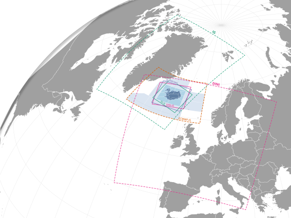
There are so many nice #QGIS plugins available. Check out Globe Builder. Need an orthographic projection view of your data? Done!

These are the different weather forecast models used by The Icelandic Met Office + subsets. IG and DINI are jointly operated with Denmark, Ireland and Netherlands 🤝🏻
A globe map with areas around Iceland
#qgis


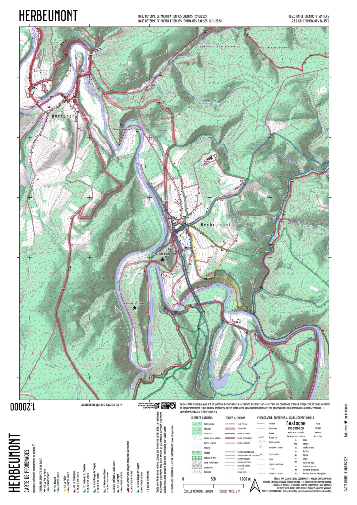
I've made a few improvements in the OpenArdenneMap style, mostly in the #QGIS style. So I'll start to update and make new maps on https://hiking.osm.be using QGIS instead of Mapnik -> https://www.nobohan.be/2025/03/06/openardennemap-hiver-24-25/ #OpenStreetMap
Map of Herbeumont using OpenArdenneMap style


Hi #GISchat 📢

Tomorrow I´ll be leading a #QGIS course for my Met Office coworkers, first group out of 3!

Do you have any fun geometry generators for my course? I have a few practical examples but need some funny ones to show that there are no limits (except your imagination).


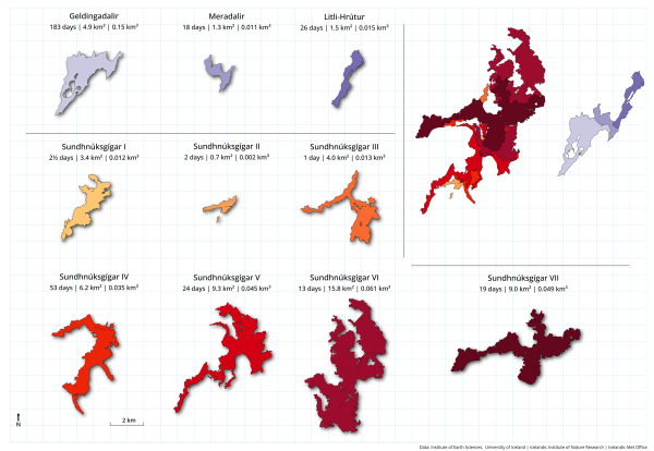
The first lava field from Dec 2023 is now almost fully covered! A simple comparison map showing all the ten lava fields since 2021. Made this as part of very nice overview article (in Icelandic) put together by my very talented colleagues and coworkers (link in reply). All the maps were with #QGIS
Lava fields shown as individual outlines AND as a stacked map like they are in reality.
#qgis