Suche
Beiträge, die mit OSM getaggt sind
Ich hatte mal eine Umfrage gemacht und daraus ein paar weitere Empfehlungen versucht abzuleiten: Mitarbeit bei OpenStreetMap: "Viel lesen um alles richtig einzutragen" oder "Fang einfach an!"?
Weitere Empfehlungen sind da u.a. @MapComplete #MapComplete oder #OpenStop
https://www.kom-in.de/170/openstop-haltestelle-an-der-datenautobahn
Es gibt auch nen lebendigen #Matrix Raum zu #OpenStreetMap #osm

OpenStop - Haltestelle an der Datenautobahn?
Die Erfassung von Daten zur Barrierefreiheit von Haltestellen des öffentlichen Verkehrs ist notwendig.www.kom-in.de
The Call for Participation is now open! Submit your talk today!
https://2025.stateofthemap.org/calls/general/
#OpenStreetMap #OSM #gischat #sotm #sptm2025 @sotm
State of the Map 2025 – Manila
The global OpenStreetMap conference. 2025 in Manila & online.2025.stateofthemap.org
#tts #osm #osmand #organicmaps #grapheneos
📍 26.–29. März in Münster
✨ Highlights:
🔹 Eröffnungssession „25 Jahre FOSSGIS“ mit Eszter Kiss
🔹 Fachvorträge zu #OpenData, Indoor-Positionsbestimmung & sicherer #OpenSource Entwicklung
Kommt vorbei & vernetzt euch mit uns! 🚀
https://fossgis-konferenz.de/2025/
#FOSSGIS2025 #OSM #GIS @FOSSGISeV @fossgis_konf
FOSSGIS 2025
Die FOSSGIS-Konferenz ist im D-A-CH Raum die führende Konferenz für Freie und Open Source Software für Geoinformationssysteme OpenStreetMap.fossgis-konferenz.de
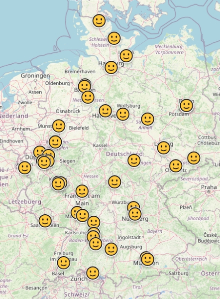
1000+ (Eintausend) Leute auf der #Fedikarte . DANKE 🥰👍
Wie... Kennst du noch nicht? Eine Karte, auf der sich Leute aus dem Fediverse selbstständig ein oder austragen können. Keine KI, sondern ein liebevoll programmierter Bot von @wolfmond . Karte auf Basis von OpenStreetMap, alle Daten (bis auf die Kartenkacheln) selbst gehosted.
Alle Infos zum Projekt (und die Karte 🥰) unter https://fedikarte.de
#GemeinsamStattEinsam
#Fediversum
#Fedikarte
#Opensource
#OSM
#OpenStreetMap
#unplugtrump
edit: kurze sammlung der beiträge:
https://flopp.net & https://lokjo.com sind quasi genau das was ich gesucht hatte.
weitere hilfreiche empfehlungen
- HERE WeGo: Maps & Navigation für Android
- Geoportale diverser Kreise / Städte / Länder für offizielle GIS-Daten
und noch ein allgemeiner Link: https://european-alternatives.eu/alternatives-to
ich suche nach eine Webanwendung, mit der ich Marker auf eine Map setzen kann. Zu diesem Marker soll man dann eine Beschreibung setzen können. Pro Marker soll man Bilder hochladen können, die als "Diashow" durchgeschaut werden können.
Es soll foss sein und auf osm basieren.
Am nächsten kommt da uMap ran. Leider ist die Bildintegration nicht so dolle, weil man einzelne URLs zum eigentlichen Bild eintragen muss.
#foss #osm #openstreetmap
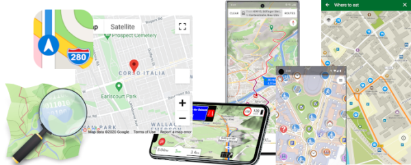
siehe auch Wie navigierst Du? Karten-Apps: Von "Datenschleudern" und "Funktionsmonstern"

Wie navigierst Du? Karten-Apps: Von "Datenschleudern" und "Funktionsmonstern"
In einer kleinen Umfrage haben wir gefragt, welche Karten-App Ihr nutzt und vor allem: Warum? Was zeichnet die verschiedenen Apps aus und welche Apps können für verschiedene individuelle Anforderungen empfehlenswert sein?GNU/Linux.ch
Is anyone working on something like this based on OSM and the Fediverse? Recently, Foursquare released their location data, which could be a great kick-off.
I would love to contribute.
#applemaps #osm #googlemaps #fediverse #foursquare
https://location.foursquare.com/resources/blog/products/foursquare-open-source-places-a-new-foundational-dataset-for-the-geospatial-community/

Foursquare Open Source Places: A new foundational dataset for the geospatial community | Foursquare
Stay up to date with the latest from Foursquare! Learn more about Foursquare Open Source Places: A new foundational dataset for the geospatial communityFoursquare
There's a ton of useful data now available, like cycling infrastructure, winter maintenance, playgrounds, sports facilities, all sorts of things. Automatic imports would still need approval, but manual mapping is 100% good to go now!
https://wiki.openstreetmap.org/wiki/Waterloo_region
With both you can navigate as well as edit/add OSM data.
Car drivers also like Magic Earth, which is OSM-based and without trackers, but it's not #FOSS .
#OSM #OSMand #OrganicMaps @Organic Maps
@Mike Kuketz 🛡
I have to ask astupid question: Are there actually OSM maps with longitude and latitude grids?
#OpenStreetMap
Also: Routen bewerten, eintragen, kommentieren, kopieren wären tolle Funktionen.
Mit Organic Maps konnte ich zumindest "Tracks aufzeichen", was ich schon sehr cool fand'.
#komoot #Wandern #opensource #maps #gps #trekking #hiking #organicMaps #osm #openstreetmap
overpass turbo
A web based data mining tool for OpenStreetMap which runs any kind of Overpass API query and shows the results on an interactive map.overpass-turbo.eu


