Suche
Beiträge, die mit palisadesfire getaggt sind
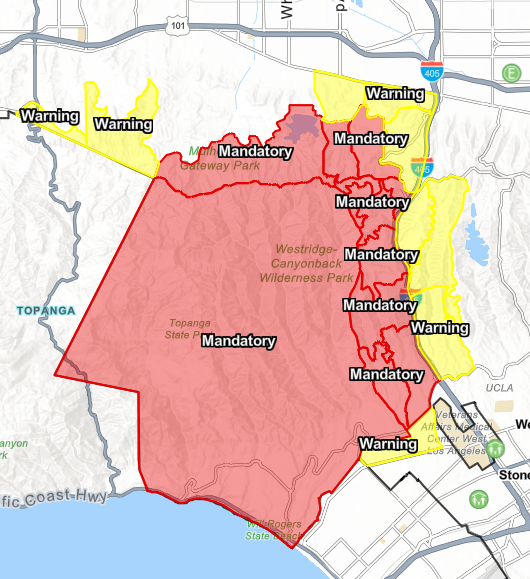
AFD: Evacuation Warning for Palisades Fire at Louise to Ventura to the 405 freeway to Sepulveda/Havenhurst. Prepare to evacuate by gathering supplies, pets, and loved ones. Monitor local news, LAFD social media, and www.lafd.org/alerts for maps and info. Source: 200277,LA City Public Alerts,City of Los Angeles
#Evacuation
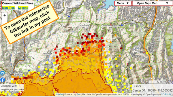
The NE part of the fire is expanding and more evacuations have been ordered.
Check this same link in the morning and you will see newer data.
The fire camera layer (brown arrowheads) is ‘on top’ and clickable.
Open GISsurfer map:
https://mappingsupport.com/p2/gissurfer.php?center=34.110596,-118.535092&zoom=13&basemap=Open_Topo_Map&overlay=MODIS_7_day,VIIRS_7_day,Perimeter_FIRIS_intel,Fire_camera_location&data=https://mappingsupport.com/p2/special_maps/disaster/USA_wildland_fire.txt
GISsurfer General Purpose Web Map and GIS Viewer | Surf GIS DATA
GISsurfer lets you surf a nearly endless amount of GIS data. Click a layer in the GIS server's table of contents and that data appears on the map.mappingsupport.com
From: @Cal_OES_bot
https://m.ai6yr.org/@Cal_OES_bot/113807615301469294

CalOES (bot) (@Cal_OES_bot@m.ai6yr.org)
Attached: 1 image Los Angeles wildfire survivors can apply for federal aid today, new website launched to help Californians #caloes #disasters https://news.caloes.ca.AI6YR's Mastodon
Our thoughts are with everyone affected by the wildfires. We know how important it is to stay connected with your loved ones.
Due to the conditions, Mint Mobile will upgrade your plan to 2TB of high-speed data, with no restriction to your hotspot. We hope you stay safe.
#PalisadesFire #EatonFire #HurstFire #CreekFire #CAwx
Lunder is a long-time professional wildfire geographer and burn boss based in Chico, California.
If you want quick no-nonsense wildfire briefings, he is your go to guy! https://www.youtube.com/watch?v=4ybFRdM07HQ
#LosAngeles #WildFire #PalisadesFire #EatonFire #Fire #LA
- YouTube
Auf YouTube findest du die angesagtesten Videos und Tracks. Außerdem kannst du eigene Inhalte hochladen und mit Freunden oder gleich der ganzen Welt teilen.www.youtube.com
The LA LGBT Center will be doing a donation drive for the wildfires on the 12th! If you can please bring anything you can spare, requested items can be found by following the link: https://lalgbtcenter.org/vanguard/calling-all-angelenos-la-wildfire-relief-drive-this-sunday-jan-12/
#PalisadesFire #PasadenaFire #hurstfire #la #losangeles #sylmarfire #eatonfire #lafires #losangelesfire #hollywood #hollywoodfire #sunsetfire #wildfires #lgbt #lgbtq #lalgbt
1/10/25 1912PT
https://lafd.maps.arcgis.com/apps/Media/index.html?appid=ba8cfed4b4a04d49b7489eb8300727a8
Cole Euken, Staff Reporter
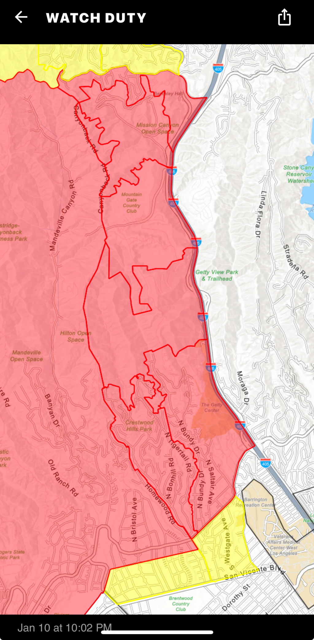
Jan 10 at 10:02 PM EST
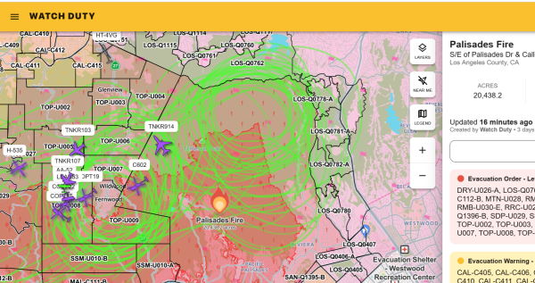
The Evacuation Orders have been expanded to the East to include Zones: LOS-Q0780, LOS-Q0782-A, LOS-Q0781-A, LOS-Q0782-B, LOS-Q0798, LOS-Q0778-A and additional areas east of Zone LOS-Q0780 to the 405 - per the LA City Evacuation Map https://lafd.maps.arcgis.com/apps/Media/index.html?appid=ba8cfed4b4a04d49b7489eb8300727a8
https://share.watchduty.org/i/40335?ts=1736564596000
Watch Duty - Wildfire Maps & Alerts
Real-time information about wildfire and firefighting efforts nearbyWatch Duty
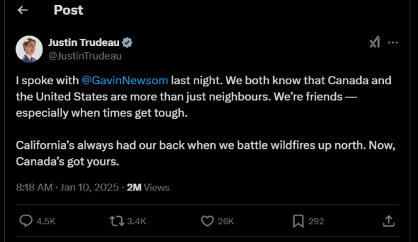
Thank you for being a friend and helping us out when we are in distress.
The CA Peeps need to stick together.
#Canada #LAFire #Malibu #PalisadesFire #SF #SFBay #SanFrancisco
#News #GreatNews
https://www.youtube.com/watch?v=KbnswV20IJ4
#wildfires #LosAngeles #Altadena
- YouTube
Auf YouTube findest du die angesagtesten Videos und Tracks. Außerdem kannst du eigene Inhalte hochladen und mit Freunden oder gleich der ganzen Welt teilen.www.youtube.com
EVACUATION WARNING ADDED Brush Fire; INC#0738; 06:00PM; 1190 N Piedra Morada Dr; MAP: https://lafd.maps.arcgis.com/apps/Media/index.html?appid=ba8cfed4b4a04d49b7489eb8300727a8; Pacific Palisades; The Evacuation Warning on the Northeast corner of the Palisades Fire is extending to include the area within Sepulveda / Sapphire to Mulholland https://lafd.org/alert/evacuation-warn
• Staff Reporter
8 minutes ago · Jan 10 at 6:06 PM
Evacuation Warnings have been issued for Zones: LOS-Q0765 & LOS-Q1118 - per the LA City Evacuation Map and the Genasys Evacuation Map.
The Evacuation Warning on the Northeast corner of the Palisades Fire is extending to include the area within Sepulveda / Sapphire to Mulholland to Escalon to Action Road/High Valley. While no immediate action is required, we ask residents to ensure they are Ready, Set, Go! with an evacuation bag and a plan - per LAFD.
These evacuation zones are viewable on the Watch Duty map or via the linked maps above.
#PalisadesFire #WatchDuty
All the Celebrities Who Lost Homes Amid California Wildfires
All the Celebrities Who Lost Homes Amid California Wildfires - INBELLAINBELLA
https://kcra.com/article/california-insurance-moratorium-palisades-eaton-fire/63394532
#CaliforniaWildfire
#PalisadesFire
#EatonFire
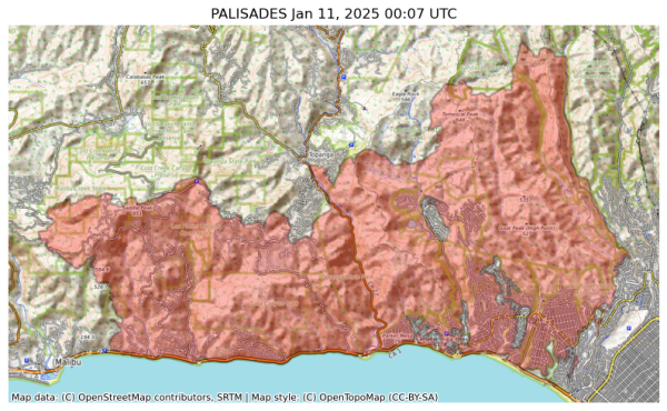
NIFC New Or Updated Wildfire Perimeter
Incident Name: PALISADES
Acres: 20455.9 acres
Updated: Jan 11, 2025 00:07 UTC
Source: IRWIN
#PALISADESFire #CAwx
"The section of the fire moving north in Sullivan Canyon is still active along that flank and resources do anticipate that the fire will reach the dirt section of the Mulholland Dr area eventually due to the terrian and fuels. The fire remains west of the West Mandeville Fire Rd."
Sad. I guess the big push would be to hold it there and not let it start down the other side.
#Palisadesfire
Deaths 5
Injuries 3
#EatonFire
Deaths 6
Injuries 5 (firefighters)
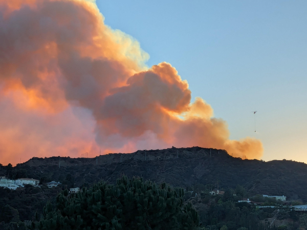
Hopefully nothing new, just seeing flames from the northern edge.
#PalisadesFire
UPDATE 1/10, 4:00 PM: The Palisades Fire has now burned 21,317 acres with 8% containment. No one allowed into evac area; night time Curfew in effect
UPDATE 1/10, 4:00 PM: The Palisades Fire has now burned 21,317 acres, 8% contained. Winds have improved, but situation remains dangerous. No one is allowed into mandatory evacuated areas. Night time Curfew in effect 6PM-6AM.
https://www.malibucity.org/AlertCenter.aspx?AID=3393
#PalisadesFire
https://space-solutions.airbus.com/newsroom/satellite-image-gallery/pleiades-neo/wildfires-in-los-angeles/
#LAWildfires #PalisadesFire
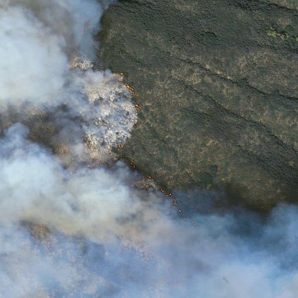
Wildfires in Los Angeles, USA | Watch out the highest resolution satellite image from natural disaster
Our state of the art Pléiades Neo imagery specialized satellite reveals Palissade Wildfires in Los Angeles, USA in very high-resolution enhanced by Pléiades Neospace-solutions.airbus.com
It basically hasn't rained this winter.
Doesn't matter how many firefighters you have. Doesn't matter if there's enough water pressure.
The fires were unfightable until the winds died down and/or the humidity went up. End of story.
This is the new normal. This is the coolest decade of the rest of your life.
This is #ClimateChange.
#PalisadesFire #LosAngeles #EatonFire
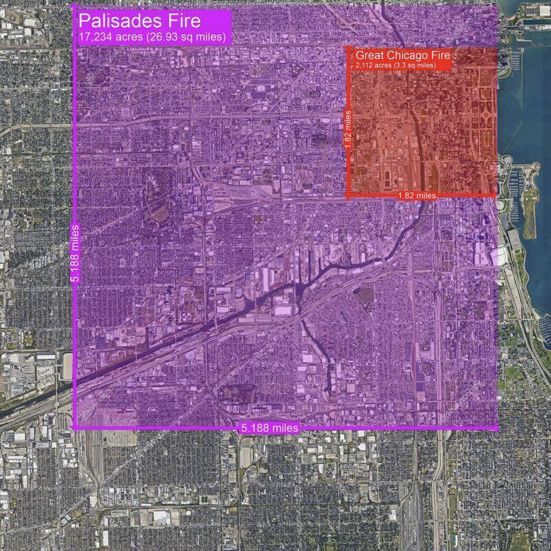
Seen here in comparison to modern Chicago, the Palisades Fire in LA is about eight times larger than the Great Chicago Fire of 1871.
LA has 6 concurrent fires spread across the metropolis.
#greatchicagofire #lafires2025 #PalisadesFire #chicago #brushfire #santaannawinds #CaliforniaWildFires
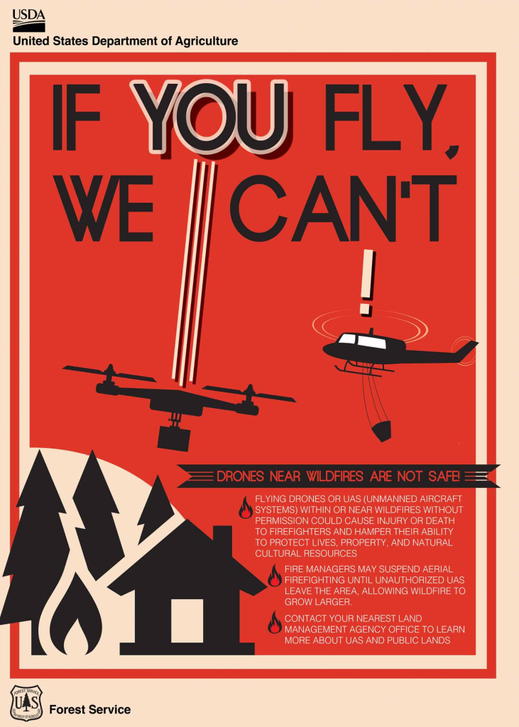
IF YOU FLY WE CAN'T
DRONES NEAR WILDFIRE ARE NOT SAFE!
Flying drones or UAS (Unmanned Aircraft Systems) within or near wildfires without permission could cause injury or death to firefighters and hamper the ability to protect lives, property, and natural cultural resources.
Fire managers may suspend aerial firefighting until unauthorized UAS leave the area, allowing wildfire to grow larger.
#drones #wildfires #aviation #PalisadesFire #EatonFire
From Los Angeles Time: Insurance commissioner issues moratorium on home policy cancellations in fire zones
https://www.latimes.com/business/story/2025-01-10/insurance-commissioner-issues-moratorium-on-home-policy-cancellations-in-fire-zones
https://www.youtube.com/live/JSTTY4vZORE
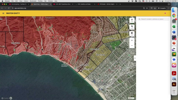
Weather and climate office hours by Weather West: 01/10/2025: Continuing SoCal wildfire coverage
The latest in a recurring series of live, virtual, & interactive "office hours" hosted by Dr. Daniel Swain on various topics related to extreme weather and c...YouTube
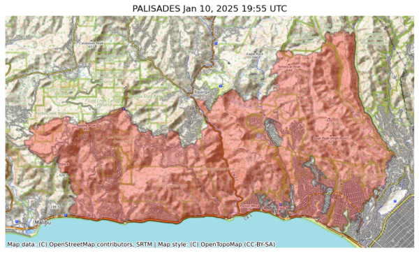
NIFC New Or Updated Wildfire Perimeter
Incident Name: PALISADES
Acres: 20036.7 acres
Updated: Jan 10, 2025 19:55 UTC
Source: IRWIN
#PALISADESFire #CAwx
Reposted from Bluesky:
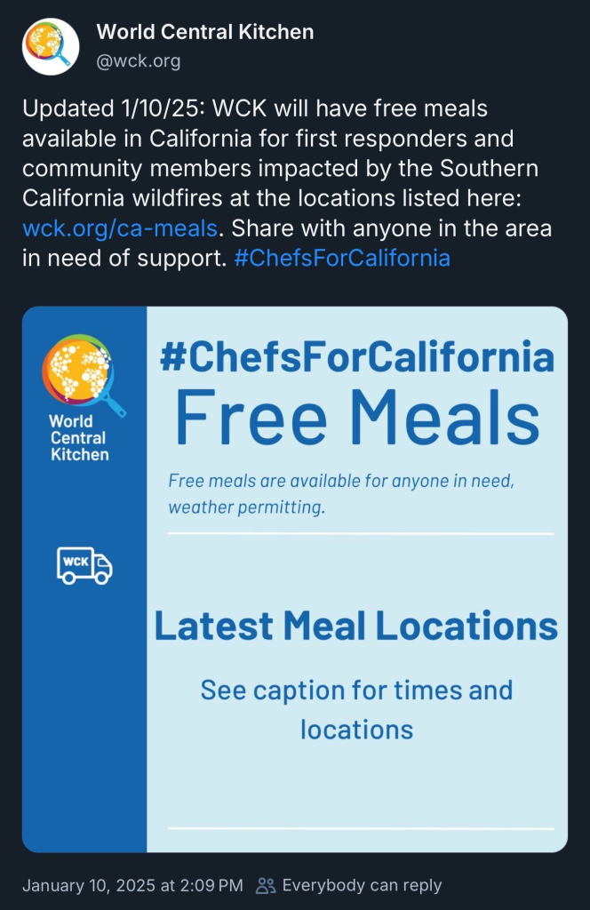
Updated 1/10/25: WCK will have free meals available in California for first responders and community members impacted by the Southern California wildfires at the locations listed here: https://wck.org/ca-meals. Share with anyone in the area in need of support. #ChefsForCalifornia
Their link tree: https://linktr.ee/wckitchen
World Central Kitchen | Instagram, Facebook, TikTok | Linktree
WCK is first to the frontlines, providing meals in response to crises.Linktree
If you are looking for someone impacted by the January 2025 #wildfires in Los Angeles County, or you want to inform your family of your safety wellness. Please, contact the Red Cross at (800) 675-5799 or visit > https://www.redcross.org/get-help/disaster-relief-and-recovery-services/contact-and-locate-loved-ones/california-wildfires-reunification.html

California Wildfires Reunification
If you need assistance locating or connecting with a loved one in California because of the wildfires the Red Cross may be able to help.www.redcross.org
Miles Teller & Bryan Greenberg Lose Home In L.A. Fires
Miles Teller & Bryan Greenberg Lose Home In L.A. Fires - INBELLAINBELLA
Anthony Hopkins Homes Burnt Down Amid Pacific Palisades Wildfires
Anthony Hopkins Homes Burnt Down Amid Pacific Palisades Wildfires - INBELLAINBELLA
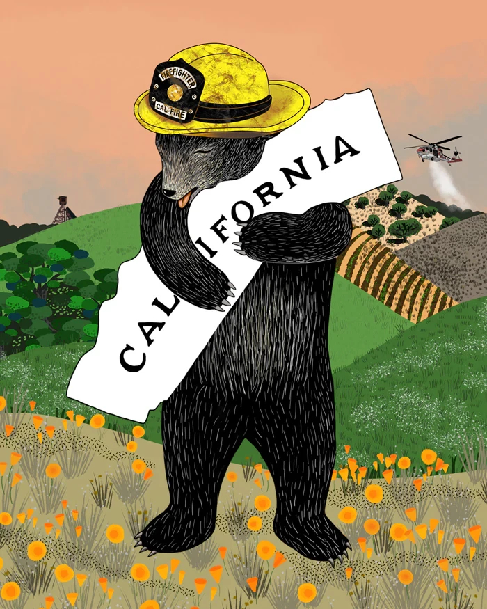
https://www.3fishstudios.com/products/calfire-bear?utm_campaign=LA%20Fundraiser%20-%20Jan%2010%2C%202025%2C%209%3A17%20AM%20%2801JH8KGPPK7ZPR4KZC7A6N6NN6%29&utm_medium=email&utm_source=3%20Fish%20Studios%20Email%20Subscribers&_kx=pwmK4boK8RSM0bPXxMCUehb_4QeFfx4Fk1Oand8OZuM.Yhxtsb
#FireWX #PalisadesFire #CalFire
CalFire Fundraising Print
Join us in supporting our community during fire season by purchasing this print. Your purchase directly funds fire relief efforts in California, making a meaningful impact.3 Fish Studios
#PalisadesFire
19,978 acres, 6% contained
#EatonFire
13,690 acres, 3% contained
#KennethFire
1000 acres, 35% contained
#HurstFire
771 acres, 37% contained
#LidiaFire
395 acres, 75% contained, fwd progress stopped
@ai6yr
UPDATE 1/10, 9:30 AM. The Palisades Fire has now burned 20,438 acres with 8% containment. New shelter locations. Night time Curfew in effect
UPDATE 1/10, 9:30 AM. The Palisades Fire has now burned 20,438 acres with 8% containment. Winds have improved, but situation remains dangerous. Even if your area is not under evacuation orders, be prepared. New shelters. Night time Curfew in effect.
UPDATE 1/10, 9:30 AM. The Palisades Fire has now burned 20,438 acres with 8% containment. Over 5,000 damaged or destroyed (Malibu and Pacific Palisades). Malibu Building inspectors are conducting rapid visual assessments;
1/x
#PalisadesFire #FireWx #CAwx
https://www.malibucity.org/AlertCenter.aspx?AID=3384
Fatalities 2
Injuries 3
#EatonFire
Fatalities 5
Injuries 4
three additional fatalities have yet to be confirmed
Backup Power for Air Filters + Water
https://susankayequinn.com/2025/01/backup-power-for-air-filters-water.html
#climatecrisis #disaster #psa #airquality #wildfire #water
Backup Power for Air Filters + Water
Learning From Climate Disasters You absolutely should get the Watch Duty app if you or anyone you love is in a wildfire zone. I paid for the annual fee upgrade because I want to support their impor…SUSAN KAYE QUINN

