Suche
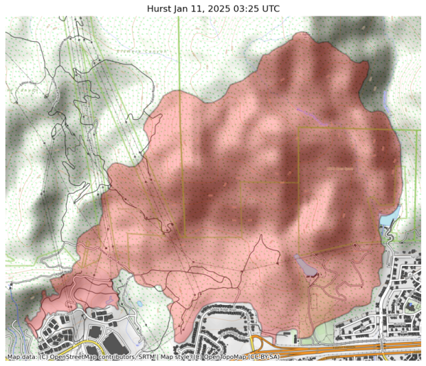
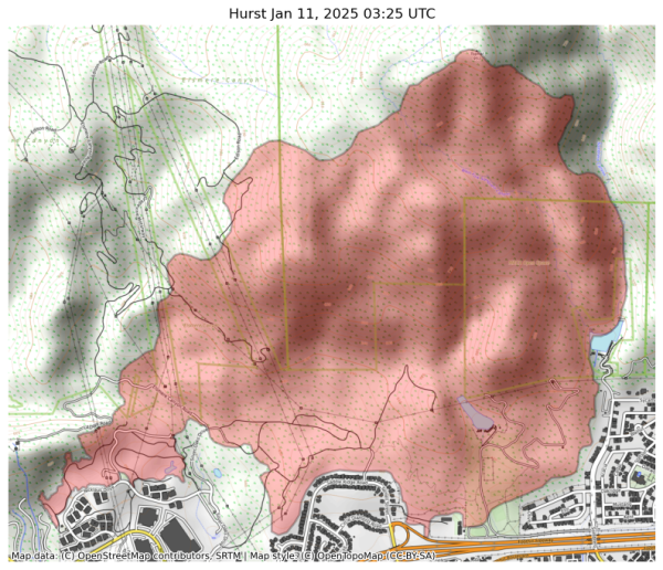
Beiträge, die mit HurstFire getaggt sind
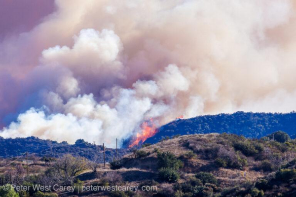
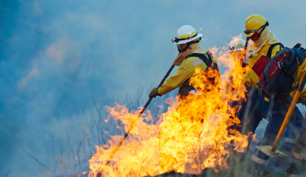
Mandatory evacuation orders have been lifted for the #SunsetFire, #KennethFire, #HurstFire, and #LidiaFire — but residents are strongly encouraged to continue heeding evacuation warnings still covering these affected areas.
Track real-time information ➡️ Fire.CA.Gov
https://fmcsc.org/2025/01/fire/
#EatonFire #PacificPalisadesFire #HurstFire #LosAngeles
Fire Emergency: Support Resources and Updates - Free Methodist Church in Southern California
Multiple wildfires are affecting our Southern California communities, with several Free Methodist churches and members under evacuation orders.Christopher Frazier (Free Methodist Church in Southern California)
#palisadesfire #eatonfire #KennethFire #hurstfire #creekfire
https://docs.google.com/document/d/1opb9XeteEDFqAxlilyg7o4791c3t_WScF8TQ3o0NeDM/mobilebasic?fbclid=PAZXh0bgNhZW0CMTEAAaajo8kRqq1D7J5snPvDMbNGrudhQ1WlpyJNmxhgUMUQG041FHx0D4Xsjt0_aem_O1Us7x-0qTWLahlThE-0Ow
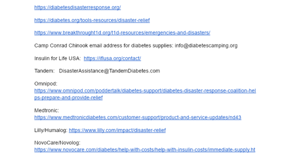
Diabetes Resources for LA Fires
Diabetes Resources: https://diabetesdisasterresponse.org/ https://diabetes.org/tools-resources/disaster-relief https://www.breakthrought1d.Google Docs
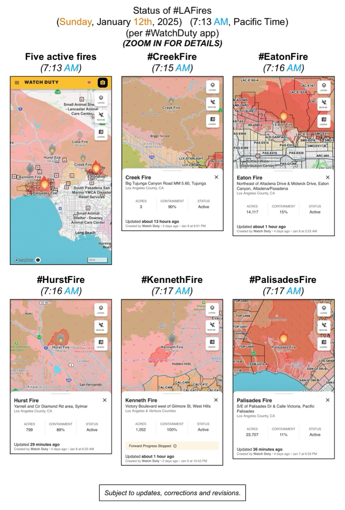
(Sunday, January 12th, 2025)
(7:13 AM, Pacific Time)
(per #WatchDuty app)
ZOOM IN FOR DETAILS
#CreekFire
#EatonFire
#HurstFire
#KennethFire
#PalisadesFire
(subject to updates, corrections, and revisions)
Because we have the time right now > An explanation:
Can firefighters use saltwater to battle the #LosAngelesFires? (or why not)
📋 > https://www.technology.org/how-and-why/can-salt-water-put-out-fire/
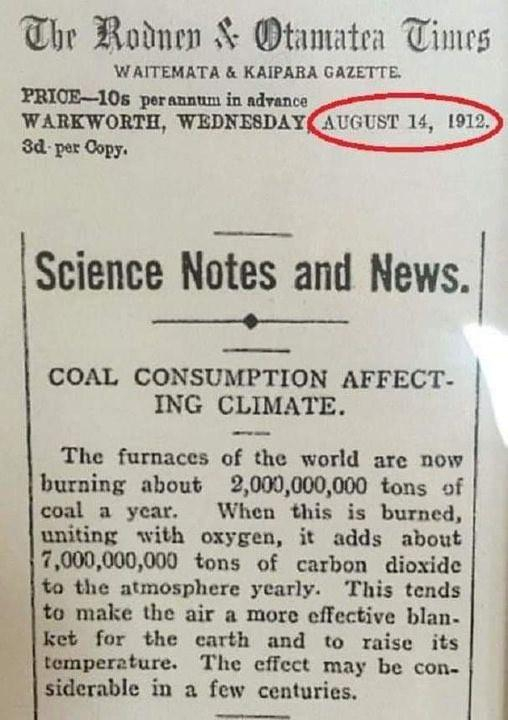
https://www.usatoday.com/story/news/factcheck/2021/08/13/fact-check-yes-1912-article-linked-burning-coal-climate-change/8124455002/
#ClimateChange #ClimateCrisis #ClimateAction #ClimateCatastrophe #fire #LAfires #wildfires #LosAngeles #socal #SouthernCalifornia #PacificPalisades #altadena #hollywood #EatonFire #PalisadesFire #SunsetFire #HurstFire #KennethFire #USpolitics #AmericanPolitics #political #politics #ClimateJustice #climate #USpol
Fact check: A 1912 article about burning coal and climate change is authentic
Social media users are sharing an article from 1912 that warns about the danger of coal contributing to climate change.McKenzie Sadeghi, USA TODAY (USA TODAY)
If you're looking for ways to help those affected by the fires in Los Angeles, I have a place for you to start with financial donations.
Charity Navigator has a li
https://thecareyadventures.com/blog/how-to-help-those-in-los-angeles-part-1/
#California #NorthAmerica #PhotoOfTheDay #USA #Volunteering #Weather #CaliforniaWildfires #Diasater #EartonFire #fire #help #helping #HurstFire #LAFire #LAFires #PalisadesFire #volunteer #wildfires
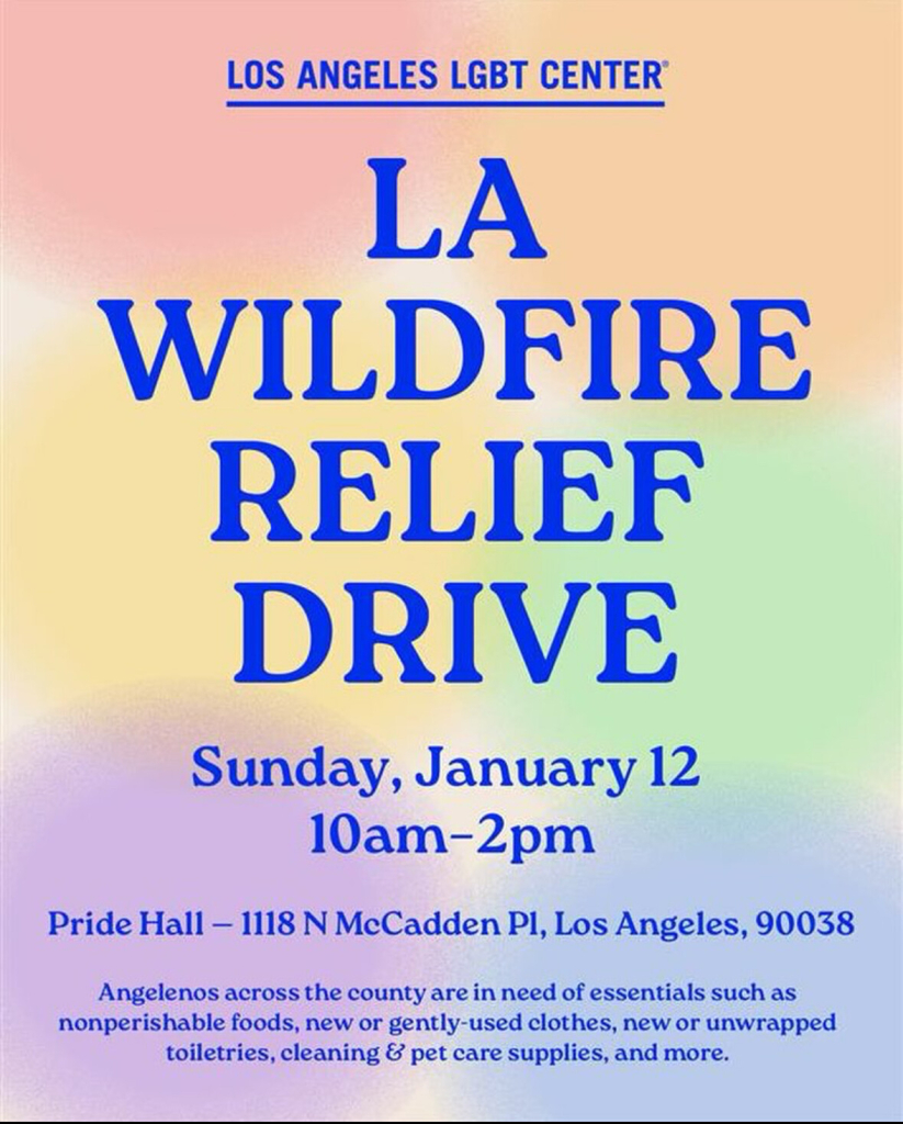
The LA LGBT Center will be holding a donation drive for the wildfires on the 12th! If you can please bring anything you can spare, requested items can be found here: https://lalgbtcenter.org/vanguard/calling-all-angelenos-la-wildfire-relief-drive-this-sunday-jan-12/
#PalisadesFire #PasadenaFire #hurstfire #la #losangeles #sylmarfire #eatonfire #lafires #losangelesfire #hollywood #hollywoodfire #sunsetfire #wildfires #lgbt #lgbtq #lalgbt
Family Assistance Center
2551 Motor Ave, Los Angeles, CA 90064
(310) 837-5286
The Cheviot Hills location is operated by LA City, and Los Angeles Police officers will be present to take missing persons reports. The Mayor’s Crisis Response Team, American Red Cross, LA County Medical Examiner’s Office, and LA County Department of Mental Health will provide additional information and support. For more information on missing loved ones, please call (800) 675-5799 or visit the Red Cross https://www.redcross.org/get-help/disaster-relief-and-recovery-services/contact-and-locate-loved-ones/california-wildfires-reunification.html

California Wildfires Reunification
If you need assistance locating or connecting with a loved one in California because of the wildfires the Red Cross may be able to help.www.redcross.org
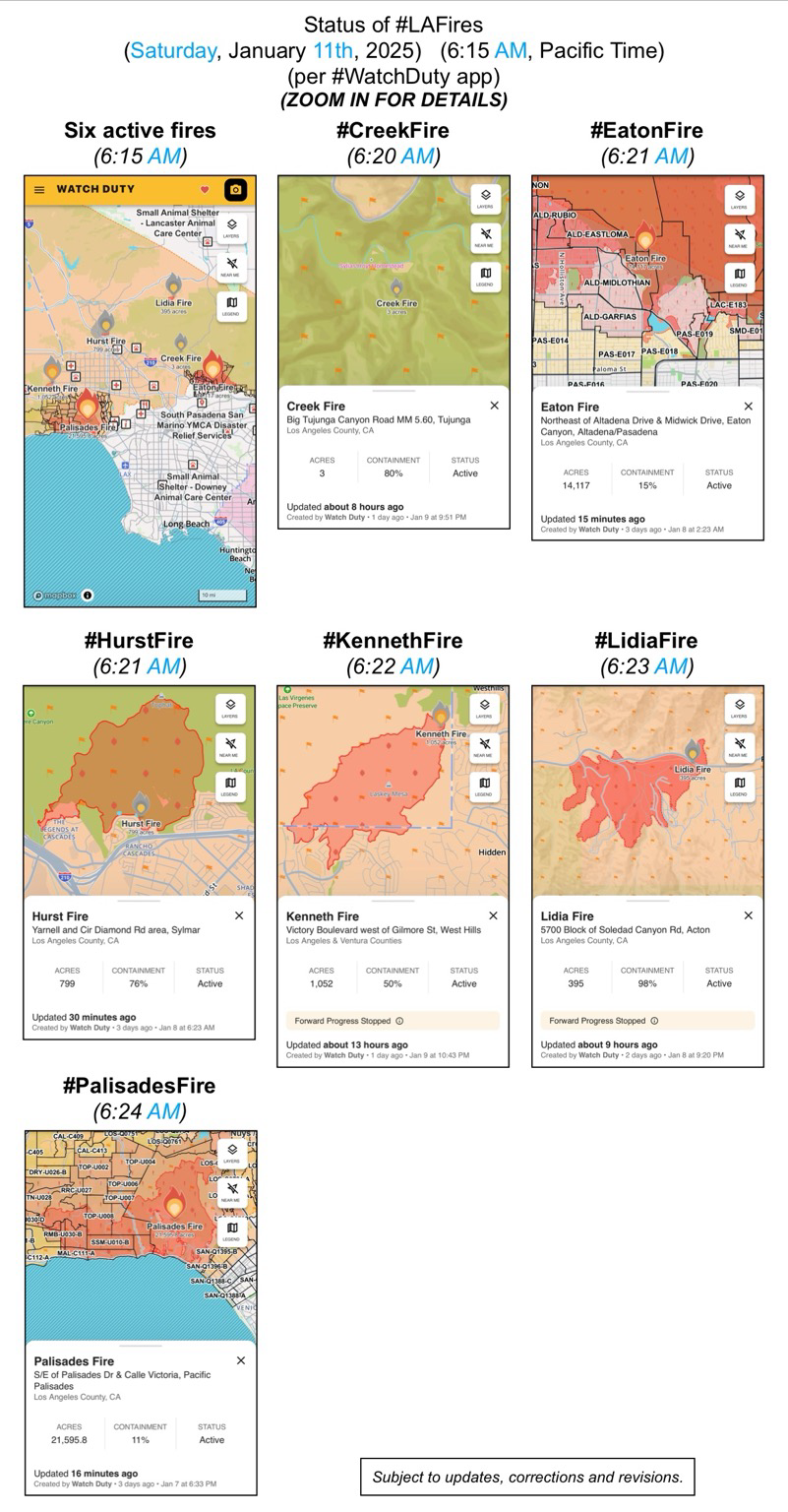
(Saturday, January 11th, 2025)
(6:15 AM, Pacific Time)
(per #WatchDuty app)
ZOOM IN FOR DETAILS
#CreekFire
#EatonFire
#HurstFire
#KennethFire
#LidiaFire
#PalisadesFire
(subject to updates, corrections, and revisions)
The YMCA is providing no-cost child care for children of essential workers and families who have been displaced, evacuated, or experienced property loss due to the firestorms. Programs are available for children aged 4 years, 9 months through 8th grade and teens between 12 and up and are designed to assist families whose schools are currently closed.
#PalisadesFire #EatonFire #HurstFire #CreekFire #KennethFire #CAwx #LAUSD
SHELTER - Small Animal
Agoura Animal Care Center
29525 Agoura Rd, Agoura Hills, CA 91301, USA
Baldwin Park Animal Care Center
4275 Elton St, Baldwin Park
Carson Animal Care Center
216 W Victoria St, Gardena, CA
Downey Animal Care Center
11258 Garfield Ave, Downey CA
Lancaster Animal Care Center
5210 W Ave I, Lancaster. CA
Palmdale Animal Care Center
38550 Sierra Hwy, Palmdale. CA
@LASchools is here for our Palisades School Communities affected by the fires. Our Student Mental Health and Wellness Branch has activated Regional Crisis Response Teams to support schools in the Palisades community impacted by the wildfires. Together, we're committed to rebuilding and sustaining mental health and well-being. #WeAreLAUSD (1/3)
#PalisadesFire #EatonFire #HurstFire #CreekFire #KennethFire #CAwx #MentalHealth
FB posts bottom of the page from
Los Angeles County Department of Mental Health
“#LACountyresidents during these challenging times. Remember, our 24/7 Help Line is available for support at 1-800-854-7771. You can also download and use the iPrevail app to be connected to 24/7 on-demand support at lacounty.iprevail.com. Visit lacounty.gov/emergency for the latest updates”
#PalisadesFire #EatonFire #HurstFire #CreekFire #KennethFire #CAwx #MentalHealth
Department of Mental Health - hope. recovery. wellbeing.
hope. recovery. wellbeing.Department of Mental Health
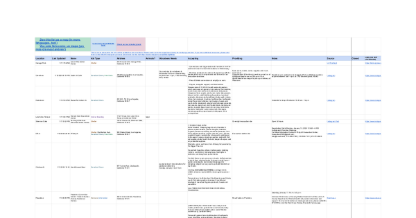
https://docs.google.com/spreadsheets/d/1uAMVz8TQMzShQeuEA6kmOP0jyRN7qe1Iiqb6JOLTPqg/htmlview?fbclid=PAZXh0bgNhZW0CMTEAAaaUz7bkHMpripmH9o9l_COlAlfegu_IJDzx1IAQsUNkHtQgfHTMwWSYqgk_aem_tqCl1cWxWt2iaz0cGryAwA
From: @Cal_OES_bot
https://m.ai6yr.org/@Cal_OES_bot/113807615301469294

CalOES (bot) (@Cal_OES_bot@m.ai6yr.org)
Attached: 1 image Los Angeles wildfire survivors can apply for federal aid today, new website launched to help Californians #caloes #disasters https://news.caloes.ca.AI6YR's Mastodon
Our thoughts are with everyone affected by the wildfires. We know how important it is to stay connected with your loved ones.
Due to the conditions, Mint Mobile will upgrade your plan to 2TB of high-speed data, with no restriction to your hotspot. We hope you stay safe.
#PalisadesFire #EatonFire #HurstFire #CreekFire #CAwx
The LA LGBT Center will be doing a donation drive for the wildfires on the 12th! If you can please bring anything you can spare, requested items can be found by following the link: https://lalgbtcenter.org/vanguard/calling-all-angelenos-la-wildfire-relief-drive-this-sunday-jan-12/
#PalisadesFire #PasadenaFire #hurstfire #la #losangeles #sylmarfire #eatonfire #lafires #losangelesfire #hollywood #hollywoodfire #sunsetfire #wildfires #lgbt #lgbtq #lalgbt
#PalisadesFire
19,978 acres, 6% contained
#EatonFire
13,690 acres, 3% contained
#KennethFire
1000 acres, 35% contained
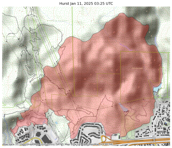
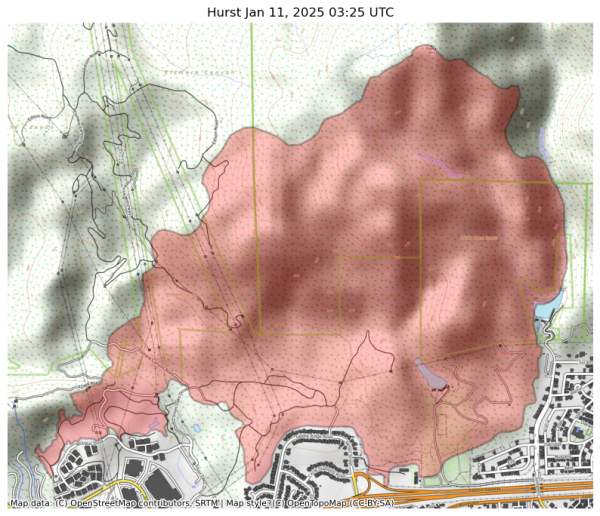
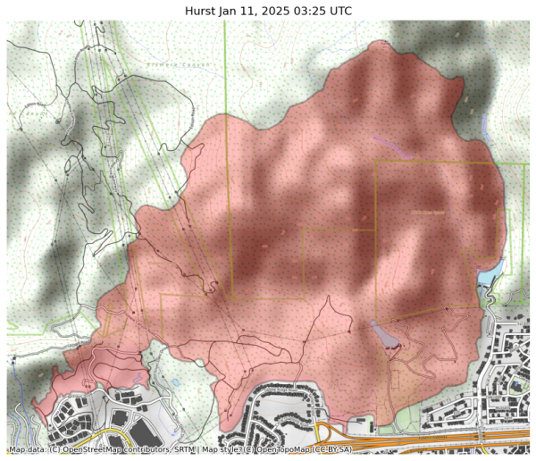
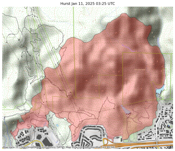
#HurstFire
771 acres, 37% contained
#LidiaFire
395 acres, 75% contained, fwd progress stopped
@ai6yr
#PalisadesFire: 20,438 acres and 8% contained
#EatonFire: 13,956 acres and 3% contained
#HurstFire: at least 771 acres and 37% contained
#LidiaFire: 395 acres and 75% contained
#KennethFire: 960 acres and 35% contained
#PalisadesFire: at least 19,978 acres and 6% contained
#EatonFire: at least 13,690 acres and 0% contained
#HurstFire: at least 771 acres and 37% contained
#LidiaFire: at least 348 acres and 60% contained
#KennethFire: at least 960 acres and 35% contained
Structures destroyed / damaged ~ 10,000
Death toll at 10
#HurstFire #LosAngeles #Sylmar
If you have been affected by any #lafire, including these two, the #hurstfire, #sunsetfire, etc. please, for your health, wear a mask/respirator when you step outside.
#maskup #losangeles
RESOURCES
211 LA is your locally based, nonprofit guide to the services & information you need to navigate life in Los Angeles. NOTE: Airbnb info for fire survivors and forms https://211la.org/

