Suche
Beiträge, die mit palisadesfire getaggt sind
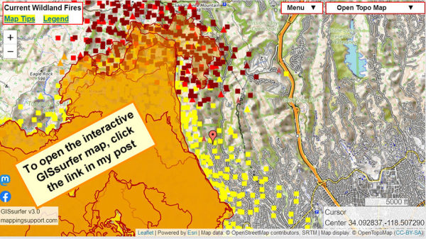
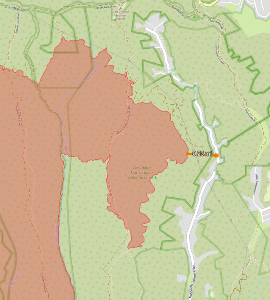
When the map opens there is a red marker (just below map center) at Cordelia Rd.
Fire is approaching this area. Helicopters dropping water are working. Structure defense teams are present. H/T @ai6yr for radio monitoring.
Open GISsurfer map:
https://mappingsupport.com/p2/gissurfer.php?center=34.092837,-118.507290&zoom=13&basemap=Open_Topo_Map&overlay=MODIS_7_day,VIIRS_7_day,Perimeter_FIRIS_intel,Fire_camera_location&data=https://mappingsupport.com/p2/special_maps/disaster/USA_wildland_fire.txt||34.084767,-118.507161
GISsurfer General Purpose Web Map and GIS Viewer | Surf GIS DATA
GISsurfer lets you surf a nearly endless amount of GIS data. Click a layer in the GIS server's table of contents and that data appears on the map.mappingsupport.com
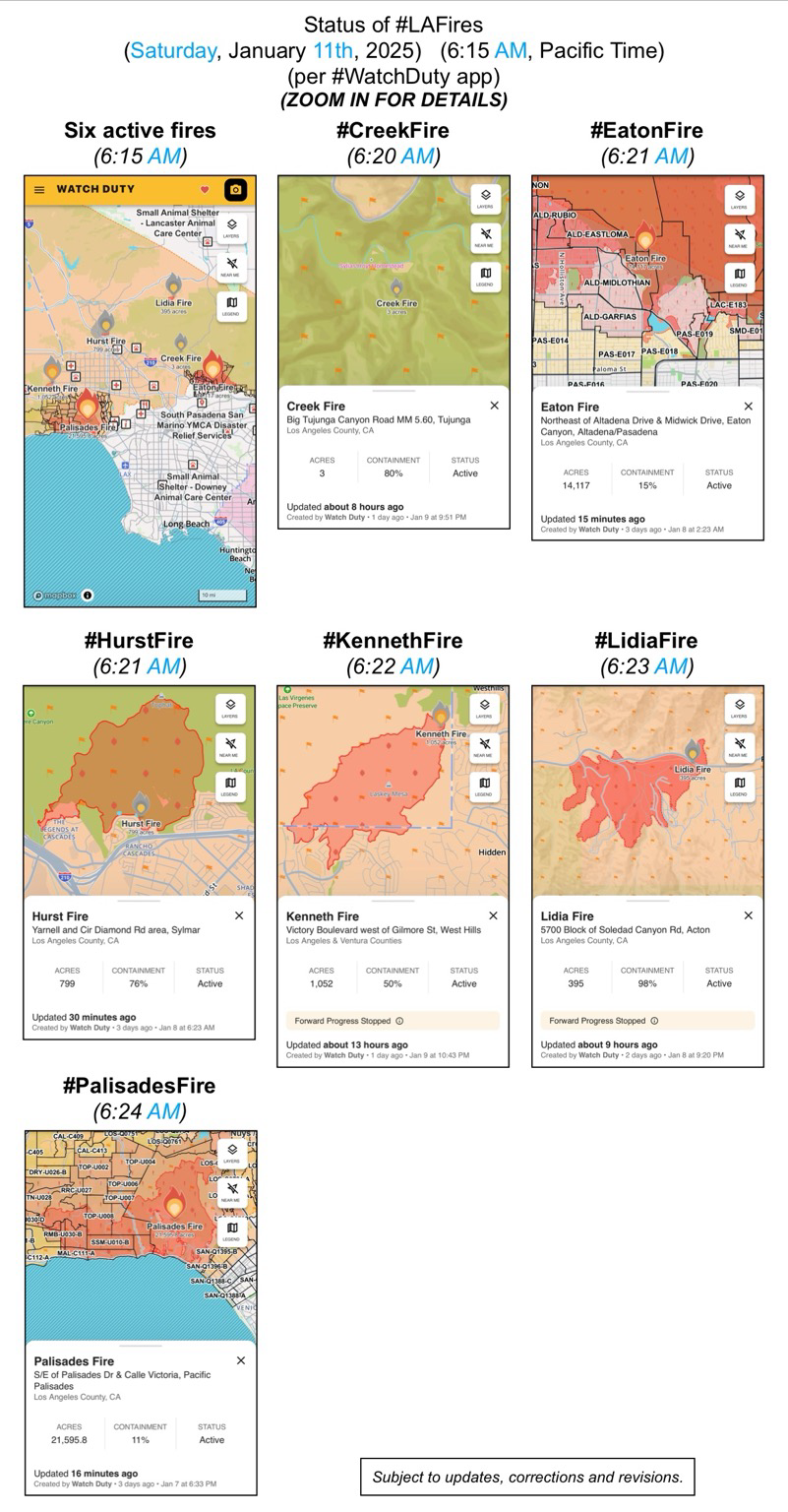
(Saturday, January 11th, 2025)
(6:15 AM, Pacific Time)
(per #WatchDuty app)
ZOOM IN FOR DETAILS
#CreekFire
#EatonFire
#HurstFire
#KennethFire
#LidiaFire
#PalisadesFire
(subject to updates, corrections, and revisions)
Watching Canadian fire bombers scoop water fr the ocean near my kid's apt has me sobbing. #gratitude https://www.tiktok.com/@dinameetsworld/video/7458080995569437998
https://www.youtube.com/watch?v=uaV9d1ZsWPc
#california #wildfires #PalisadesFire #Mulholland
- YouTube
Auf YouTube findest du die angesagtesten Videos und Tracks. Außerdem kannst du eigene Inhalte hochladen und mit Freunden oder gleich der ganzen Welt teilen.www.youtube.com
Day 5: LA Fires Could Be California's Costliest Ever - EUROPE SAYS
Wildfires are burning across Los Angeles County.Hundreds of thousands of people are under evacuation orders or warnings.Insured lossesEUROPE SAYS (EUROPESAYS.COM)
The YMCA is providing no-cost child care for children of essential workers and families who have been displaced, evacuated, or experienced property loss due to the firestorms. Programs are available for children aged 4 years, 9 months through 8th grade and teens between 12 and up and are designed to assist families whose schools are currently closed.
#PalisadesFire #EatonFire #HurstFire #CreekFire #KennethFire #CAwx #LAUSD
SHELTER - Small Animal
Agoura Animal Care Center
29525 Agoura Rd, Agoura Hills, CA 91301, USA
Baldwin Park Animal Care Center
4275 Elton St, Baldwin Park
Carson Animal Care Center
216 W Victoria St, Gardena, CA
Downey Animal Care Center
11258 Garfield Ave, Downey CA
Lancaster Animal Care Center
5210 W Ave I, Lancaster. CA
Palmdale Animal Care Center
38550 Sierra Hwy, Palmdale. CA
@LASchools is here for our Palisades School Communities affected by the fires. Our Student Mental Health and Wellness Branch has activated Regional Crisis Response Teams to support schools in the Palisades community impacted by the wildfires. Together, we're committed to rebuilding and sustaining mental health and well-being. #WeAreLAUSD (1/3)
#PalisadesFire #EatonFire #HurstFire #CreekFire #KennethFire #CAwx #MentalHealth
https://www.tiktok.com/@charleichar/video/7458141847257468203
Man believed to have started West Hills fire in California apprehended attempting to start another fire. We must collectively get to the bottom of this.
#LAWildFires #Westhillsfire #palisadesfire #losangelesfire #USA #California
FB posts bottom of the page from
Los Angeles County Department of Mental Health
“#LACountyresidents during these challenging times. Remember, our 24/7 Help Line is available for support at 1-800-854-7771. You can also download and use the iPrevail app to be connected to 24/7 on-demand support at lacounty.iprevail.com. Visit lacounty.gov/emergency for the latest updates”
#PalisadesFire #EatonFire #HurstFire #CreekFire #KennethFire #CAwx #MentalHealth
Department of Mental Health - hope. recovery. wellbeing.
hope. recovery. wellbeing.Department of Mental Health
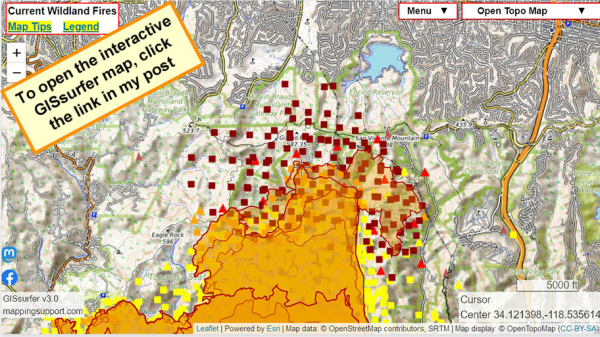
Latest perimeter shows 21,596 acres
Never ignore an order to evacuate. The fire officials have information that you do not.
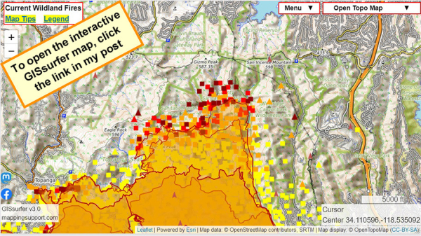
Dark symbols on the map are MODIS and VIIRS satellite heat detections. This data is not real time and location are only approximate. Sometimes this data is ‘false positive’. For more information open the map and click “Map tips” upper left corner.
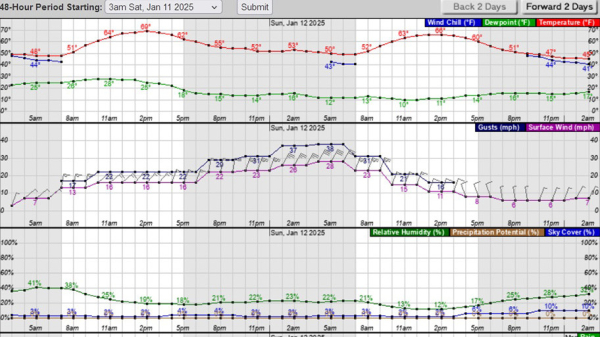
NOAA is forecasting wind gusts close to 40mph very early Sunday.
Open GISsurfer map:
https://mappingsupport.com/p2/gissurfer.php?center=34.121397,-118.535614&zoom=13&basemap=Open_Topo_Map&overlay=MODIS_7_day,VIIRS_7_day,Perimeter_FIRIS_intel,Fire_camera_location&data=https://mappingsupport.com/p2/special_maps/disaster/USA_wildland_fire.txt
GISsurfer General Purpose Web Map and GIS Viewer | Surf GIS DATA
GISsurfer lets you surf a nearly endless amount of GIS data. Click a layer in the GIS server's table of contents and that data appears on the map.mappingsupport.com
Palisades fire forces new evacuations in Brentwood - EUROPE SAYS
Los Angeles faces another tense night as the Palisades fire moved northeast, prompting new mandatory evacuations.The latest orderEUROPE SAYS (EUROPESAYS.COM)
What a shame. 🤦
#LosAngeles #WildFire #PalisadesFire #EatonFire #Fire #LA
https://ici.radio-canada.ca/nouvelle/2131793/feux-foret-avion-citerne-quebec-drone
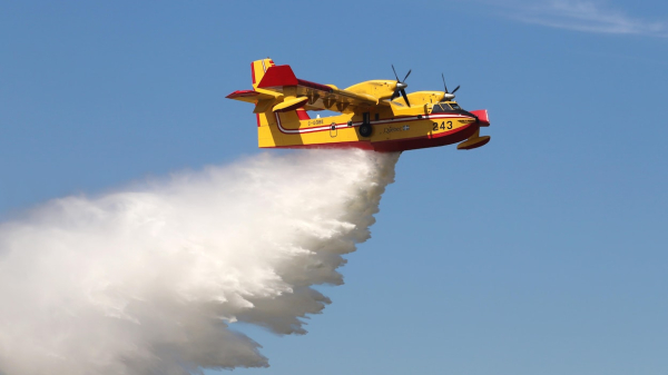
Un avion-citerne du Québec endommagé par un drone à Los Angeles
Un des deux avions-citernes CL-415 que le gouvernement du Québec a envoyés en Californie pour lutter contre les feux de broussailles a été cloué au sol jeudi après avoir heurté un drone civil au-dessus du brasier de Pacific Palisades, dans le comté d…Stéphane Bordeleau (Radio-Canada)
#california #wildfires #PalisadesFire
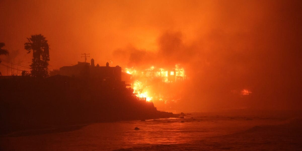
I pulled off the freeway just to get this on tape.
This is getting a bit…. Intense.
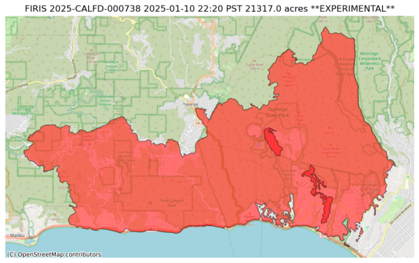
Fire is now 21,317 acres as of 2025-01-10 22:20 PST.
#wildfires #PacificPalisades #LosAngeles #Malibu #Topanga
https://docs.google.com/spreadsheets/d/1uAMVz8TQMzShQeuEA6kmOP0jyRN7qe1Iiqb6JOLTPqg/htmlview?fbclid=PAZXh0bgNhZW0CMTEAAaaUz7bkHMpripmH9o9l_COlAlfegu_IJDzx1IAQsUNkHtQgfHTMwWSYqgk_aem_tqCl1cWxWt2iaz0cGryAwA
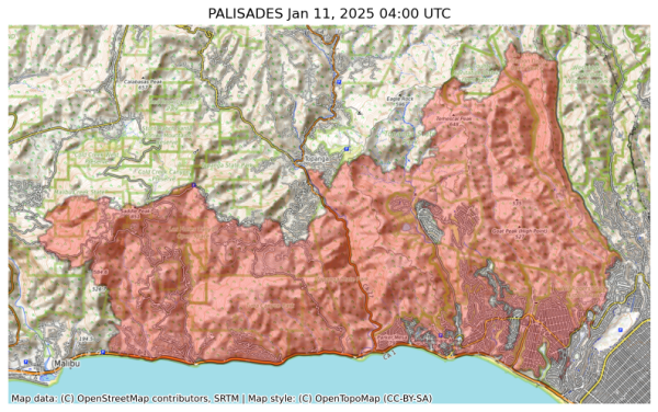
NIFC New Or Updated Wildfire Perimeter
Incident Name: PALISADES
Acres: 21317.0 acres
Updated: Jan 11, 2025 04:00 UTC
Source: IRWIN
#PALISADESFire #CAwx
https://m.ai6yr.org/@TrentSiggard/113805926082411999

TrentSiggard (@TrentSiggard@m.ai6yr.org)
Attached: 1 image I am very suspicious about the Blip drone delivery company as the drone collision suspect. They posted a video looking at #PalisadesFire around the time of the incident.AI6YR's Mastodon
Miles Teller’s Wife Shares Last Photo of Home Before Destroyed in L.A. Fire
Miles Teller's Wife Shares Last Photo of Home Before Destroyed in L.A. Fire - INBELLAINBELLA
Fire officials are responding to at least 6 fires in the region, including the Archer, Eaton, Hurst, Kenneth, Lidia and Palisades fires. They have spread to 36,500 acres.
🔗https://app.watchduty.org/?search=mt+lee
🔗https://gavinnewsom.com/california-fire-facts/
🔗https://gov.ca.gov/2025/01/08/more-than-7500-firefighting-emergency-personnel-deployed-to-fight-unprecedented-los-angeles-fires/
🔗https://www.latimes.com/wildfires-map/
🔗https://www.latimes.com/california/live/pacific-palisades-fire-updates-los-angeles
🔗https://www.cnn.com/weather/live-news/los-angeles-wildfires-palisades-eaton-california-01-11-25/index.html
#PalisadesFire #cafire #calfire #lafires
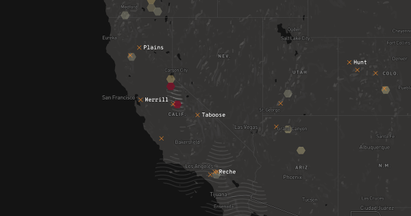
2025 California fire map
A map of wildfires currently burning in CaliforniaCasey Miller (Los Angeles Times)
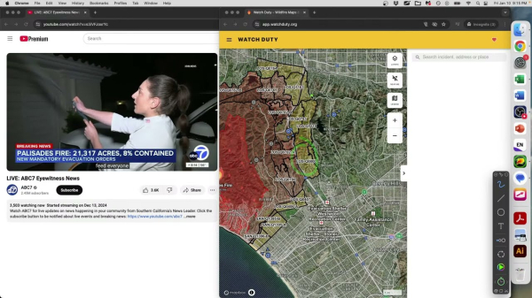
Weather and climate office hours by Weather West: 01/10/2025 #:2 New Palisades Fire Evacuations
The latest in a recurring series of live, virtual, & interactive "office hours" hosted by Dr. Daniel Swain on various topics related to extreme weather and c...YouTube
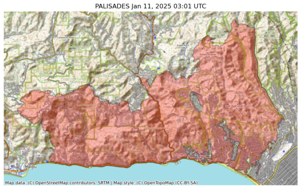
NIFC New Or Updated Wildfire Perimeter
Incident Name: PALISADES
Acres: 20459.7 acres
Updated: Jan 11, 2025 03:01 UTC
Source: IRWIN
#PALISADESFire #CAwx
#PalisadesFire https://share.watchduty.org/i/40335?ts=1736566463000
#EatonFire https://share.watchduty.org/i/40388?ts=1736564108000
Watch Duty - Wildfire Maps & Alerts
Real-time information about wildfire and firefighting efforts nearbyWatch Duty
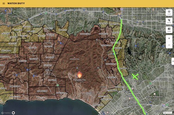
AFD: Evacuation Warning for Palisades Fire at Louise to Ventura to the 405 freeway to Sepulveda/Havenhurst. Prepare to evacuate by gathering supplies, pets, and loved ones. Monitor local news, LAFD social media, and www.lafd.org/alerts for maps and info. Source: 200277,LA City Public Alerts,City of Los Angeles
#Evacuation
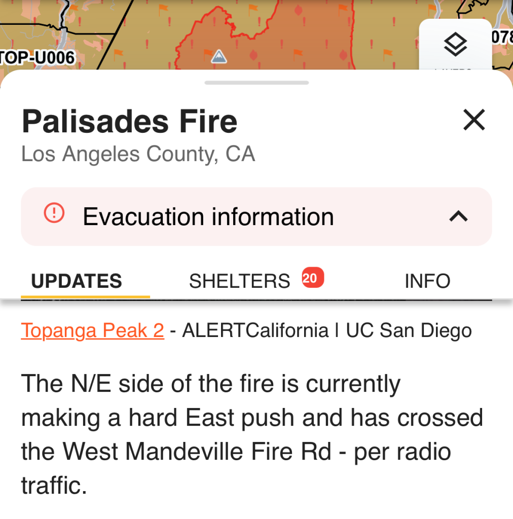
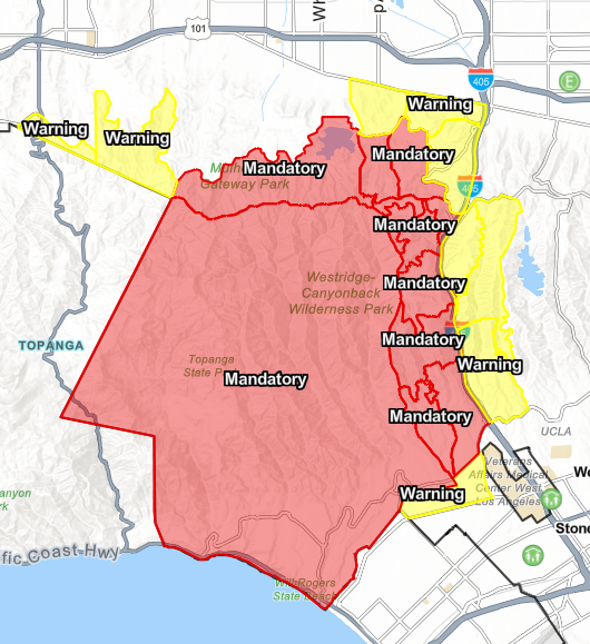
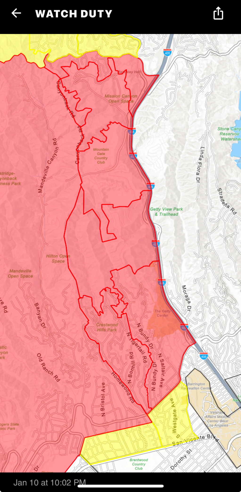
The NE part of the fire is expanding and more evacuations have been ordered.
Check this same link in the morning and you will see newer data.
The fire camera layer (brown arrowheads) is ‘on top’ and clickable.
Open GISsurfer map:
https://mappingsupport.com/p2/gissurfer.php?center=34.110596,-118.535092&zoom=13&basemap=Open_Topo_Map&overlay=MODIS_7_day,VIIRS_7_day,Perimeter_FIRIS_intel,Fire_camera_location&data=https://mappingsupport.com/p2/special_maps/disaster/USA_wildland_fire.txt
GISsurfer General Purpose Web Map and GIS Viewer | Surf GIS DATA
GISsurfer lets you surf a nearly endless amount of GIS data. Click a layer in the GIS server's table of contents and that data appears on the map.mappingsupport.com
From: @Cal_OES_bot
https://m.ai6yr.org/@Cal_OES_bot/113807615301469294

CalOES (bot) (@Cal_OES_bot@m.ai6yr.org)
Attached: 1 image Los Angeles wildfire survivors can apply for federal aid today, new website launched to help Californians #caloes #disasters https://news.caloes.ca.AI6YR's Mastodon
Our thoughts are with everyone affected by the wildfires. We know how important it is to stay connected with your loved ones.
Due to the conditions, Mint Mobile will upgrade your plan to 2TB of high-speed data, with no restriction to your hotspot. We hope you stay safe.
#PalisadesFire #EatonFire #HurstFire #CreekFire #CAwx
Lunder is a long-time professional wildfire geographer and burn boss based in Chico, California.
If you want quick no-nonsense wildfire briefings, he is your go to guy! https://www.youtube.com/watch?v=4ybFRdM07HQ
#LosAngeles #WildFire #PalisadesFire #EatonFire #Fire #LA
- YouTube
Auf YouTube findest du die angesagtesten Videos und Tracks. Außerdem kannst du eigene Inhalte hochladen und mit Freunden oder gleich der ganzen Welt teilen.www.youtube.com
The LA LGBT Center will be doing a donation drive for the wildfires on the 12th! If you can please bring anything you can spare, requested items can be found by following the link: https://lalgbtcenter.org/vanguard/calling-all-angelenos-la-wildfire-relief-drive-this-sunday-jan-12/
#PalisadesFire #PasadenaFire #hurstfire #la #losangeles #sylmarfire #eatonfire #lafires #losangelesfire #hollywood #hollywoodfire #sunsetfire #wildfires #lgbt #lgbtq #lalgbt
1/10/25 1912PT
https://lafd.maps.arcgis.com/apps/Media/index.html?appid=ba8cfed4b4a04d49b7489eb8300727a8
Cole Euken, Staff Reporter
Jan 10 at 10:02 PM EST
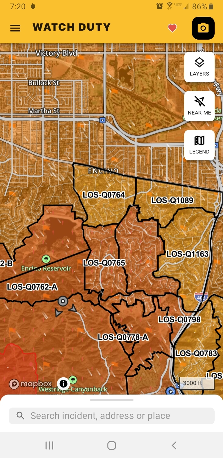
The Evacuation Orders have been expanded to the East to include Zones: LOS-Q0780, LOS-Q0782-A, LOS-Q0781-A, LOS-Q0782-B, LOS-Q0798, LOS-Q0778-A and additional areas east of Zone LOS-Q0780 to the 405 - per the LA City Evacuation Map https://lafd.maps.arcgis.com/apps/Media/index.html?appid=ba8cfed4b4a04d49b7489eb8300727a8
https://share.watchduty.org/i/40335?ts=1736564596000
Watch Duty - Wildfire Maps & Alerts
Real-time information about wildfire and firefighting efforts nearbyWatch Duty
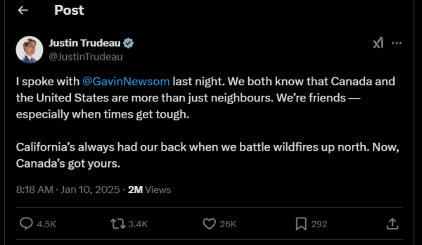
Thank you for being a friend and helping us out when we are in distress.
The CA Peeps need to stick together.
#Canada #LAFire #Malibu #PalisadesFire #SF #SFBay #SanFrancisco
#News #GreatNews
