Suche
Beiträge, die mit palisadesFire getaggt sind
Meryl Streep’ Cut a Fence to Escape L.A. Fires
Meryl Streep' Cut a Fence to Escape L.A. Fires - INBELLAINBELLA
Since the devastation of the Eaton and Palisades fires, FEMA has provided financial assistance to LA County residents who have had damage to their home, personal property, or other disaster-caused emergency needs.
If you need help, the deadline to apply for financial assistance is March 10, 2025.
To learn more and apply:
https://recovery.lacounty.gov/resources
#PalisadesFire #EatonFire #FEMA
#EatonFire #PalisadesFire
https://grist.org/climate/climate-change-los-angeles-wildfire-attribution/ #EatonFire #PalisadesFire
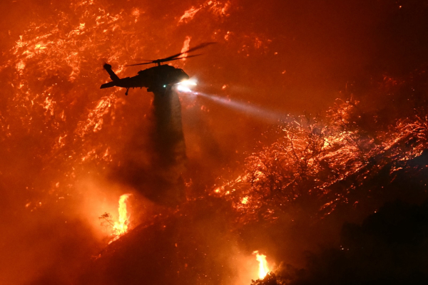
Climate change primed LA to burn — catastrophically
A new study finds that the region's extremely dry and hot conditions were about 35 percent more likely because of climate change.Matt Simon (Grist)
To participate, residents must complete the Right of Entry form, which is now available to download or complete online at recovery.lacounty.gov/debris-removal and at Disaster Recovery Centers.
https://recovery.lacounty.gov/debris-removal/?utm_content=&utm_medium=email&utm_name=&utm_source=govdelivery&utm_term=
1/2
#PalisadesFire #EatonFire #DebrisRemoval
From: @deewani
https://mastodon.social/@deewani/113812138215554120
deewani (@deewani@mastodon.social)
@BakerRL75@m.ai6yr.org Repeating for this disaster; Naturalized citizens may need documents to replace other documents….Mastodon
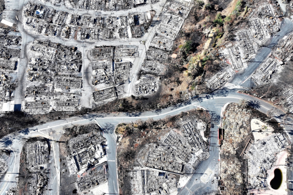
Deaths from Los Angeles-area wildfires rise to 29
The number of deaths from the wildfires that destroyed entire communities in the Los Angeles area this month has risen to 29, the county medical examiner’s office said Monday.Phil Helsel (NBC News)
#PalisadesFire #Batteries
#PalisadesFire https://lafd.org/alert/palisades-fire-repopulation-residents-only-01272025-inc0738
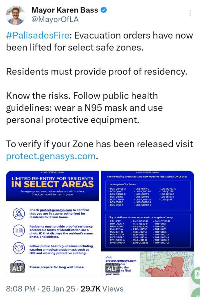
#PalisadesFire: Evacuation orders have now been lifted for select safe zones.
Residents must provide proof of residency.
Know the risks. Follow public health guidelines: wear a N95 mask and use personal protective equipment.
To verify if your Zone has been released visit protect.genasys.com.
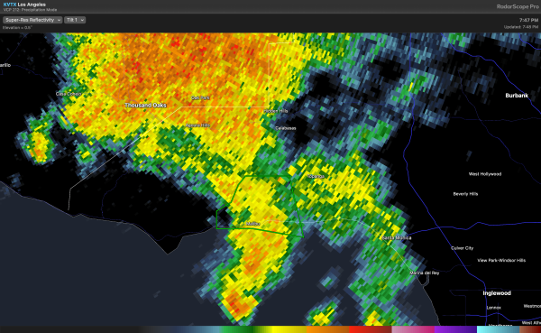
"* Flash Flood Warning for...
The Franklin Burn Scar and the western portion of the Palisades
Burn Scar west of Las Flores Canyon Road...
* Until 1100 PM PST.
* At 740 PM PST, Doppler radar and automated rain gauges indicated thunderstorms producing heavy rain across the warned area including across the Franklin Burn Scar and the western portion of the Palisades Burn Scar. While not immediately likely, a life
threatening debris flow will be possible."
#FlashFloodWarning #Malibu #PalisadesFire #FranklineFire
https://m.ai6yr.org/@flashflood_bot/113898270967740967

Flash Flood Warning Bot (@flashflood_bot@m.ai6yr.org)
Attached: 1 image #NWS #flood #nwsflashflood #FlashFloodWarning Flash Flood Warning for Los Angeles, CA #CAwx https://alerts-v2.weather.gov/search?id=urn:oid:2.49.0.1.840.0.bda275d98700e0c9777c9a4cb1946d9889185c77.001.1AI6YR's Mastodon
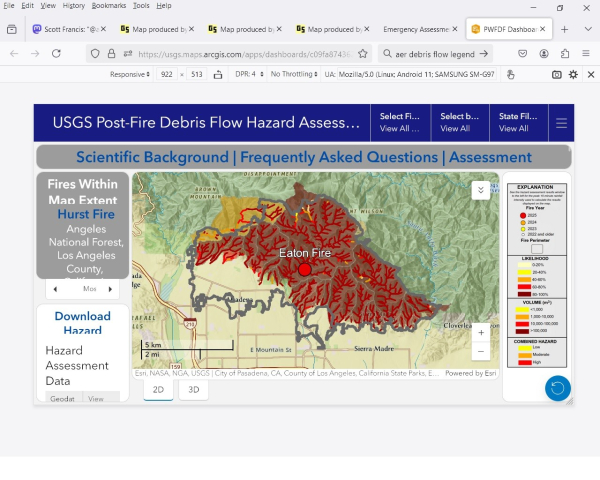
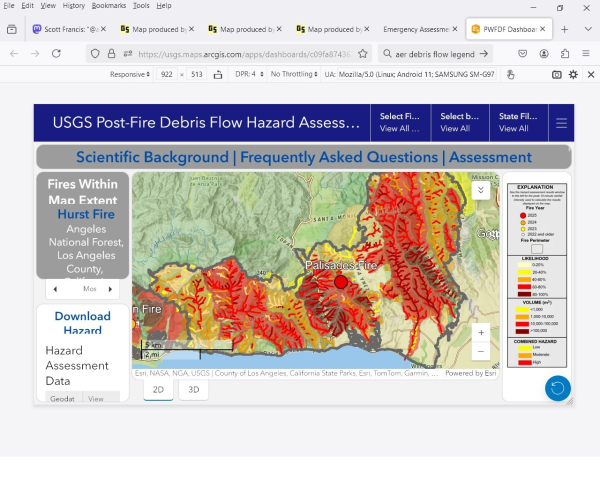
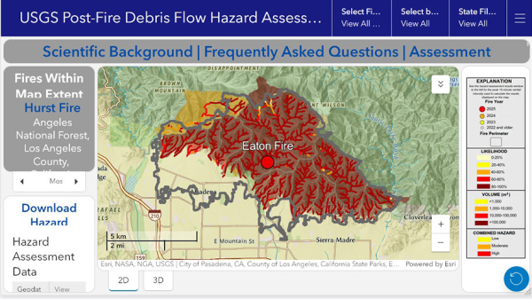
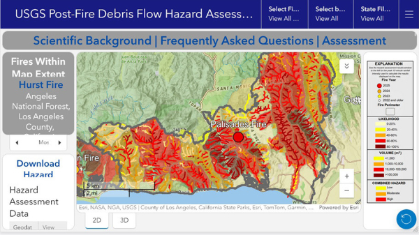
Open interactive map with lots of links for more information. It will automatically zoom in on the Eaton fire. You can pan the map to the Palisades fire.
https://usgs.maps.arcgis.com/apps/dashboards/c09fa874362e48a9afe79432f2efe6fe#fire_id=eat2025
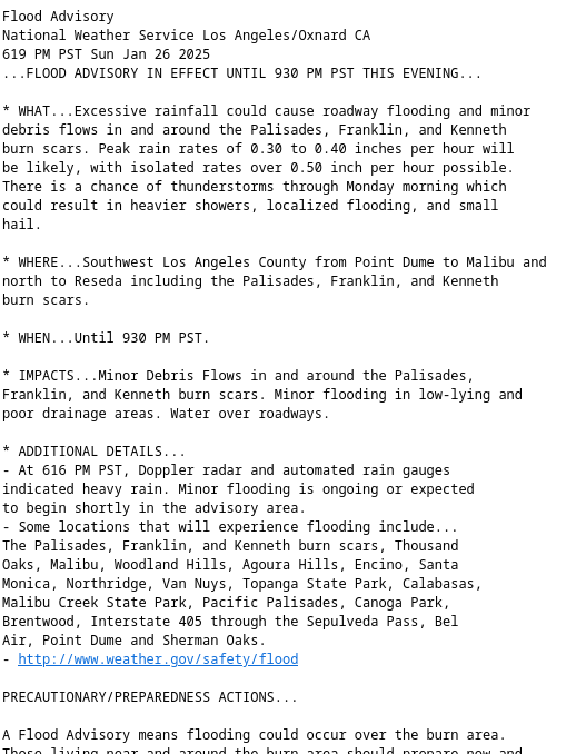
National Weather Service Los Angeles/Oxnard CA
619 PM PST Sun Jan 26 2025
...FLOOD ADVISORY IN EFFECT UNTIL 930 PM PST THIS EVENING...
* WHAT...Excessive rainfall could cause roadway flooding and minor debris flows in and around the Palisades, Franklin, and Kenneth burn scars. Peak rain rates of 0.30 to 0.40 inches per hour will be likely, with isolated rates over 0.50 inch per hour possible. There is a chance of thunderstorms through Monday morning which could result in heavier showers, localized flooding, and small
hail.
#CAwx #FloodAdvisory #PalisadesFire #FranklinFire #KennethFire
"Applications for the funds for eligible small businesses and workers are set to open in February 2025, offering grants between $2,000 and $25,000 for eligible small businesses and nonprofits, and $2,000 for displaced workers."
https://content.govdelivery.com/accounts/CALACOUNTY/bulletins/3cea0c4
#EatonFire #PalisadesFire #Workers #SmallBusiness #Nonprofits
Kia Forum - line up:
Alanis Morissette
Green Day
Red Hot Chili Peppers
Anderson. Paak
John Fogerty
Stephen Stills
Dave Matthews & John Mayer
Joni Mitchell
Stevie Nicks
Dawes
No Doubt
The Black Crowes
Graham Nash
P!nk
Tickets > https://www.ticketmaster.com/fireaid-benefit-concert-kia-forum-inglewood-california-01-30-2025/event/090062313574587A?referrer=https%3A%2F%2Fwww.ticketmaster.com%2Ffireaid-benefit-concert-kia-forum-inglewood-california-01-30-2025%2Fevent%2F090062313574587A
Intuit Dome - Line Up:
Billie Eilish
Lady Gaga
Stevie Wonder
Earth Wind & Fire
Lil Baby
Sting
Gracie Abrams
Olivia Rodrigo
Tate McRae
Jelly Roll
Peso Pluma
Katy Perry
Rod Stewart
Tickets > https://www.ticketmaster.com/fireaid-benefit-concert-intuit-dome-inglewood-california-01-30-2025/event/0900623350925BFD?referrer=https%3A%2F%2Fwww.ticketmaster.com%2Ffireaid-tickets%2Fartist%2F3443029%3F_gl%3D1*1c9qj6z*_gcl_au*MTA4Mzg0NTA5MC4xNzM3Nzg2Mjcw*_ga*ODQxNzY3NzAzLjE3Mzc3ODYyNjk.*_ga_C1T806G4DF*MTczNzc4NjI3MC4xLjEuMTczNzc4NjYzNC42MC4wLjA.*_ga_H1KKSGW33X*MTczNzc4NjI3MC4xLjEuMTczNzc4NjYzNC42MC4wLjA.%26_ga%3D2.113288391.1347382381.1737786269-841767703.1737786269
More > https://fireaidla.org/
https://www.malibucity.org/AlertCenter.aspx?AID=3427
1/5
Michael Silvester, Staff Reporter
Jan 26 at 6:17 AM EST
Note: There is info from LA County Sheriff's regarding mud & rock slides in the post below this World Central Kitchen update.
World Central Kitchen (WCK) is serving free meals to those affected, including first responders, by the fires, at the following locations. Operating times differ between locations…
Location: Palisades Fire Station 69
Time of Service: 11:00am - 8:00pm
15045 Sunset Blvd, Pacific Palisades, CA 90272
Location: Malibu Brewing Company
Time of Service: 11:00am - 5:00pm
30745 Pacific Coast Hwy R4, Malibu, CA 90265
Parents concerned over toxic ash as LA schools prepare to reopen after Palisades Fire - EUROPE SAYS
LOS ANGELES (AP) — Kelli Ferrone wiped blinds and window sills inside her daughter’s elementary school, just aEUROPE SAYS (EUROPESAYS.COM)
American Cinematheque 4th Tribute To The Crafts Honors Firefighters
American Cinematheque 4th Tribute To The Crafts Honors Firefighters - INBELLAINBELLA
https://fireaidla.org/
As an out-of-towner who wanted to help with fire recovery, I donated to the Immigrant Fire Relief Fund at the National Day Laborer Organizing Network, which someone on here recommended.
https://ndlon.org
(And I'm not forgetting the folks in Asheville, NC, and continuing to donate to help with their ongoing recovery needs.)
#PalisadesFire #EatonFire #music #LosAngeles
Welcome - National Day Laborer Organizing Network (NDLON)
NDLON is a national network of over 50 member organizations through out the country and we work to unify and strengthen our members to develop leadership, mobilize, and organize day laborers in order to protect and expand their civil, labor and human…National Day Laborer Organizing Network (NDLON)
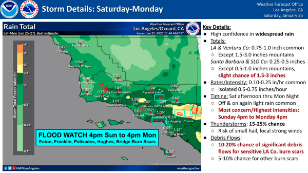
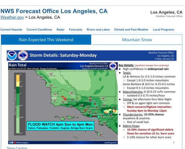
FLOOD WATCH 4pm Sun to 4pm Mon Eaton, Palisades, Franklin, Hughes, Bridge Burn Scars
https://www.weather.gov/lox/
#CAwx #EatonFire #PalisadesFire #FranklinFire #HughesFire #BridgeFire
Los Angeles, CA
NOAA National Weather Service Los Angeles, CAUS Department of Commerce, NOAA, National Weather Service
#disaster #government #society #wildfires #PalisadesFire #fire #CaliforniaFires #self #thoughts
UPDATE | Medical Examiner - Fire-Related Deaths at 4:30 p.m. on January 21
(ps. significant details here, not for the queasy -- yes, how fast you can get people evacuated in a fast moving wildfire is most certainly life/death).
https://me.lacounty.gov/2025/press-releases/update-medical-examiner-fire-related-deaths-at-430-p-m-on-january-21/

UPDATE 1/23/25 5:00 PM: Palisades Fire at 23,448 acres with 72% containment; Town Hall at 4PM, 1/25; Malibu City zones open to residents 12PM-6PM
UPDATE 1/23/25 5:00 PM: Palisades Fire at 23,448 acres with 72% containment; Town Hall scheduled 4PM, Sat 1/25; Red Flag Warning thru 10AM 1/24; Malibu City zones open to residents only 12PM-6PM, check in at Pier with photo ID/proof of residency.Malibu, CA
Via LA County Coordinated Joint Info Center:
Ahead of the anticipated rain, Public Works is providing free sandbags to residents in areas impacted by the wildfires to help protect their property from potential flooding and debris flow.
More info at lacounty.pw/sandbags
#PalisadesFire #EatonFire #LACounty #Pasadena #Altadena #Malibu #PacificPalisades
#sandbags
#PalisadesFire 68% contained
Deaths 11
Injuries 4
Damage Assessment (95%)
Structures damaged 882
Structures destroyed 6,528
#EatonFire 91% contained
Deaths 17
Injuries 9
Damage Assessment (99%)
Structures damaged 1,072
Structures destroyed 9,418
There is a potential storm expected to enter the region on Saturday, Jan. 25, and last through Monday, Jan. 27. The latest forecast calls for a quarter to a half inch of rain with 10-20% chance of thunderstorms. Call the Los Angeles County Public Works 24-hour Dispatch Center to report storm-related damage, traffic signal outages, flooding or other concerns at 1-800-675-HELP (4357).
#CAwx #storm #PalisadesFire #EatonFire
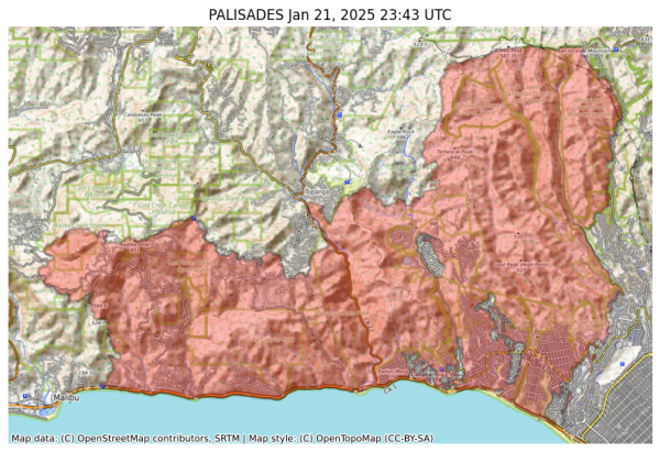
NIFC New Or Updated Wildfire Perimeter
Incident Name: PALISADES
Acres: 23448.0 acres
Updated: Jan 21, 2025 23:43 UTC
Source: IRWIN
#PALISADESFire #CAwx
#PalisadesFire
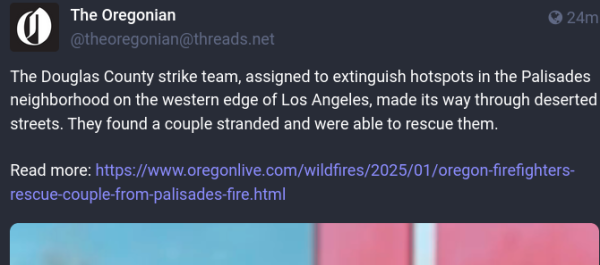
Oregon firefighters rescue couple from Palisades Fire
The firefighters rescue elderly couple from Palisades neighborhood.Gosia Wozniacka | The Oregonian/OregonLive (oregonlive)
#LACounty #housing #evictions #wildfires #PalisadesFire #EatonFire

Los Angeles County - Board of Supervisors
The Board of Supervisors is the five-member governing body of the County of Los Angeles, a charter county. Members are elected by voters in their respective districts and are limited to three four-year terms.YouTube
Thursday, Jan. 30, at 6 p.m. PT
Intuit Dome & Kia Forum #LosAngeles
TIckets will go on sale Wednesday January 22 at 12:00PM PST.
https://help.ticketmaster.com/hc/en-us/articles/31850335155601-FireAid-Benefit-Concert
Line-Up:
Billie Eilish
Finneas
Jelly Roll
Katy Perry
Lady Gaga
Earth, Wind & Fire
Gracie Abrams
Green Day
Gwen Stefani
Joni Mitchell
Lil Baby
Red Hot Chili Peppers
Rod Stewart
Sting
Stephen Stills
Stevie Nicks
Tate McRae
Dave Matthews & John Mayer
Alanis Morissette
Anderson .Paak
Dawes
Graham Nash
John Fogerty
Olivia Rodrigo
Peso Pluma
Stevie Wonder
The Black Crowes
https://fireaidla.org/
Homepage - FireAid
Join us for an evening of music and solidarity. The FireAid benefit concert will be held at Intuit Dome on January 30th dedicated to rebuilding communities that have been devastated by wildfires.FireAid
https://en.m.wikipedia.org/wiki/Los_Angeles_Railway
#LosAngeles #Palisades #Eaton #Wildfires #FuckCars
https://www.laconservancy.org/save-places/issues/disaster-relief-for-l-a-county-fires/
#palisadesFire #EatonFire #LosAngeles
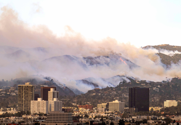
Disaster Relief for L.A. County Fires - LA Conservancy
Preserving the historic places that make L.A. County uniqueLA Conservancy
James Rainey for #LosAngelesTimes: https://longreads.com/2025/01/20/in-the-ruins-of-palisades-fire-confronting-my-elusive-malibu-life/
#Longreads #California #SouthernCalifornia #LosAngeles #Malibu #PalisadesFire #Fire #Wildfire #Essay
In the Ruins of Palisades Fire, Confronting My Elusive Malibu Life
"Memories, nostalgia and regret mix on a trek to find the old family home."Cheri Lucas Rowlands (Longreads)
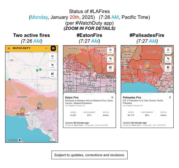
(Monday, January 20th, 2025)
(7:26 AM, Pacific Time)
(per #WatchDuty app)
ZOOM IN FOR DETAILS
#EatonFire
#PalisadesFire
(subject to updates, corrections, and revisions)


