Suche
Beiträge, die mit WildFires getaggt sind
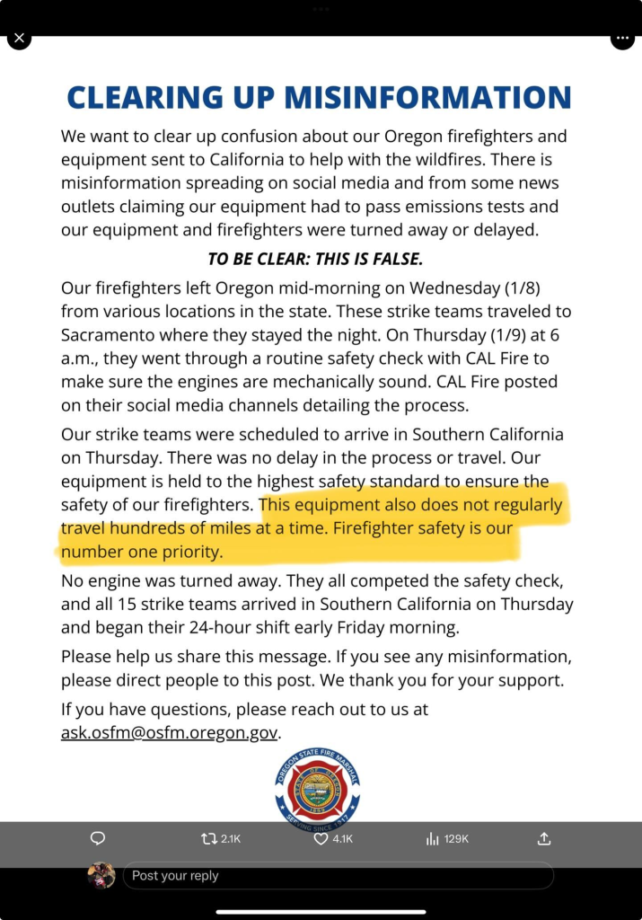
(claim that Oregon couldn't send firefighters to California because of not passing smog tests, folks 🙄 )
#disinformation #wildfires
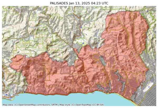
NIFC New Or Updated Wildfire Perimeter
Incident Name: PALISADES
Acres: 23465.4 acres
Updated: Jan 13, 2025 04:23 UTC
Source: IRWIN
#PALISADESFire #CAwx
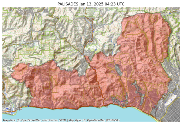
NIFC New Or Updated Wildfire Perimeter
Incident Name: PALISADES
Acres: 23465.4 acres
Updated: Jan 13, 2025 04:23 UTC
Source: IRWIN
#PALISADESFire #CAwx
Link: https://tinyurl.com/ca5yaw4t
(See pink ‘Donate’ button, if you can spare it.)
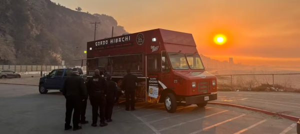
These lovely people fed #Australians after devastating 2020 Bushfires & 2022 Floods.
#WCK #FoodIsAUniversalHumanRight #LosAngeles2025
World Central Kitchen | Meal Distribution Sites: California Fires
In response to the Palisades Fires WCK is distributing free hot meals to the public at the following locations in southern California. For more information please check our social pages.World Central Kitchen
PBS: The #wildfires scorching the region around #LosAngeles are likely to be the most expensive in history. But future #climatechange-related disasters will certainly top them in cost.
https://www.pbs.org/newshour/nation/analysis-5-ways-to-look-at-the-los-angeles-fires-through-the-lens-of-climate-realism
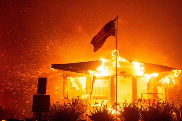
Analysis: 5 ways to look at the Los Angeles fires through the lens of climate realism
The wildfires scorching the region around Los Angeles are likely to be the most expensive in history. But future climate change-related disasters will certainly top them in cost.PBS News
https://time.com/7206380/los-angeles-teen-recovery-fund-for-wildfire-victims-viral-movement/
KEWL🌀NEWS
#AVERYCOLVERT #LA #WILDFIRES #PRESS

A Los Angeles Teen Started a Recovery Fund for Wildfire Victims. Now It’s a Movement
Avery Colvert, 14, never imagined her recovery fund for the teenage victims of the Eaton Fire would go viral.Meg Zukin (Time)
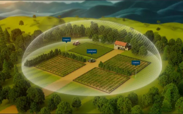
https://www.timesofisrael.com/israeli-startup-takes-inspiration-from-iron-dome-for-system-to-stop-wildfires/
KEWL🌀NEWS
#ISRAEL #IRONDOME #WILDFIRES #PRESS
Dennis Quaid Says ‘So Many Friends’ Have Lost Homes in L.A. Wildfires
Dennis Quaid Says 'So Many Friends' Have Lost Homes in L.A. Wildfires - INBELLAINBELLA
... and if it was man-made, then it is evil.
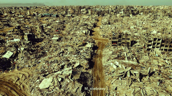
2. The destruction of property and devastation of lives in Palestine is utterly terrible and heartbreaking ..
... and if it was man-made, then it is evil.
Both can be true. Both are true.
#gaza #palestine #wildfires #california
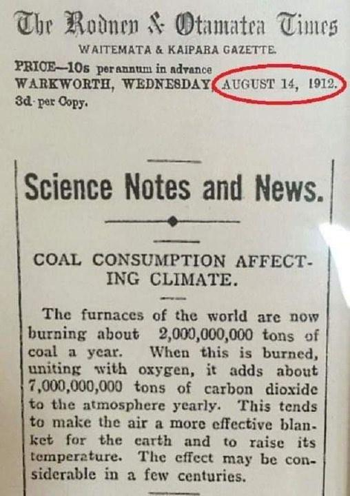
https://www.usatoday.com/story/news/factcheck/2021/08/13/fact-check-yes-1912-article-linked-burning-coal-climate-change/8124455002/
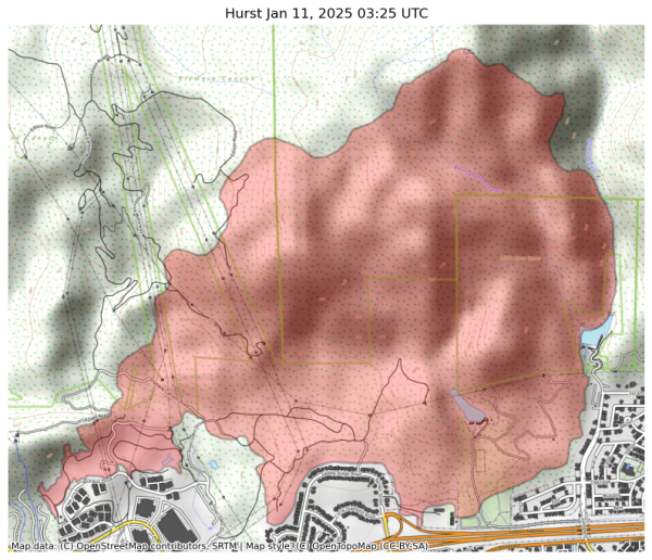
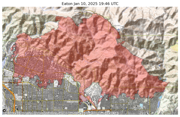
#ClimateChange #ClimateCrisis #ClimateAction #ClimateCatastrophe #fire #LAfires #wildfires #LosAngeles #socal #SouthernCalifornia #PacificPalisades #altadena #hollywood #EatonFire #PalisadesFire #SunsetFire #HurstFire #KennethFire #USpolitics #AmericanPolitics #political #politics #ClimateJustice #climate #USpol
Fact check: A 1912 article about burning coal and climate change is authentic
Social media users are sharing an article from 1912 that warns about the danger of coal contributing to climate change.McKenzie Sadeghi, USA TODAY (USA TODAY)
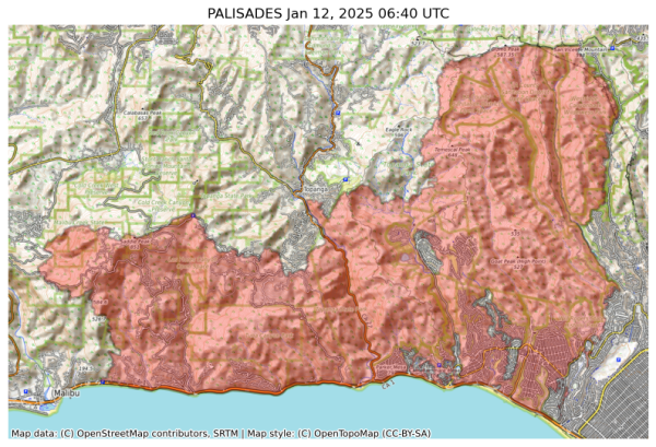
NIFC New Or Updated Wildfire Perimeter
Incident Name: PALISADES
Acres: 23508.0 acres
Updated: Jan 12, 2025 06:40 UTC
Source: IRWIN
#PALISADESFire #CAwx
Chateau Marmont, Sunset Tower Offer Free Rooms to L.A. Firefighters
Chateau Marmont, Sunset Tower Offer Free Rooms to L.A. Firefighters - INBELLAINBELLA
#wildfires #smoke
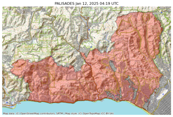
NIFC New Or Updated Wildfire Perimeter
Incident Name: PALISADES
Acres: 23440.4 acres
Updated: Jan 12, 2025 04:19 UTC
Source: IRWIN
#PALISADESFire #CAwx
Displaced Black Families GoFund Me Directory : GoFund Me
https://docs.google.com/spreadsheets/u/0/d/1pK5omSsD4KGhjEHCVgcVw-rd4FZP9haoijEx1mSAm5c/htmlview?pli=1&fbclid=PAZXh0bgNhZW0CMTEAAaaF7pdY9iJkWlnREN6JTbK67d9jFVQeZoIblOqsBVvpC9_6H6WIvmPrUdI_aem_JM-yJ9DdN_fRFCEmLv09Lg
#altadena #news
Will Grammys Be Postponed Due to L.A. Fires? Discussions Are Underway
Will Grammys Be Postponed Due to L.A. Fires? Discussions Are Underway - INBELLAINBELLA
Palisades Mansion Reportedly From ‘Succession’ Destroyed in L.A. Fires
Palisades Mansion Reportedly From 'Succession' Destroyed in L.A. Fires - INBELLAINBELLA
Former Child Star and Motivational Speaker Dies in L.A. Fires, Mother Says
Former Child Star and Motivational Speaker Dies in L.A. Fires, Mother Says - INBELLAINBELLA
Is #Landman compelling television. Sure (though it's already getting a little stupid). Is it also thinly veiled, ham-fisted #BigOil -servicing, anti- #EnergyTransition, #Climate-worsening #Disinformation & even outright #Propaganda? Without a doubt. By every definition of the word.
#wildfires #ClimateCrisis
https://youtu.be/EM37OE0xH5k
#piersmorgan #PrinceHarry #MeghanMarkle #California #californiafires #wildfires #CaliforniaOnFire #CaliforniaBurning #CaliforniaWildfires2025 #californiawildfire
I.e. to counter the conflagration of lies, CTs and accusations from MAGA leaders and their online supporters.
Let's keep doing our part.
https://gavinnewsom.com/california-fire-facts/
#Wildfires #California #Newsom
18/n
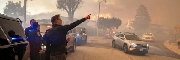
California Fire Facts | Governor Gavin Newsom
Get the facts about the Los Angeles fires.Rashida Tlaib for Congress
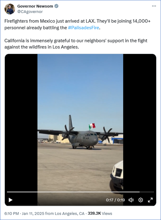
The news is sure to make MAGA heads explode.
#Wildfires #California #Mexico
17/n
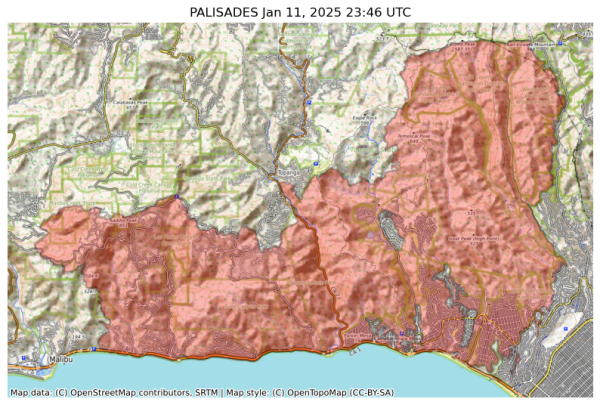
NIFC New Or Updated Wildfire Perimeter
Incident Name: PALISADES
Acres: 23342.9 acres
Updated: Jan 11, 2025 23:46 UTC
Source: IRWIN
#PALISADESFire #CAwx
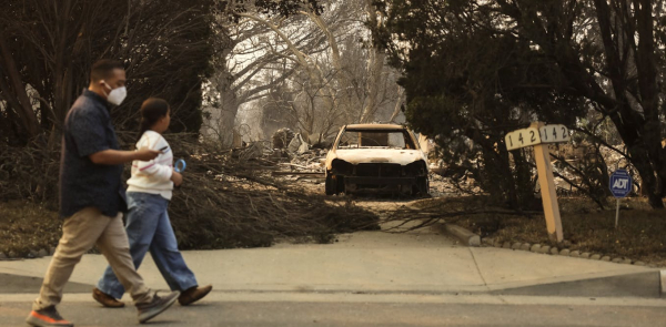
LA fires show the human cost of climate-driven ‘whiplash’ between wet and dry extremes
The heath-related impacts of climate change will reach US$1 trillion a year by 2050.The Conversation
Governor Gavin Newsom sits down with Jon Favreau to talk about California’s response to the devastating Los Angeles fires, his invitation to Donald Trump, and his demand for clear answers about the water shortages that hindered fire fighting efforts. They also discuss what recovery and rebuilding efforts look like, how these fires could affect the future of home insurance in California,
https://www.youtube.com/watch?v=EKdioEFwQZw
- YouTube
Auf YouTube findest du die angesagtesten Videos und Tracks. Außerdem kannst du eigene Inhalte hochladen und mit Freunden oder gleich der ganzen Welt teilen.www.youtube.com
Republican congressman calls for halting of disaster relief to California
https://www.theguardian.com/us-news/2025/jan/11/warren-davidson-republican-disaster-relief-california-wildfires
#WarrenDavidson #GOP #Ohio #CAFires #WildFires #ClimateChange #ClimateEmergency #ExxonKnew #USPol
More, incl video of news reporting https://t.me/BellumActaNews/138491?single #Nature #LABurning #Tornado #Wildfires #LosAngelesBurning #Hellscape
Fire tornadoes 😱
#ClimateCrisis #Wildfires #LAFires
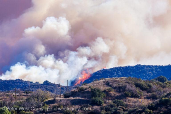
If you're looking for ways to help those affected by the fires in Los Angeles, I have a place for you to start with financial donations.
Charity Navigator has a li
https://thecareyadventures.com/blog/how-to-help-those-in-los-angeles-part-1/
#California #NorthAmerica #PhotoOfTheDay #USA #Volunteering #Weather #CaliforniaWildfires #Diasater #EartonFire #fire #help #helping #HurstFire #LAFire #LAFires #PalisadesFire #volunteer #wildfires
