Suche
Beiträge, die mit PALISADESFire getaggt sind
#losangelesfires
#PalisadesFire
#EatonFire
#HurtsFire
#KennethFire
Because we have the time right now > An explanation:
Can firefighters use saltwater to battle the #LosAngelesFires? (or why not)
📋 > https://www.technology.org/how-and-why/can-salt-water-put-out-fire/
I have never seen anything like this in my entire existence as a Southern California native. And I have seen a LOT.
This is absolutely insane.
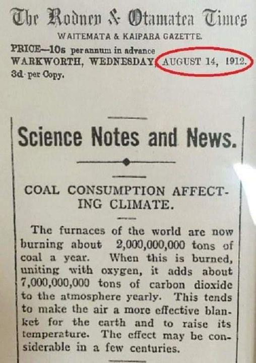
https://www.usatoday.com/story/news/factcheck/2021/08/13/fact-check-yes-1912-article-linked-burning-coal-climate-change/8124455002/
#ClimateChange #ClimateCrisis #ClimateAction #ClimateCatastrophe #fire #LAfires #wildfires #LosAngeles #socal #SouthernCalifornia #PacificPalisades #altadena #hollywood #EatonFire #PalisadesFire #SunsetFire #HurstFire #KennethFire #USpolitics #AmericanPolitics #political #politics #ClimateJustice #climate #USpol
Fact check: A 1912 article about burning coal and climate change is authentic
Social media users are sharing an article from 1912 that warns about the danger of coal contributing to climate change.McKenzie Sadeghi, USA TODAY (USA TODAY)
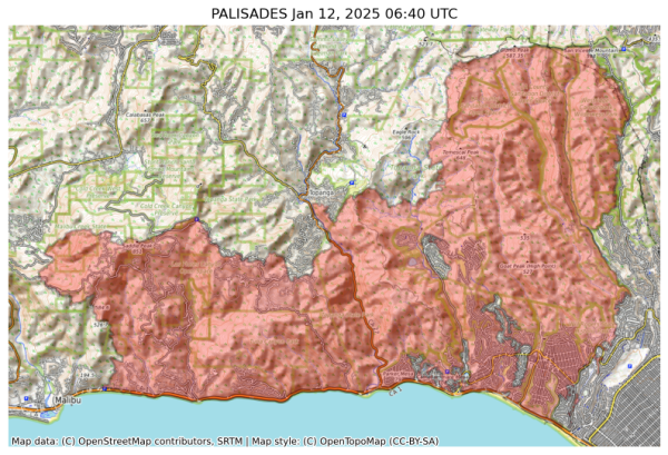
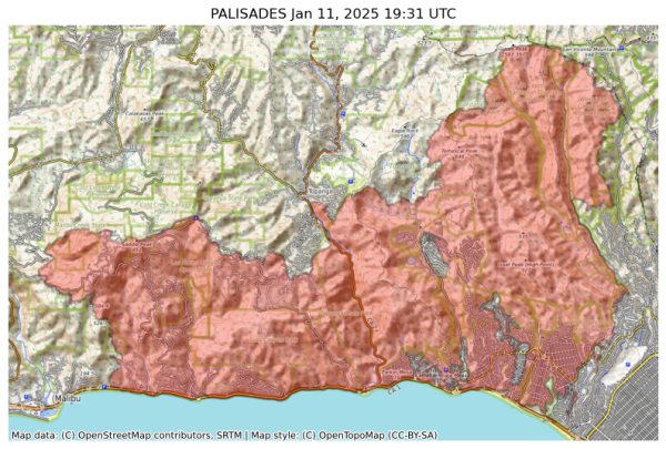
NIFC New Or Updated Wildfire Perimeter
Incident Name: PALISADES
Acres: 23508.0 acres
Updated: Jan 12, 2025 06:40 UTC
Source: IRWIN
#PALISADESFire #CAwx
Chateau Marmont, Sunset Tower Offer Free Rooms to L.A. Firefighters
Chateau Marmont, Sunset Tower Offer Free Rooms to L.A. Firefighters - INBELLAINBELLA
#wildfires #smoke
#palisadesfire #pointdume
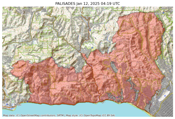
NIFC New Or Updated Wildfire Perimeter
Incident Name: PALISADES
Acres: 23440.4 acres
Updated: Jan 12, 2025 04:19 UTC
Source: IRWIN
#PALISADESFire #CAwx
Will Grammys Be Postponed Due to L.A. Fires? Discussions Are Underway
Will Grammys Be Postponed Due to L.A. Fires? Discussions Are Underway - INBELLAINBELLA
Palisades Mansion Reportedly From ‘Succession’ Destroyed in L.A. Fires
Palisades Mansion Reportedly From 'Succession' Destroyed in L.A. Fires - INBELLAINBELLA
Former Child Star and Motivational Speaker Dies in L.A. Fires, Mother Says
Former Child Star and Motivational Speaker Dies in L.A. Fires, Mother Says - INBELLAINBELLA
#CaliforniaFires #Firefighters #Aircraft #California #PalisadesFire
https://asmac.org/la-fires/
Periodically updating the list. Let us know if you have other useful links.
#EatonFire #PalisadesFire #KennethFire #SunsetFire #LAFires #LosAngeles #Altadena #Pasadena #Palisades #Musicians
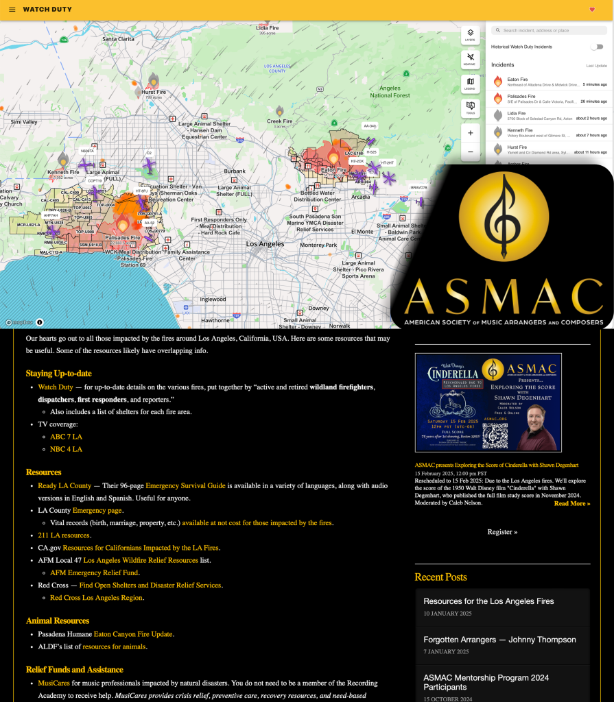
Resources for the Los Angeles Fires - ASMAC
Our hearts go out to all those impacted by the fires around Los Angeles, California, USA. Here are some resources that may be useful. Some of the resources likely have overlapping info.Jeff Kellem (American Society of Music Arrangers and Composers (ASMAC))
‘Succession’ $83 Million Mega-Mansion Leveled By Palisades Fire
'Succession' $83 Million Mega-Mansion Leveled By Palisades Fire - INBELLAINBELLA
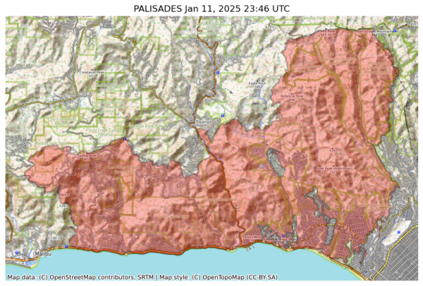
NIFC New Or Updated Wildfire Perimeter
Incident Name: PALISADES
Acres: 23342.9 acres
Updated: Jan 11, 2025 23:46 UTC
Source: IRWIN
#PALISADESFire #CAwx
Katlyn C, Staff Reporter
Jan 11 at 7:26 PM EST
The LA County Sheriff’s Department is enforcing a curfew in evacuation order zones and evacuation warning zones within City of LA, Santa Monica, Malibu and unincorporated communities from 6:00 PM to 6:00 AM per the County of Los Angeles. See the full post HERE
7:19 PM EST
Five fixed wing air tankers have been released from the incident per radio traffic.
https://share.watchduty.org/i/40335?ts=1736641609000
Watch Duty - Wildfire Maps & Alerts
Real-time information about wildfire and firefighting efforts nearbyWatch Duty
LA County residents directly impacted by fires can request property and vital records (i.e., birth, death, marriage) free of charge to help with recovery efforts.
📱800-201-8999 (Option 1 followed by Option 2)
📨recorder@rrcc.lacounty.gov.
#PalisadesFire #eatonfire

Weather and climate office hours: 01/11/2025 topic: Ongoing coverage of SoCal wildfires
The latest in a recurring series of live, virtual, & interactive "office hours" hosted by Dr. Daniel Swain on various topics related to extreme weather and c...YouTube
As wildfires continue to devastate LA, remember that price gouging on essentials during a state of emergency is illegal.
Stay safe, listen to your local emergency officials, and report suspected price gouging to my office at oag.ca.gov/report or local law enforcement.
#PalisadesFire #eatonfire
#EatonFire #PalisadesFire
https://me.lacounty.gov/2025/press-releases/update-medical-examiner-fire-related-deaths/
#EatonFire 8
#PalisadesFire 5
(11 listed so far)
https://me.lacounty.gov/2025/press-releases/update-medical-examiner-fire-related-deaths/
More, incl video of news reporting https://t.me/BellumActaNews/138491?single #Nature #LABurning #Tornado #Wildfires #LosAngelesBurning #Hellscape
If you're looking for ways to help those affected by the fires in Los Angeles, I have a place for you to start with financial donations.
Charity Navigator has a li
https://thecareyadventures.com/blog/how-to-help-those-in-los-angeles-part-1/
#California #NorthAmerica #PhotoOfTheDay #USA #Volunteering #Weather #CaliforniaWildfires #Diasater #EartonFire #fire #help #helping #HurstFire #LAFire #LAFires #PalisadesFire #volunteer #wildfires
Day 5 of L.A. fire siege focuses on threat to Brentwood, Encino - EUROPE SAYS
An epic aerial assault was underway Saturday as a fleet of aircraft worked to prevent the Palisades fireEUROPE SAYS (EUROPESAYS.COM)
Katlyn C, Staff Reporter
Jan 11 at 5:30 PM EST
"LA County residents directly impacted by fires can request property and vital records (i.e., birth, death, marriage) free of charge to help with recovery efforts.
Call 800-201-8999 (Option 1 followed by Option 2) or Email recorder@rrcc.lacounty.gov."
per County of Los Angeles
https://share.watchduty.org/i/40335?ts=1736634624000
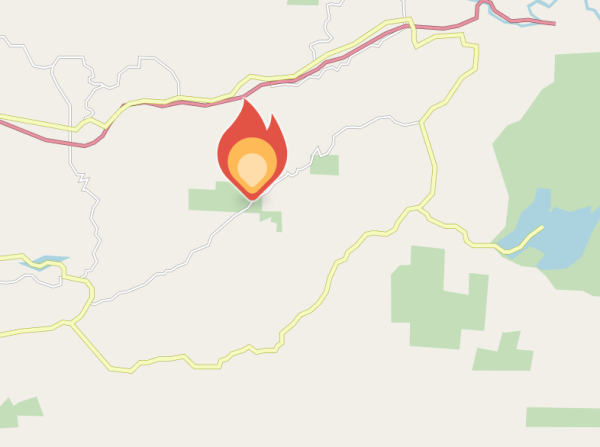
Watch Duty - Wildfire Maps & Alerts
Real-time information about wildfire and firefighting efforts nearbyWatch Duty
Katlyn C, Staff Reporter
Jan 11 at 5:06 PM EST
The helicopters and fixed wing have swapped. The slop over in Division Zulu (near East of Sylvia Park) appears like it is going in towards the black (the already burned area) but could change with a wind shift. Fixed wing are working to box it in per air attack. Additionally two Modular Airborne Fire Fighting Systems (MAFFS) are inbound towards the fire.
https://share.watchduty.org/i/40335?ts=1736633163000
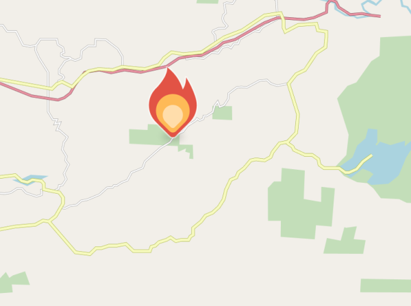
Watch Duty - Wildfire Maps & Alerts
Real-time information about wildfire and firefighting efforts nearbyWatch Duty
PUMA91 from Riverside https://fr24.com/PUMA91/38afc161
Watch Duty has added 750,000 users in the last 12 hours, as L.A. residents rely on it for real-time information to track the wildfires around them.
https://www.fastcompany.com/91257639/l-a-wildfire-tracking-app-watch-duty
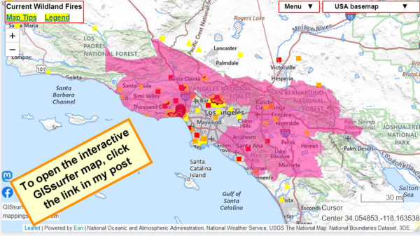
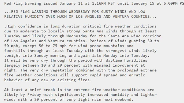
#RedFlagWarning now includes #PalisadesFire.
For details from NOAA - including timing - open the map, click a spot in the red area. Scroll down in the popup that appears since there might be more than one watch/warning and each one has its own link for the details.
Open GISsurfer map:
https://mappingsupport.com/p2/gissurfer.php?center=34.054853,-118.163538&zoom=8&basemap=USA_basemap&overlay=MODIS_7_day,VIIRS_7_day,Perimeter_FIRIS_intel,Lake_river_stream,Red_flag_warning&data=https://mappingsupport.com/p2/special_maps/disaster/USA_wildland_fire.txt
GISsurfer General Purpose Web Map and GIS Viewer | Surf GIS DATA
GISsurfer lets you surf a nearly endless amount of GIS data. Click a layer in the GIS server's table of contents and that data appears on the map.mappingsupport.com
NIFC New Or Updated Wildfire Perimeter
Incident Name: PALISADES
Acres: 22346.7 acres
Updated: Jan 11, 2025 19:31 UTC
Source: IRWIN
#PALISADESFire #CAwx
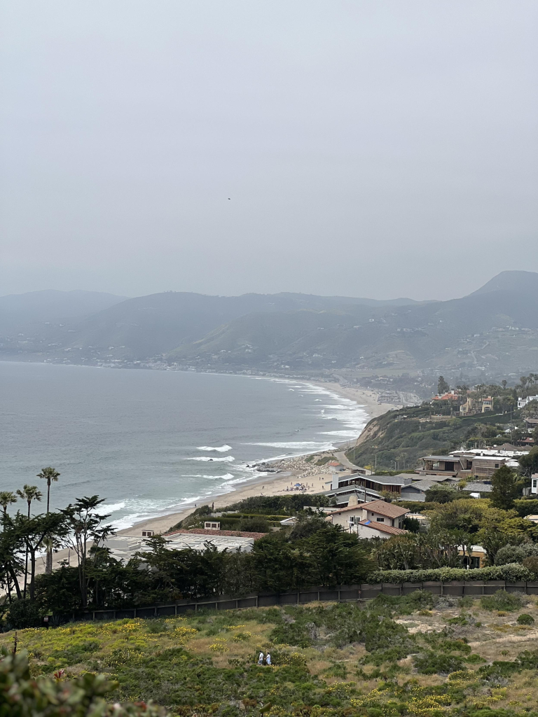
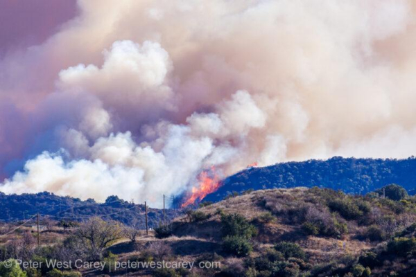
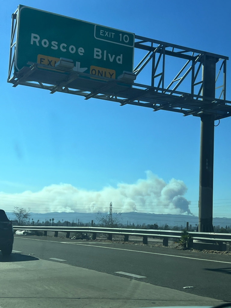
#palisadesFire
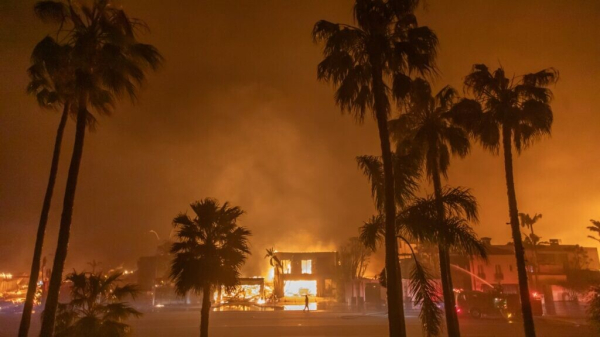
Picture taken by my son while on his way back to downtown LA this morning.
Cole Euken, Staff Reporter
Jan 11 at 2:33 PM EST
Airbnb.org is providing free, emergency housing for people who have been displaced by the Los Angeles wildfires... You can get help - or provide help – at Airbnb.org/lawildfires.
PALISADES FIRE: Community Meeting
The first in-person Community Meetings are happening tonight at 6:30PM in two locations:
Calvary Westlake (5495 Via Rocas Westlake Village)
Oaks Gymnasium (31749 La Tienda Road Westlake Village)
Representatives from agencies ready to assist the community in with their immediate needs and through the recovery process will be in attendance.
The Community Meeting will be live streamed on YouTube
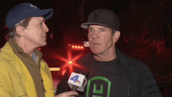
Dennis Quaid Details Palisades Fire Experience While Evacuating
Dennis Quaid Details Palisades Fire Experience While Evacuating - INBELLAINBELLA

