Suche
Beiträge, die mit PalisadesFIre getaggt sind
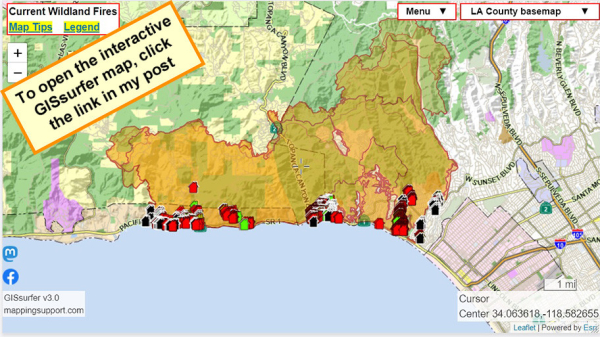
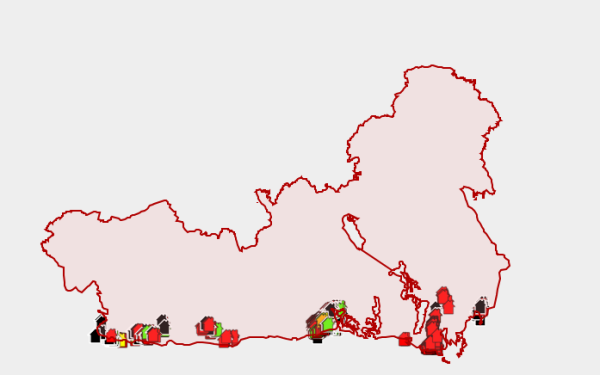
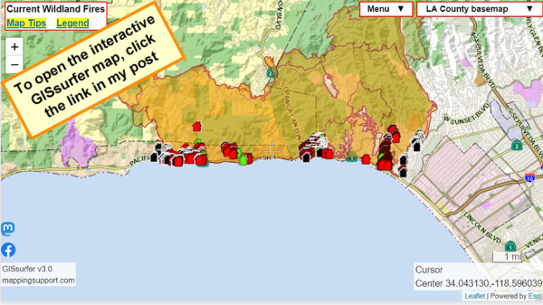
To search on an address click Menu > Search.
The damage layer is 'on top' and clickable.
The parcel layer (at end of overlay list) includes address and owner's name. To learn how to make that the 'top' layer and clickable, please read the "Map tips" link in upper left corner.
Red - Destroyed > 50%
Orange - Major 26-50%
Yellow - Minor 10-25%
Green - Affected 1-9%
Black - No damage
White - Inaccessible
Open GISsurfer map:
https://mappingsupport.com/p2/gissurfer.php?center=34.063618,-118.582655&zoom=12&basemap=LA_County_basemap&overlay=Perimeter_FIRIS_intel,LA_County_map,LA_County_parcels,Palisades_damage_assessment&data=https://mappingsupport.com/p2/special_maps/disaster/USA_wildland_fire.txt
GISsurfer General Purpose Web Map and GIS Viewer | Surf GIS DATA
GISsurfer lets you surf a nearly endless amount of GIS data. Click a layer in the GIS server's table of contents and that data appears on the map.mappingsupport.com
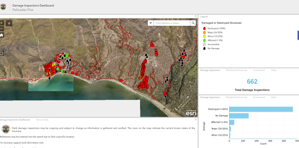
(Note they have done 662 inspections, likely there are more than 5000 structures destroyed here in the Palisades Fire. This map also includes damage from the earlier Franklin Fire)
#PalisadesFire #PacificPalisades #Malibu #FranklinFire
https://m.ai6yr.org/@disaster_bot/113821465905200531
#firewx #PalisadesFire #EatonFire
#PalisadesFire
https://www.fire.ca.gov/incidents/2025/1/7/palisades-fire
#EatonFire #PalisadesFire
California wildfires death toll rises to 24 amid new urgent warning about more strong winds
The warning begins Monday night and runs through Wednesday morning, the service said.6abc Philadelphia
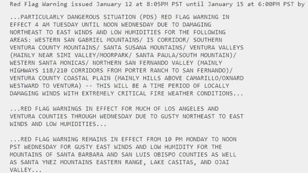
#RedFlagWarning (red).
#HighWindWarning (diagonals).
For official details from NOAA including timing, open the map, zoom in, click in red area. Scroll down in the popup that appears since there might be multiple weather watches/warnings for the spot you clicked and each one has its own link to the details.
#PalisadesFire #EatonFire #LAfires #SantaAnna
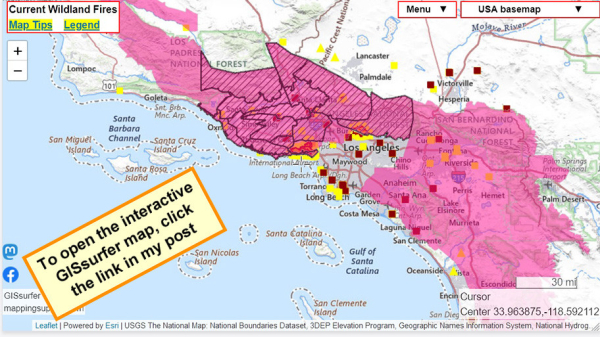
Open GISsurfer map:
https://mappingsupport.com/p2/gissurfer.php?center=33.963875,-118.592112&zoom=8&basemap=USA_basemap&overlay=MODIS_7_day,VIIRS_7_day,Perimeter_FIRIS_intel,High_wind_warning,Red_flag_warning&data=https://mappingsupport.com/p2/special_maps/disaster/USA_wildland_fire.txt
GISsurfer General Purpose Web Map and GIS Viewer | Surf GIS DATA
GISsurfer lets you surf a nearly endless amount of GIS data. Click a layer in the GIS server's table of contents and that data appears on the map.mappingsupport.com
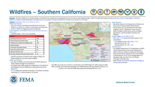
https://recovery.lacounty.gov/palisades-fire/
#LACounty #PalisadesFire #EatonFire
#PalisadesFire #EatonFire #LosAngelesFires
“Hiring a private fire crew costs thousands of dollars a day, and most work through government contracts or with insurance companies. Some wealthy property owners are calling them in directly.”
“About 45 percent of all firefighters working in the United States today are employed privately…”
#PalisadesFire #Firefighters #PrivateFirefighters
Gift link:
https://www.nytimes.com/2025/01/12/us/private-firefighters-la-wildfires.html?unlocked_article_code=1.o04.j7My.rcQKoCBwzLJf&smid=nytcore-ios-share&referringSource=articleShare&tgrp=off
Kim Kardashian Advocates for Incarcerated Firefighters Amid L.A. Fires
Kim Kardashian Advocates for Incarcerated Firefighters Amid L.A. Fires - INBELLAINBELLA
#EatonFire
Deads: 16
Injuries: 5 (firefighters)
Missing: 12
#PalisadesFire
Deads: 8
Injuries: 8
Missing: 4
https://me.lacounty.gov/2025/press-releases/update-medical-examiner-fire-related-deaths-at-5-p-m-on-january-12/
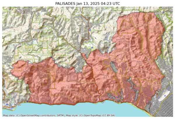
NIFC New Or Updated Wildfire Perimeter
Incident Name: PALISADES
Acres: 23465.4 acres
Updated: Jan 13, 2025 04:23 UTC
Source: IRWIN
#PALISADESFire #CAwx
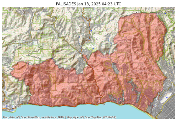
NIFC New Or Updated Wildfire Perimeter
Incident Name: PALISADES
Acres: 23465.4 acres
Updated: Jan 13, 2025 04:23 UTC
Source: IRWIN
#PALISADESFire #CAwx
https://youtu.be/dznW0TCauAs
https://www.ndtv.com/world-news/fire-away-bidens-insensitive-pun-during-los-angeles-wildfire-meeting-goes-viral-7454302
Well, at least she didn't start off on her loud cackle in reply to...

#Politics
#Biden
#Harris
#PalisadesFire
#LAFires
#USA

"Fire Away": Biden's Insensitive Pun During Los Angeles Wildfire Meeting Goes Viral
Kamala Harris looked at Jode Biden with a stunned expression, prompting the president to add: "No pun intended."Abhinav Singh (NDTV)
Daniella Pineda Wishes Post Wildfire House Loss: “Keep Altadena Black”
Daniella Pineda Wishes Post Wildfire House Loss: "Keep Altadena Black" - INBELLAINBELLA
https://www.youtube.com/watch?v=ksPUuQQoheE
- YouTube
Auf YouTube findest du die angesagtesten Videos und Tracks. Außerdem kannst du eigene Inhalte hochladen und mit Freunden oder gleich der ganzen Welt teilen.www.youtube.com
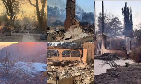
Numerous Fundraisers Set Up for Animation Professionals Who Lost Their Homes in the L.A. Fires
This past week’s Los Angeles County fires have taken a huge toll on the lives of many of the members of the animation and vfx community. Many have lost theirAnimation Magazine
James Woods Says Home Survived LA Wildfires
James Woods Says Home Survived LA Wildfires - INBELLAINBELLA
"Along with crews from other states and Mexico, hundreds of inmates from California’s prison system were also helping firefighting efforts. Nearly 950 incarcerated firefighters were dispatched “to cut fire lines and remove fuel to slow fire spread,” according to an update from the California Department of Corrections and Rehabilitation.
Though the state has long relied on prison labor to fight fires, the practice is controversial as the inmates are paid little for dangerous and difficult work. Inmates are paid up to roughly $10.24 each day, with additional money for 24-hour shifts, according to the corrections department."
https://www.pbs.org/newshour/nation/death-toll-from-los-angeles-wildfires-rises-to-16-as-crews-fight-to-contain-blazes
#Prison #Slavery #LAfires #PalisadesFire #EatonFire #Police #HumanRights #Racism #Abolition
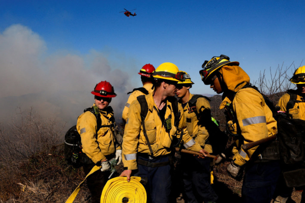
Death toll from Los Angeles wildfires rises to 16 as crews fight to contain blazes
Firefighters scrambled Sunday to make further progress against wildfires that have killed 16 people in the Los Angeles area as forecasters again warned of dangerous weather with the return of strong winds this week.PBS News
California Governor Suspends Environmental Laws To Speed Up Rebuilding After Devastating Wildfires - EUROPE SAYS
California Governor Gavin Newsom declares key environmental laws suspended to rebuild faster in wildfire areas. In his order,EUROPE SAYS (EUROPESAYS.COM)
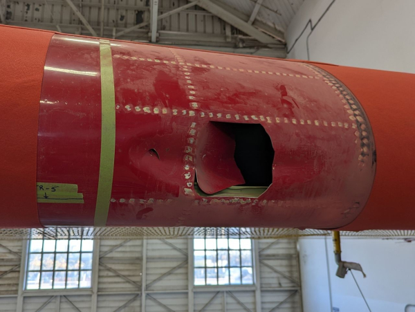
Authorities were able to recover some pieces of the privately-owned drone ...
$83M Mansion From ‘Succession’ Burns Down in LA Wildfires: Report
$83M Mansion From 'Succession' Burns Down in LA Wildfires: Report - INBELLAINBELLA
Daniel Swain: Following historic wildfire disasters in Southern California, a statewide dry spell intensifies and extreme fire weather conditions persist in the south
https://weatherwest.com/archives/43193
Following historic wildfire disasters in Southern California, a statewide dry spell intensifies and extreme fire weather conditions persist in the south - Weather West
Remarkable wet-to-dry transition combined with extreme downslope wind event yields dual wildfire catastrophes in SoCal It's never good feeling when a dire weather or disaster risk prognostication comes to fruition; that "pit in your stomach" sensatio…Daniel Swain (Weather West)
https://recovery.lacounty.gov/palisades-fire/
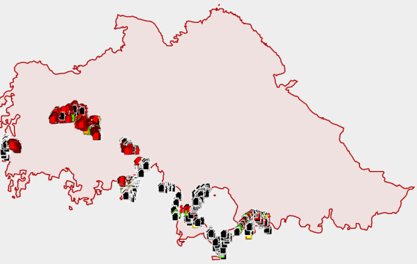
#EatonFire damage assessment map
https://recovery.lacounty.gov/eaton-fire/
Note: Damage inspections are still ongoing.
“Why don’t you take some of that ‘go to mars’ money and actually help rather than Monday morning quarterbacking during a live fire?”#USPol #MAGA #disinfo #elonmusk #fascism #trump #pacificpalisades #WatchDuty #palisadesfire
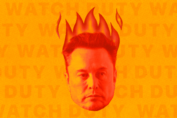
LA fires: This Bay Area fire tracking app is saving lives
Watch Duty has overtaken ChatGPT to become the top free app in Apple’s App Store, while correcting misinformation from Elon Musk.Rya Jetha (The San Francisco Standard)
I mean, look at — it’s all around us.
Why do I have to be on Democracy Now! saying this?
I grew up in Santa Monica. I fled to the Northeast.
It will get worse.
#palisadesfire https://aus.social/@drrimmer/113813444753381345
Matthew Rimmer (@drrimmer@aus.social)
Climate Scientist Peter Kalmus Fled L.A. Fearing Wildfires. His Old Neighborhood Is Now a Hellscape https://www.democracynow.org/2025/1/10/peter_kalmus_los_angeles_wildfires_climate #climate #wildfires #uspolAus.Social
Photo: @marcel_cameraop
Joshua Jackson’s Topanga Canyon Home Destroyed In Palisades Fire
Joshua Jackson's Topanga Canyon Home Destroyed In Palisades Fire - INBELLAINBELLA
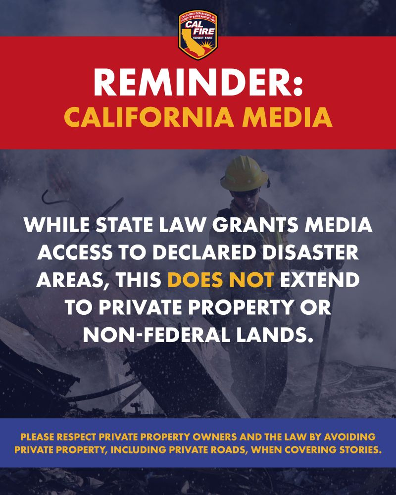
While state law (CA Penal Code 409.5 (d)) grants media access to declared disaster areas, this does NOT extend to private property or federal lands. Thank you for your professionalism and commitment to responsible reporting. #journalism
#media
#EatonFire #PalisadesFire
To search on an address click Menu > Search.
The damage layer is 'on top' and clickable.
The parcel layer (at end of overlay list) includes address and owner's name. To learn how to make that the 'top' layer and clickable, please read the "Map tips" link in upper left corner.
Red - Destroyed > 50%
Orange - Major 26-50%
Yellow - Minor 10-25%
Green - Affected 1-9%
Black - No damage
White - Inaccessible
Open GISsurfer map:
https://mappingsupport.com/p2/gissurfer.php?center=34.043097,-118.596044&zoom=12&basemap=LA_County_basemap&overlay=Perimeter_FIRIS_intel,LA_County_map,LA_County_parcels,Palisades_damage_assessment&data=https://mappingsupport.com/p2/special_maps/disaster/USA_wildland_fire.txt
GISsurfer General Purpose Web Map and GIS Viewer | Surf GIS DATA
GISsurfer lets you surf a nearly endless amount of GIS data. Click a layer in the GIS server's table of contents and that data appears on the map.mappingsupport.com
"By Sunday morning, Cal Fire reported the Palisades, Eaton, Kenneth and Hurst fires had consumed more than 62 square miles (160 square kilometers), an area larger than San Francisco."
59 of those square miles came from the Palisades and Eaton fires.
"The level of devastation is jarring even in a state that regularly confronts massive wildfires."
https://www.kron4.com/top-stories/ap-top-headlines/ap-los-angeles-wildfires-death-toll-rises-as-crews-fight-heavy-winds-to-save-homes-and-landmarks/
#PalisadesFire #EatonFire #LosAngeles
https://gofund.me/02fb4c95
#lafire #palisadesfire
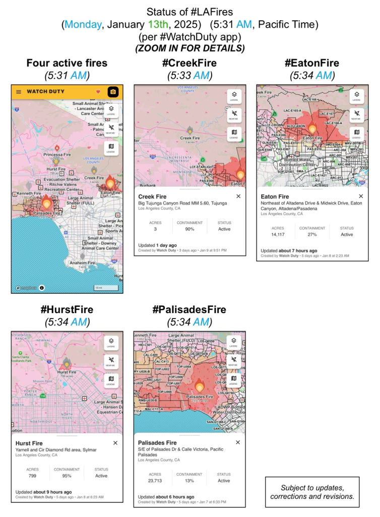
#palisadesfire #eatonfire #KennethFire #hurstfire #creekfire
https://docs.google.com/document/d/1opb9XeteEDFqAxlilyg7o4791c3t_WScF8TQ3o0NeDM/mobilebasic?fbclid=PAZXh0bgNhZW0CMTEAAaajo8kRqq1D7J5snPvDMbNGrudhQ1WlpyJNmxhgUMUQG041FHx0D4Xsjt0_aem_O1Us7x-0qTWLahlThE-0Ow

Diabetes Resources for LA Fires
Diabetes Resources: https://diabetesdisasterresponse.org/ https://diabetes.org/tools-resources/disaster-relief https://www.breakthrought1d.Google Docs
